Canada’s three northern territories — the Yukon, the Northwest Territories, and Nunavut — cover more than 3.9 million square kilometres between them. That is an area larger than India, with a combined population smaller than a mid-sized southern city. The north is not a region you drift through on the way to somewhere else. You go for the sky above Yellowknife exploding green and magenta on a February night at -35°C. You go for the sun still blazing above the Klondike plateau at one in the morning in July. You go for silence so complete that the ring in your own ears becomes a presence, for landscapes so enormous that the human scale almost vanishes entirely, and for the sense — increasingly rare on this planet — of being somewhere that has not been thoroughly tamed.
The north also carries profound historical and cultural weight. The Klondike Gold Rush of 1896-1899 brought 100,000 stampeders to a muddy river junction at the edge of the Arctic and became one of the great human migrations of the modern era. Long before that, and continuing to this day, Indigenous peoples — Dene, Gwich’in, Tlingit, Tr’ondëk Hwëch’in, Tłı̨chǫ, and the Inuit of Iqaluit and the wider eastern Arctic — have lived in these territories for thousands of years. Spending time with a northern community, on their terms and with respect, is one of the most illuminating experiences Canada has to offer any visitor.
This guide divides the north into its three territories, because that is how travel logistics actually break down. The Yukon is road-accessible from the south and anchored by two very different towns. The Northwest Territories spreads vast and empty around the aurora capital. Nunavut is almost entirely off the road network, reached only by air, and operates on different cultural and logistical premises again.
Browse all Canada Arctic and northern expedition experiencesThe Yukon: Klondike, Kluane and the far northwest

The Yukon is the most accessible of the three northern territories and the most visited. It covers 482,000 square kilometres — larger than Germany — with a population of around 44,000, of whom roughly 28,000 live in Whitehorse. The territory shares a long western border with Alaska, which gives it a character partly shaped by American frontier culture as well as Canadian northern identity. You can drive here from the south, and the paved Alaska Highway makes the Yukon the easiest of the territories for a first northern trip.
Whitehorse, the practical capital
Whitehorse is not what most people expect from a northern capital. It has excellent restaurants, a craft brewery scene, Indigenous cultural programming, and a trail network that begins at the edge of downtown and runs without interruption into some of the largest wilderness areas in North America. The Yukon River runs straight through the city. Miles Canyon — where the river squeezes through a basalt gorge that claimed dozens of gold-rush boats in 1898 — is a fifteen-minute drive from the centre. The SS Klondike sternwheeler sits in dry dock on the riverbank as a National Historic Site. The MacBride Museum and the Yukon Beringia Interpretive Centre cover First Nations history and Ice Age prehistory respectively, and both are unexpectedly good for a city this size.
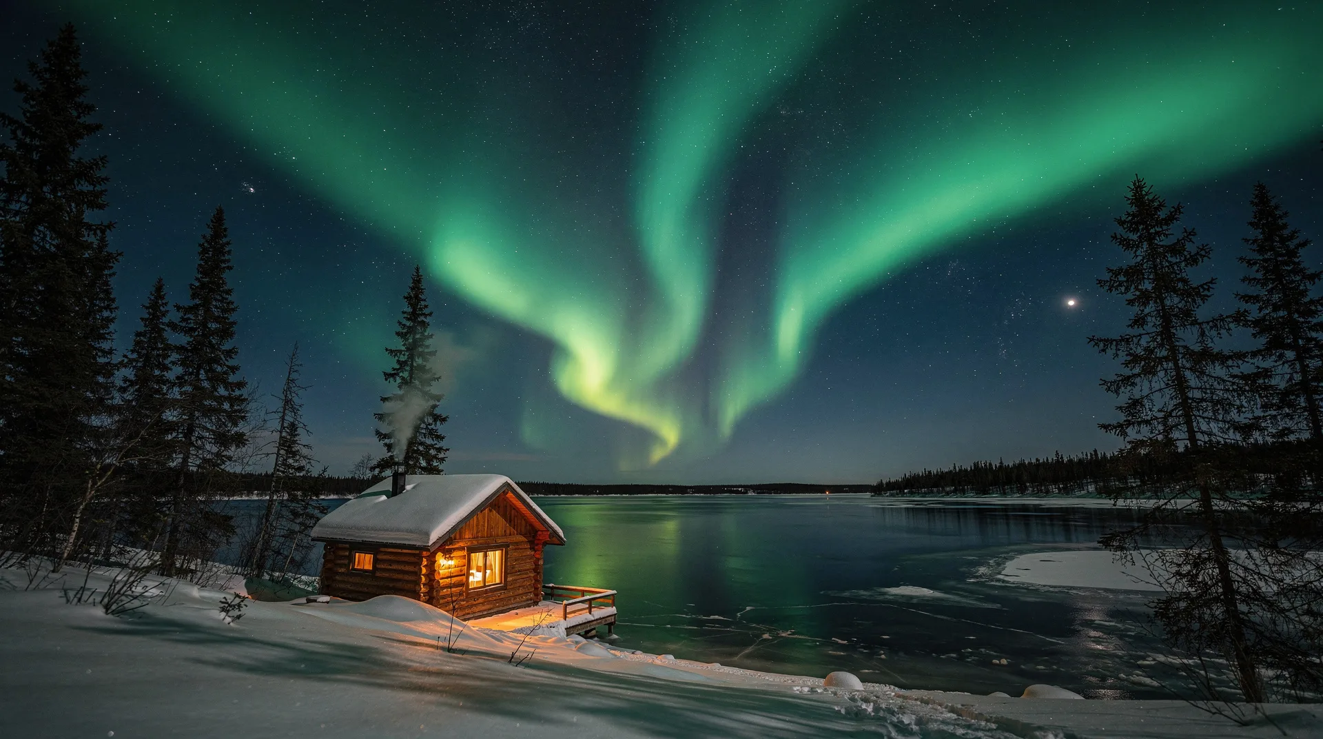
Whitehorse makes an excellent aurora base. The city sits at 60.7° North, close enough to the auroral oval that winter nights between late August and April regularly produce spectacular displays, and the Yukon’s dry continental climate gives you clear-sky conditions that many northern destinations cannot match. Aurora tour operators transport guests from downtown hotels to dark-sky sites 20–40 kilometres out, where heated cabins and teepees let you cycle between warmth and cold as the lights intensify.
Book a Yukon aurora borealis late-night viewing tour from WhitehorseDawson City and the Klondike gold rush
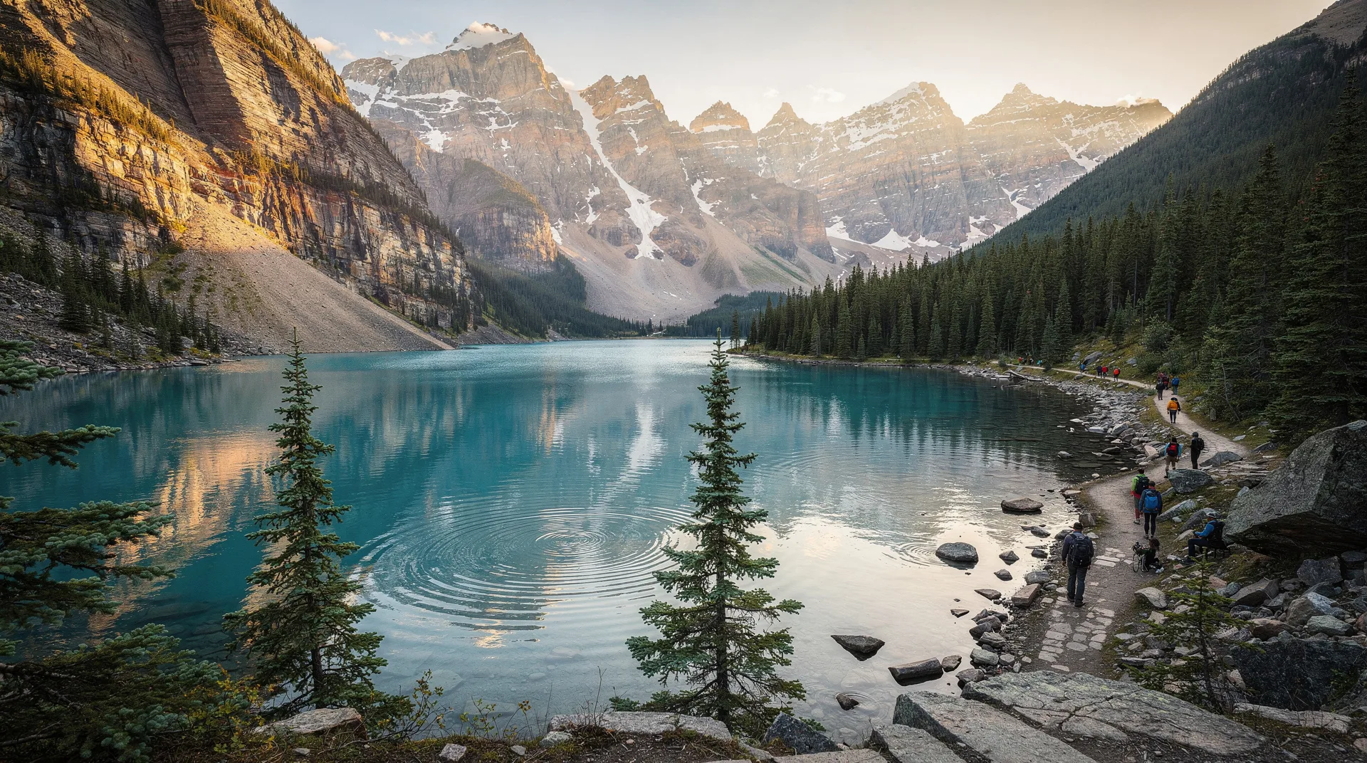
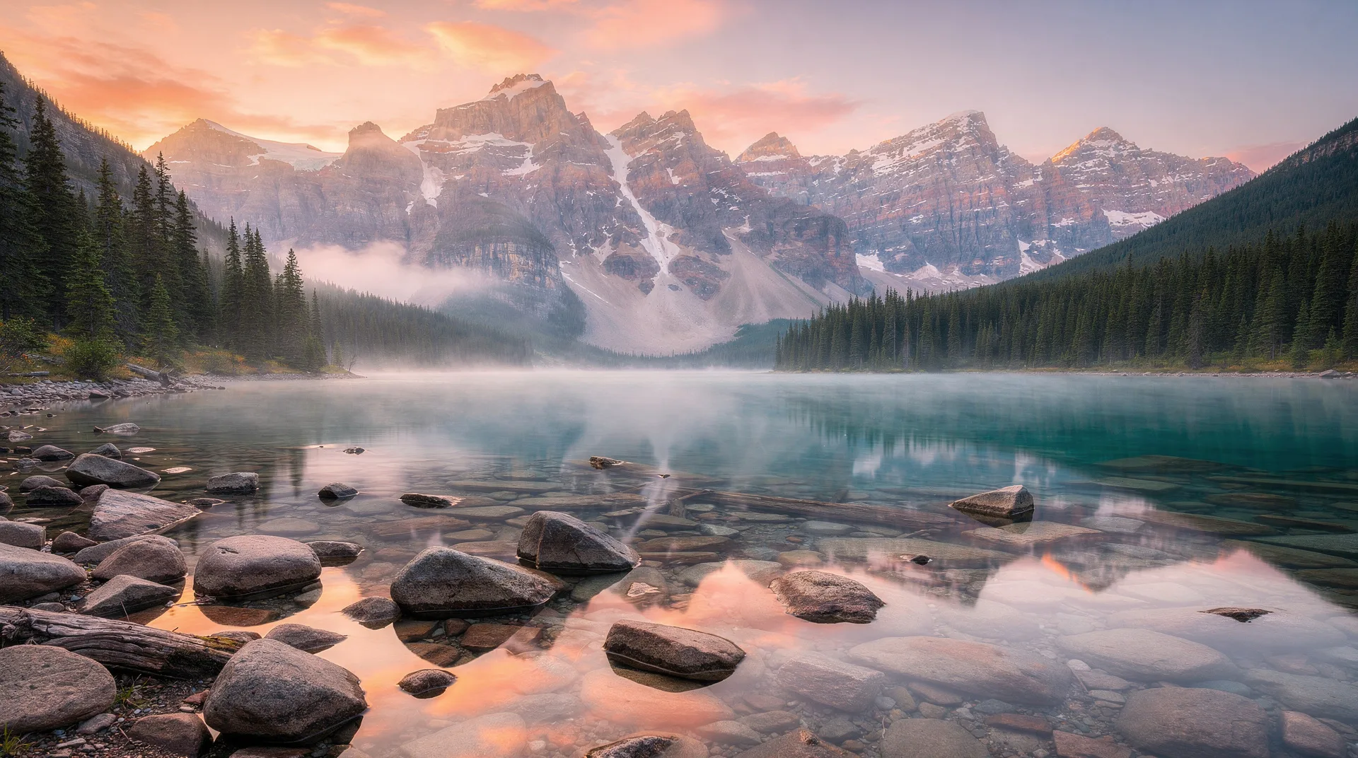
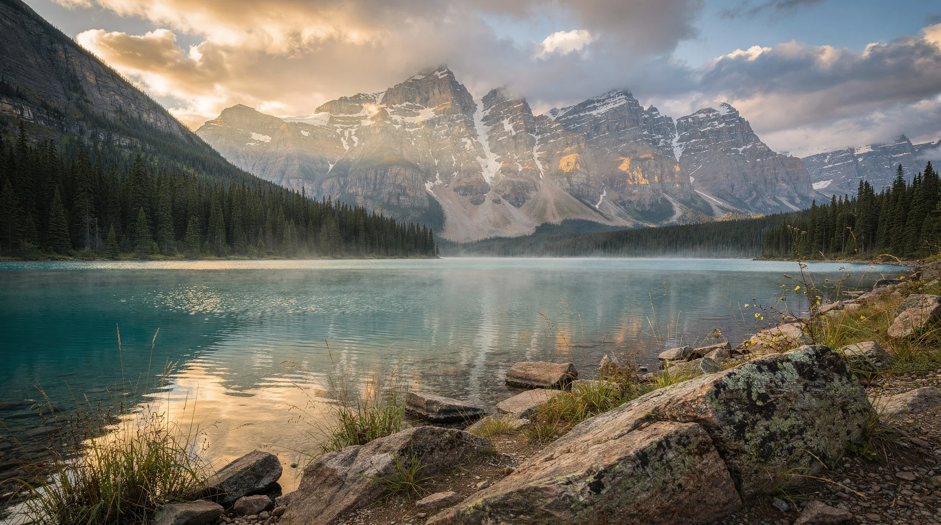
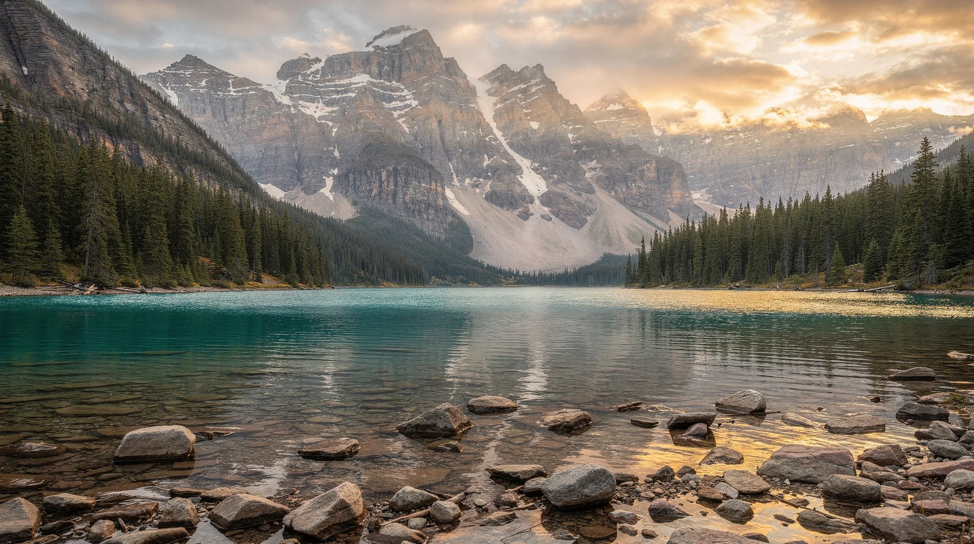
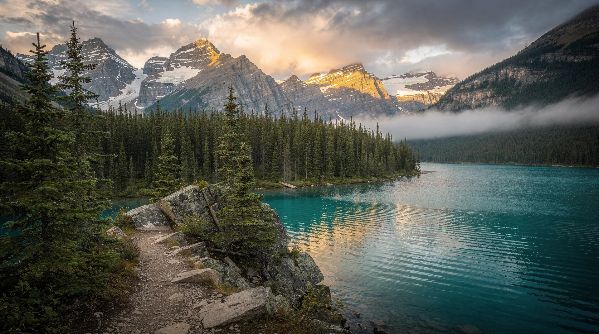
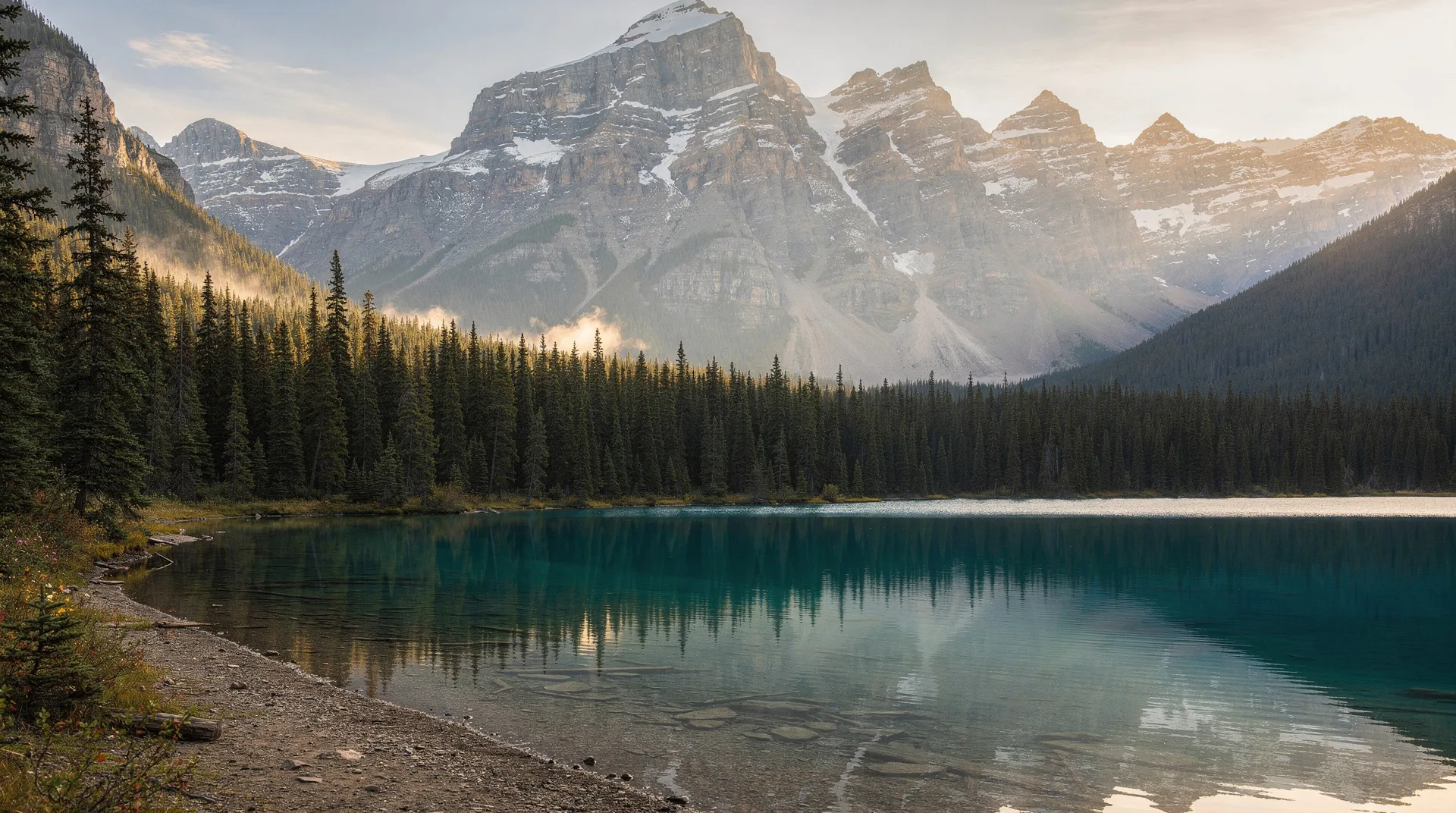
Dawson City is one of the most historically resonant places in Canada. At the height of the rush in 1898, this remote confluence of the Yukon and Klondike Rivers was the largest city west of Winnipeg and north of Seattle, with 30,000 to 40,000 people crowded into tents and hastily built boardwalk streets. Today about 1,500 people live here permanently, but the unpaved streets, the wooden boardwalks, the preserved saloons, and the dredge-tailings piles that still stretch for kilometres across the valley floor make the past almost tangible.
Dawson is 520 kilometres north of Whitehorse via the paved Klondike Highway — a 5–6 hour drive through boreal forest, past the Five Finger Rapids, and into increasingly open sub-Arctic country. Parks Canada maintains the Klondike National Historic Sites, including Dredge No. 4 (the largest wooden-hulled gold dredge ever built), Diamond Tooth Gertie’s Gambling Hall, Robert Service’s cabin, and the Jack London interpretive site. The Tr’ondëk Hwëch’in Cultural Centre (Dänojà Zho) on the waterfront provides the essential Indigenous context that the stampeder-era narrative otherwise obscures.
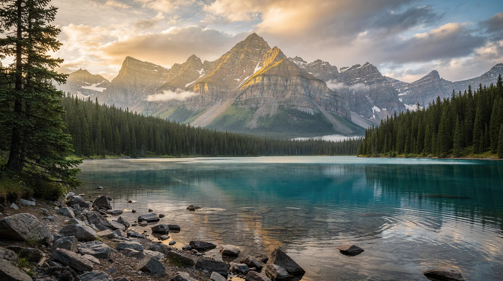
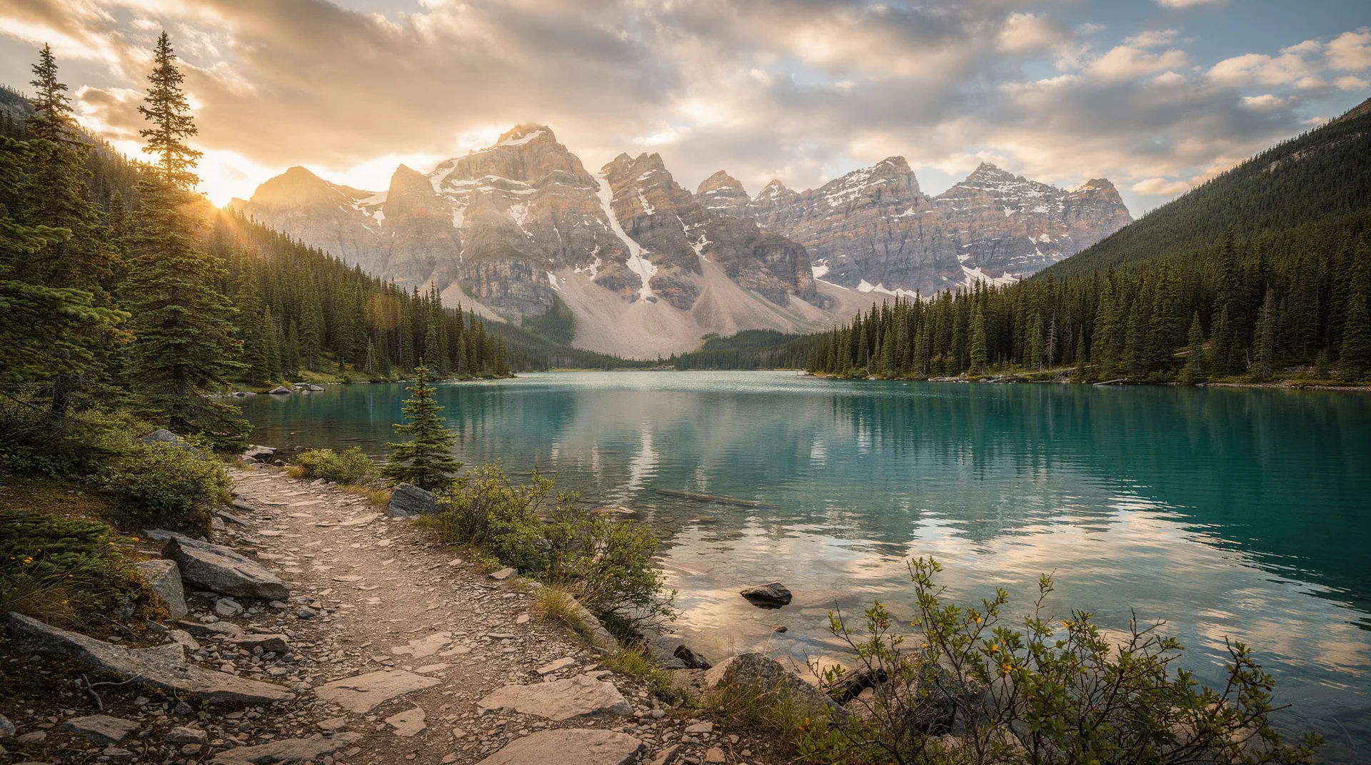
The Midnight Dome above the town is the defining visual of the Yukon: Yukon River sweeping through the valley, Klondike River joining at the townsite, forested mountains to every horizon. Climb it at midnight in late June to watch the sun hover above the northern horizon without ever setting.
Haines Junction and Kluane National Park
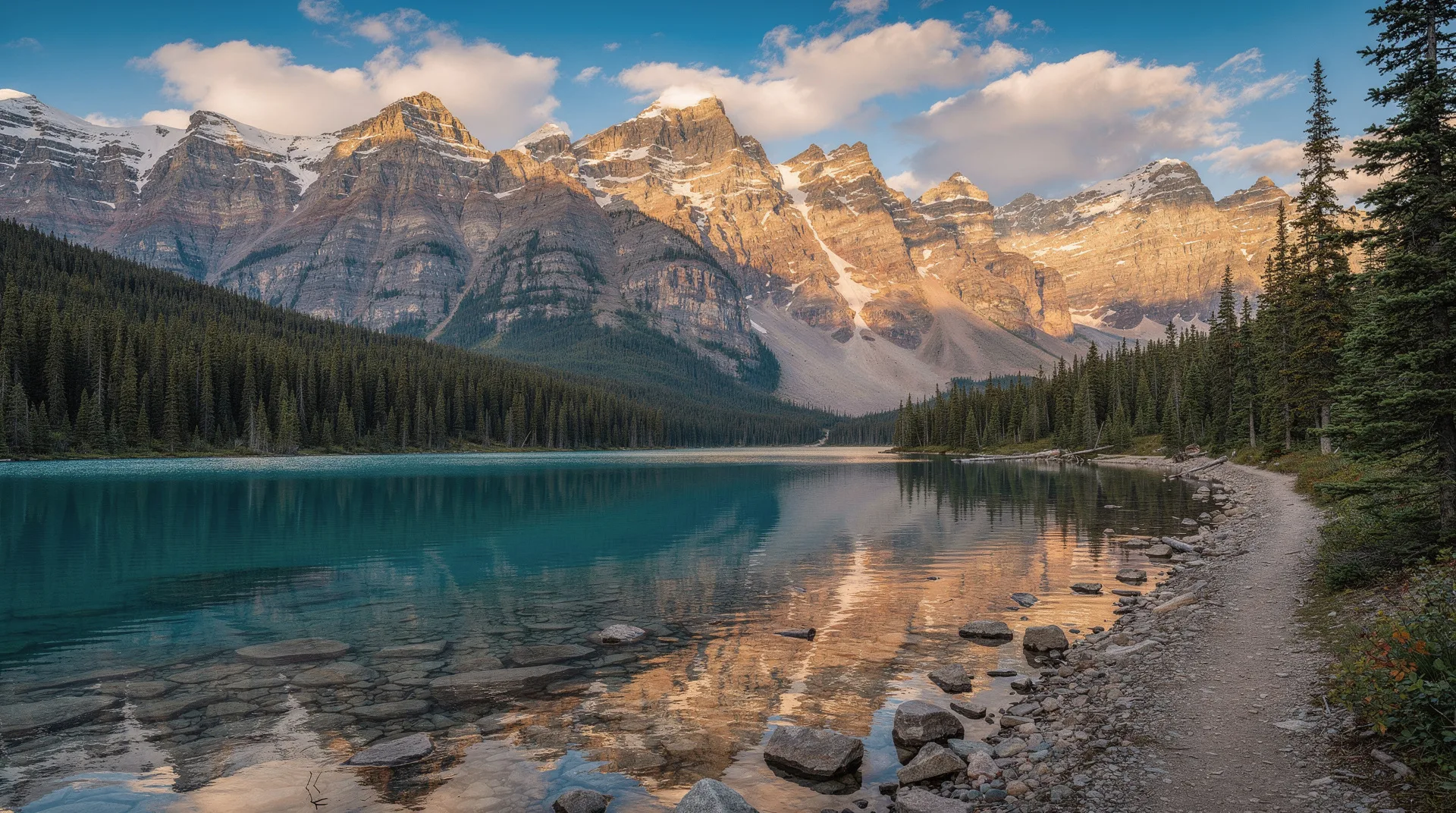
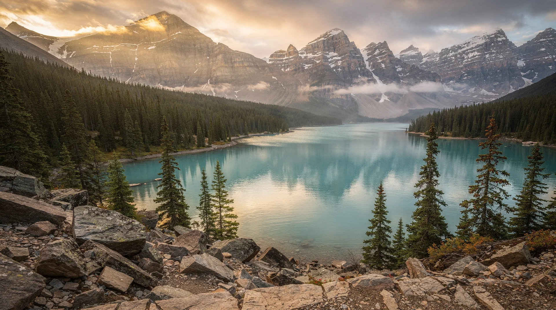
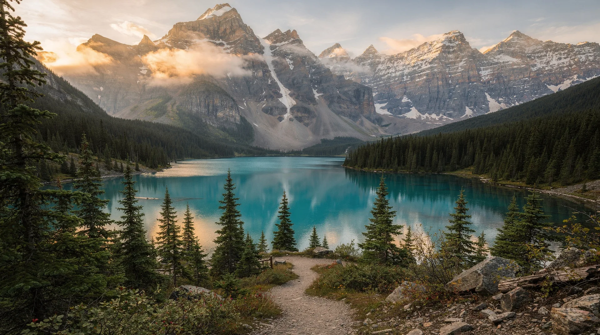
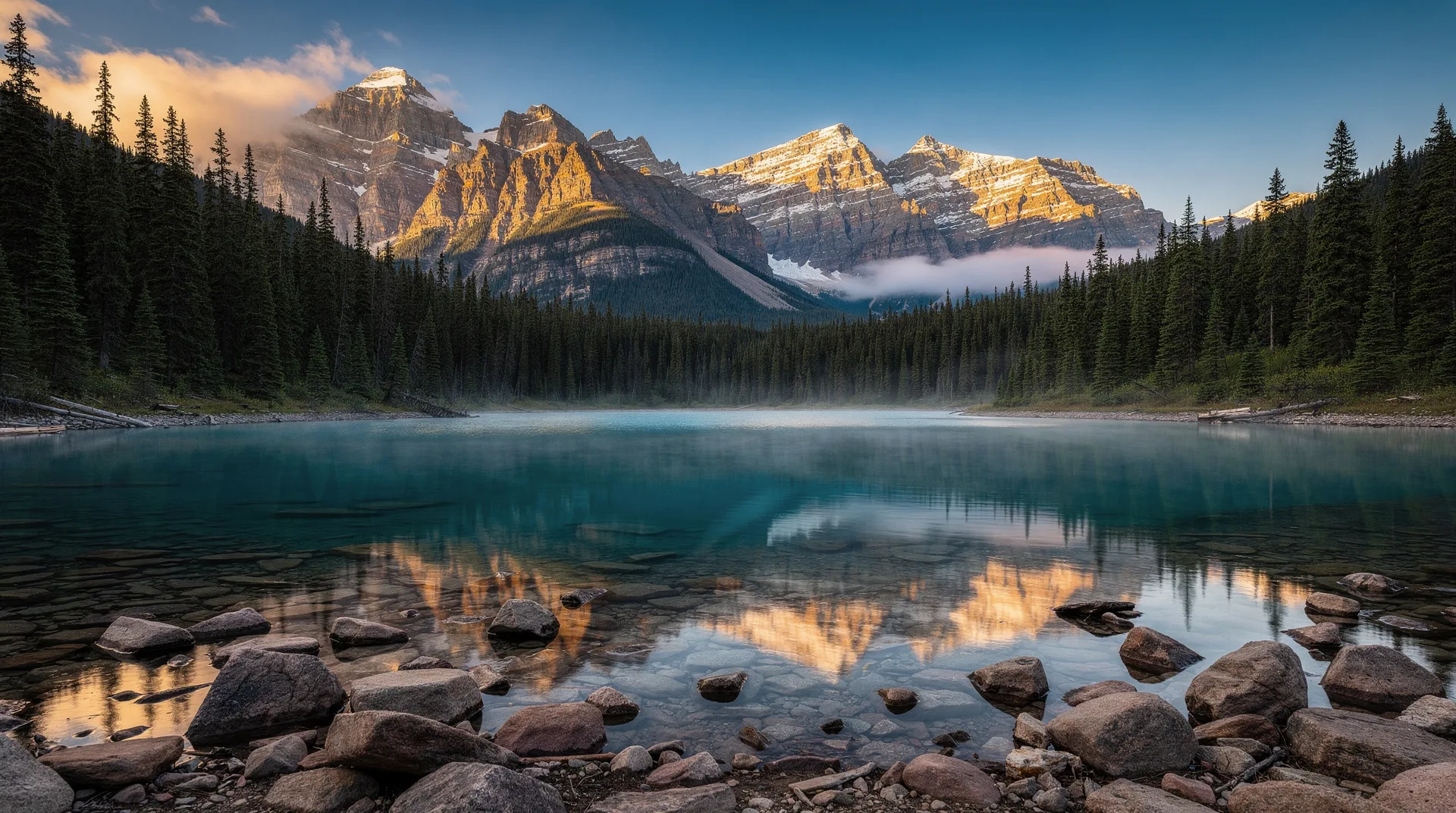
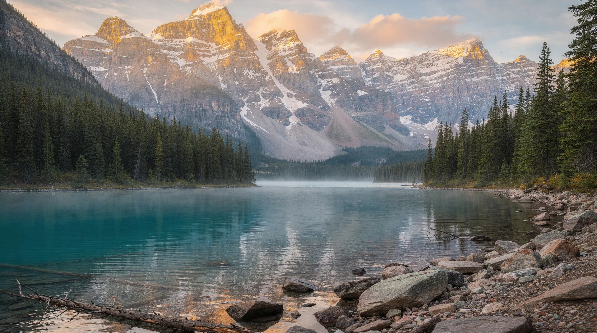
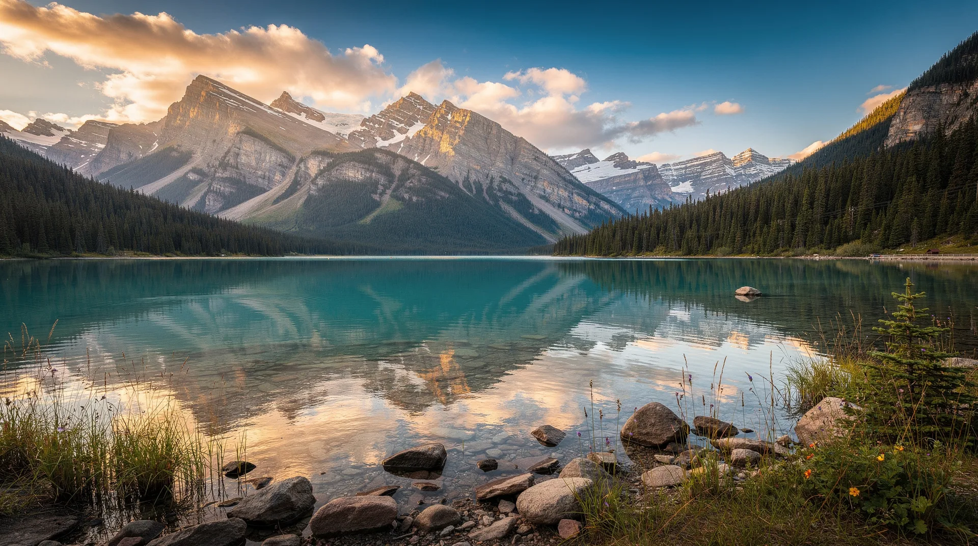
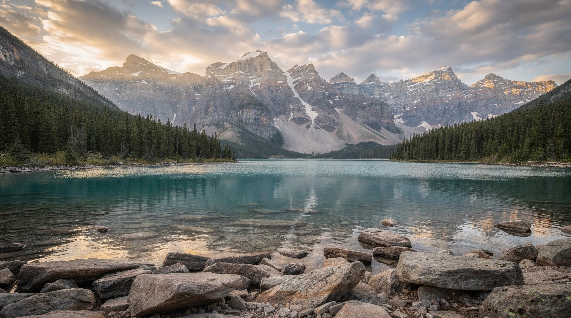
Two hours west of Whitehorse, Haines Junction is the gateway village to Kluane National Park and Reserve. The settlement itself is small — a few hundred residents, a handful of inns and restaurants — but it sits directly at the eastern edge of one of the most dramatic wilderness areas on the continent. Kluane protects the largest non-polar icefields in the world: the Kluane–Wrangell–St. Elias system, shared with Alaska, covers over 22,000 square kilometres of glacial ice. Mount Logan, at 5,959 metres, is Canada’s highest peak and rises entirely within the park.
Most of Kluane is visible only from the air. Kluane Glacier Air Tours flies small planes over the icefields from Haines Junction, and the perspective — hundreds of square kilometres of ice, nunataks breaking the surface, glaciers calving into terminal lakes — is something you cannot replicate from any ground-level experience. For those who do want to hike, the King’s Throne trail and the Slim’s River West route both deliver extraordinary mountain-and-glacier scenery without requiring technical climbing skills. Dall sheep are routinely visible on the slopes above the Alaska Highway as it skirts the park’s eastern edge.
Tombstone, Dempster, Carcross
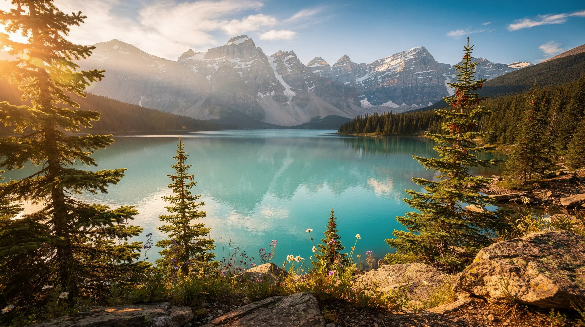
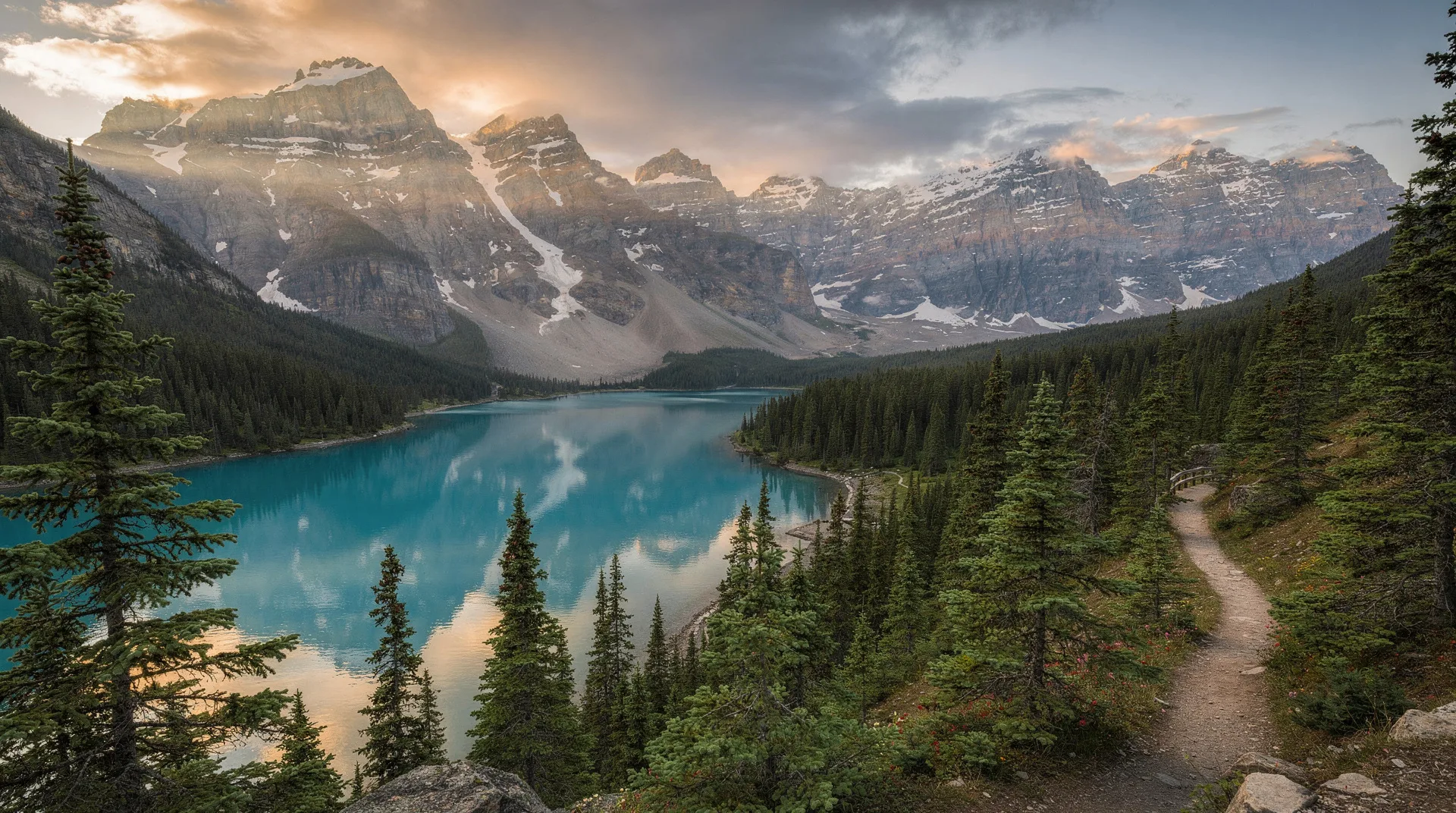
North of Dawson, the Dempster Highway heads out of the boreal forest and into some of the most dramatic sub-Arctic terrain in North America. The first 72 kilometres deliver you to Tombstone Territorial Park — jagged granite peaks rising from tundra plateaus, caribou migration corridors, and almost no other visitors. The park has been called “the Patagonia of the north,” and for once the comparison holds up. The Tombstone Interpretive Centre at Kilometre 71 is the starting point for day hikes, and backcountry campgrounds at Grizzly Lake and Divide Lake require advance reservations for a reason: they sell out every summer.
The full Dempster runs 736 kilometres north from Dawson to Inuvik in the Northwest Territories, crossing the Arctic Circle at Kilometre 406. It is the only all-season road in Canada that crosses the Arctic Circle, and since 2017 the Inuvik–Tuktoyaktuk Highway extension has added another 140 kilometres to the Arctic Ocean itself. Driving the full route is a serious undertaking — gravel surface, two spare tyres recommended, limited fuel, and weather that can turn grim in any season — but it remains one of the great road journeys of the world.
South of Whitehorse, Carcross is a small Tagish and Tlingit community on Bennett Lake, 74 kilometres from the capital along the Klondike Highway South. The Carcross/Tagish First Nation has redeveloped the historic village into a thoughtful cultural and arts hub, with totems, artist studios, and the Matthew Watson General Store (which claims to be Canada’s oldest continuously operating store). Nearby, the “Carcross Desert” — a one-square-mile area of glacial-lake sand sometimes called the world’s smallest desert — is a photogenic oddity. The White Pass & Yukon Route railway runs through here, and summer excursion trains connect Carcross to Skagway, Alaska.
Browse all Yukon northern lights and wilderness experiencesThe Northwest Territories: aurora and the Nahanni
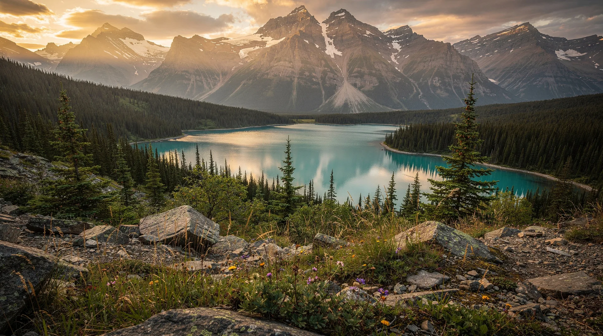
The Northwest Territories stretches across 1.3 million square kilometres of boreal forest, tundra, and Arctic archipelago. It is less visited than the Yukon but arguably offers more of the classic northern experiences: the most reliable aurora viewing in Canada, one of the world’s great wild river systems, and some of the highest-quality Indigenous-led tourism on the continent. Roughly half the territory’s population of 45,000 is Indigenous — Dene, Métis, Inuvialuit, and others — and the cultural presence is a significant part of the travel experience.
Yellowknife, aurora capital of Canada
Yellowknife sits on the northern shore of Great Slave Lake, the tenth-largest lake in the world by area and one of the deepest. The city of 20,000 is a working capital — government jobs, diamond-mining support services, and a surprisingly varied restaurant scene — but its global claim to fame is the aurora. Yellowknife sits almost directly under the auroral oval, the ring of maximum aurora activity around the magnetic pole. Combined with cold, dry winters that produce very clear skies, this location gives the city some of the most reliable northern-lights viewing on Earth. A three-night stay between November and March delivers aurora on roughly 90% of clear nights, and “clear nights” here means most of them.
The aurora industry in Yellowknife is mature. Indigenous-owned operators like Aurora Village and B.Dene Adventures run heated teepee camps in the forest outside town, with multi-hour viewing sessions that include indoor warmth, hot drinks, photography guidance, and cultural context from Dene elders. Blachford Lake Lodge — a fly-in wilderness lodge on a frozen lake — offers the most immersive version of the experience, with full-board stays in log cabins miles from any other light source.
Beyond the aurora, Yellowknife has the Prince of Wales Northern Heritage Centre (a genuinely excellent territorial museum), the Old Town neighbourhood of floating houseplanes and painted cottages on the lake, and access to Great Slave Lake fishing and boat trips in summer. The midnight sun in June and July turns the city’s 24-hour daylight into a strange kind of second summer.
Book a Yellowknife aurora viewing tour or Northern Lights experienceInuvik and Tuktoyaktuk
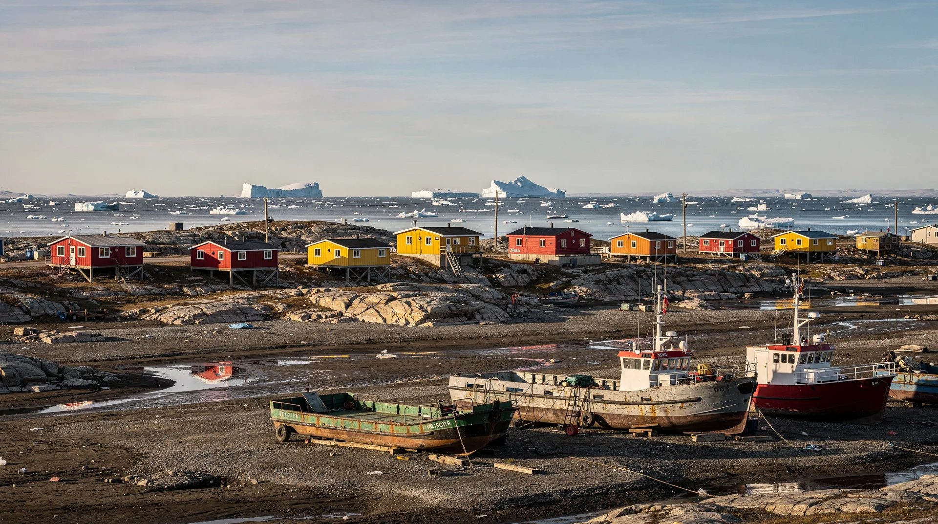
Inuvik is the largest community in the western Arctic, with roughly 3,300 people at the head of the Mackenzie Delta. Founded in 1955 as a planned settlement to replace the flood-prone community of Aklavik, it has the igloo-shaped Our Lady of Victory Church, a cluster of colourful prefab houses on permafrost, and the distinction of being the northern terminus of the original Dempster Highway. The Great Northern Arts Festival in July brings Indigenous artists from across the circumpolar north for ten days each summer.
From Inuvik, the Inuvik–Tuktoyaktuk Highway — opened in 2017 — runs 140 kilometres north to the Arctic Ocean. Tuktoyaktuk sits on the Beaufort Sea coast, an Inuvialuit community of about 900 people known for its pingos (ice-cored hills that rise from the tundra), the tradition of the Arctic Ocean “toe dip,” and a landscape of tundra and sea ice that feels entirely different from anything else on Canada’s road network. Driving all the way from Dawson to Tuk on one trip is a bucket-list route for serious road travellers.
Nahanni National Park Reserve
In the southwestern corner of the NWT, Nahanni National Park Reserve — often just called Nahanni Park — protects one of the most spectacular river-canyon systems on Earth. The South Nahanni River cuts through four deep canyons, passes Virginia Falls (at 96 metres, nearly twice the height of Niagara), and flows through the homeland of the Dehcho Dene. The park is accessible only by float plane or by a multi-week self-supported paddle. It was one of Canada’s original UNESCO World Heritage Sites, inscribed in 1978 when the list was still short enough that every entry carried real weight.
A typical Nahanni trip involves flying from Fort Simpson to either Rabbitkettle Lake or Virginia Falls, then paddling downstream over seven to fourteen days with a licensed outfitter. Costs run from CAD 5,000 per person upward, and permits are limited — book twelve months in advance for peak July–August dates. For those without the time or paddling experience, day flightseeing tours from Fort Simpson loop over Virginia Falls and the canyons in a few hours and give you a sense of the scale without the commitment.
The Mackenzie River and Wood Buffalo
The Mackenzie River is the longest river system in Canada — 4,241 kilometres from its Peace River headwaters to the Arctic Ocean. It is one of the world’s last great free-flowing rivers of its size and the cultural artery of the Dene and Métis communities along its course. Travel on the Mackenzie is almost entirely by boat, barge, or small plane. Guided river trips from Fort Simpson or Norman Wells open up sections that no road ever reaches.
Straddling the Alberta–NWT border, Wood Buffalo National Park is Canada’s largest national park and a UNESCO World Heritage Site protecting the world’s largest free-roaming herd of wood bison, the only remaining natural nesting area of the whooping crane, and one of the largest inland deltas on Earth (the Peace-Athabasca Delta). It is also a designated Dark Sky Preserve, and the aurora viewing in the park’s interior is outstanding. Fort Smith in the NWT is the main access point.
Nunavut: the Arctic proper
Nunavut — “our land” in Inuktitut — became Canada’s newest territory in 1999, when it was carved out of the NWT to create a homeland for the Inuit. It covers just over two million square kilometres, roughly 20% of Canada’s total land area, and has a population of about 40,000 people, approximately 85% of whom are Inuit. There are no roads connecting Nunavut’s communities to each other or to the south. Everything moves by plane, by boat in open-water months, or by snowmobile across sea ice. Travel here is expensive, logistically demanding, and unlike anywhere else in the country.
Iqaluit, gateway to the territory
Iqaluit sits at the head of Frobisher Bay on the south coast of Baffin Island, at 63.7° North. With around 8,000 people, it is the only genuine urban centre in Nunavut and the near-universal gateway for any trip into the territory. Canadian North flies from Ottawa in about three hours, and those three hours deliver you into a different Canada: Inuktitut in the street, Inuit art in the Nunatta Sunakkutaangit Museum, Legislative Assembly debates conducted in three languages, and the sheer cost of everything confirming that you are a long way from the road network.
The Toonik Tyme festival in April celebrates the return of spring with drum dancing, igloo-building competitions, and seal-skinning demonstrations. The Alianait Arts Festival in June brings together Indigenous artists from across the circumpolar north. Sylvia Grinnell Territorial Park, on the city’s western edge, offers tundra hiking and Arctic char fishing within walking distance of downtown. Frobisher Bay itself has one of the largest tidal ranges in the world — at low tide, mudflats extend for kilometres.
Budget realistically. A five-day Iqaluit trip with return flights from Ottawa, accommodation, and meals typically costs CAD 3,500–5,500 per person before any guided activities. Food prices are 2–3 times southern equivalents; a hotel room runs CAD 220–380 per night. This is the baseline. Onward travel within Nunavut multiplies it.
Baffin Island and Auyuittuq
Baffin Island is the fifth-largest island in the world — 507,000 square kilometres of fjords, icecaps, and tundra, with roughly 13,000 people distributed among a handful of communities. Pangnirtung (on the Cumberland Sound), Pond Inlet (in the north, near the floe edge), Cape Dorset/Kinngait (the epicentre of Inuit printmaking), and Clyde River (sea kayaking and wildlife) are the main destinations beyond Iqaluit. All are reached by scheduled Canadian North or charter flights through the capital.
Auyuittuq National Park is the signature wilderness of the eastern Arctic. The name means “the land that never melts,” and the park’s Penny Ice Cap is the last remnant of the ice sheet that covered much of Canada during the last glacial maximum. The Akshayuk Pass — a 97-kilometre U-shaped valley between Pangnirtung and Qikiqtarjuaq — runs between walls of vertical granite that reach 1,500 metres above the valley floor. Mount Thor, near the pass, has the world’s greatest purely vertical drop: 1,250 metres of sheer rock. Polar bears, ringed seals, beluga and narwhal are all present in the surrounding waters.
Travelling into Auyuittuq requires registration with Parks Canada, a mandatory orientation in Pangnirtung, and either a guide or demonstrated Arctic wilderness experience. Most visitors go with licensed Inuit-led operators who handle logistics, cultural interpretation, and the realities of polar-bear country.
The rest of Nunavut
Beyond Baffin, the rest of Nunavut is even harder to reach but genuinely extraordinary. Ukkusiksalik National Park on the Hudson Bay coast has one of the highest densities of polar bears in Canada. Quttinirpaaq National Park, on the northern tip of Ellesmere Island at 82° North, is the second-most-northerly park on Earth. Sirmilik National Park near Pond Inlet offers narwhal viewing and floe-edge camping on the sea ice in late spring. These are all multi-week, high-cost, guided expeditions organised six to twelve months in advance through operators like Arctic Kingdom or Black Feather.
Best things to do in the Canadian north
See the northern lights. The aurora is the single biggest draw and the reason most visitors choose a northern trip. Yellowknife is the most reliable location on Earth; Whitehorse is nearly as good and easier to reach; and aurora is routinely visible from Iqaluit, Inuvik, and most of the smaller communities between September and April. Budget three clear nights to be reasonably sure of a good display; five nights for near-certainty.
Walk through the Klondike Gold Rush. Dawson City is the most completely preserved gold-rush town on the planet, and standing on the boardwalk at midnight in June with the sun still up is a genuinely strange experience. Parks Canada’s heritage sites, the Tr’ondëk Hwëch’in cultural centre, and actual gold panning on Bonanza Creek fill two or three days easily.
Experience the midnight sun. Between roughly May 20 and July 20, the sun never fully sets above the Arctic Circle. In Dawson, Inuvik, and the Nunavut communities, midsummer delivers 22–24 hours of daylight. Golf is played at midnight. Photography becomes surreal. The disorientation — initially unsettling, quickly addictive — is one of the defining northern experiences.
Arctic expeditions and wildlife. Polar bears near Pond Inlet and Wood Buffalo, narwhal at the Lancaster Sound floe edge, beluga in the Mackenzie Delta, muskox on the Arctic tundra, and caribou migrations across the Dempster corridor. Most of the best wildlife experiences require guided expeditions and serious budgets, but even a drive up the Dempster in September will likely produce grizzly, moose, and Dall sheep sightings.
Dog sledding. The Yukon is inseparable from sled-dog culture, and the Yukon Quest race between Whitehorse and Fairbanks every February remains one of the toughest endurance races on Earth. Multiple operators in Whitehorse, Yellowknife, and Haines Junction offer introductory runs, full-day excursions, or multi-day kennel stays.
Paddle a legendary river. The South Nahanni, the Yukon River from Whitehorse to Dawson, the Mackenzie, the Soper on Baffin Island — the north has more classic wilderness canoe routes than any other region in Canada. Multi-week self-supported trips are the standard format.
When to visit
January to March: aurora season. The longest nights, most reliable cold-and-clear weather, and peak aurora probability. Temperatures regularly drop below -30°C in Yellowknife and the interior Yukon and can hit -50°C in Old Crow or Tuktoyaktuk. Proper clothing (parka rated to -40°C, insulated boots, mitts, face protection) is non-negotiable. Most operators provide outer layers for clients who don’t want to buy them.
April: shoulder aurora and spring events. Aurora viewing remains excellent through early April, days are rapidly lengthening, and the Nunavut spring festivals (Toonik Tyme in Iqaluit) happen now. Sea ice is still stable enough for snowmobile travel.
Late May to early August: midnight sun. Long daylight, the most comfortable temperatures (15–25°C in the Yukon and southern NWT; cooler in Nunavut), and full operation of every attraction and park. Mosquitoes peak in June and early July — head net essential off the tourist tracks. This is the hiking, paddling, and road-tripping season.
September: the sweet spot. Autumn colours across the boreal forest and tundra, decreasing mosquitoes, the aurora returning, and smaller crowds. Temperatures are cool (5–15°C) and weather can turn quickly. Many travellers who have been in midsummer say September is the best single month in the Yukon.
October to December: A transitional period. Many summer operators close by late September. The Mackenzie freezes up, road conditions deteriorate, and aurora season is technically open but weather is often unsettled. Late November onward the full winter operation begins.
Getting there and around
Flying is the backbone of all northern travel. Whitehorse has daily Air North and Air Canada flights from Vancouver and seasonal service from Calgary, Edmonton, and other Canadian cities. Yellowknife has daily service from Calgary, Edmonton, and connections through Vancouver. Iqaluit has Canadian North flights from Ottawa multiple times a week and less frequent connections from Montreal and Winnipeg. Fares run CAD 500–900 return from Vancouver/Calgary to Whitehorse or Yellowknife, and CAD 800–1,600 return from Ottawa to Iqaluit depending on season.
Driving the Yukon and western NWT. The Alaska Highway, Klondike Highway, and Stewart-Cassiar Highway are all paved and well-maintained from May through September. Winter driving is possible but requires winter tyres, an emergency kit, and realistic time buffers. The Dempster Highway and the Inuvik–Tuktoyaktuk Highway are gravel and require a prepared vehicle (two spare tyres, fuel can, satellite communication device). Rental-car companies typically prohibit their vehicles on the Dempster — you will need a specialist Yukon outfitter or a private arrangement.
Getting around Nunavut. There are no roads between Nunavut communities. Canadian North operates scheduled service between Iqaluit and the larger Baffin communities; smaller settlements require charter flights. Ski-Doo and qamutik (sled) travel across sea ice in winter is the traditional way of moving between villages and is routinely arranged as part of guided trips.
Rental-vehicle notes. Book northern rental cars months in advance for summer — demand far outstrips supply in Whitehorse and Yellowknife. Budget, National, and Driving Force are the main national brands; local Yukon operators like Klondike Recreational Rentals handle specialised needs like gravel-road-rated trucks and camper vans.
Suggested itineraries
Yukon loop — 7 days
A classic first-timer’s Yukon trip, all by road from Whitehorse.
- Days 1–2: Whitehorse. Miles Canyon, SS Klondike, Beringia Centre, MacBride Museum, Takhini Hot Springs.
- Day 3: Drive west to Haines Junction. Afternoon at Kluane Visitor Centre; Kluane Glacier Air Tour if weather permits.
- Day 4: Hike in Kluane (King’s Throne or Auriol Trail). Return to Whitehorse or overnight in Haines Junction.
- Day 5: Drive north to Dawson City via the Klondike Highway.
- Day 6: Dawson City full day: Klondike NHS, Dänojà Zho, Bonanza Creek, Midnight Dome at midnight.
- Day 7: Half-day Dempster Highway to Tombstone Territorial Park interpretive centre. Fly back to Whitehorse on Air North, or drive the long way.
NWT aurora — 5 days (winter)
- Day 1: Fly into Yellowknife. Afternoon orientation; first aurora session tonight.
- Days 2–3: Aurora viewing each evening; daytime dog sledding, snowshoeing, ice-road driving, or a visit to Prince of Wales Northern Heritage Centre.
- Day 4: Fly-in or road trip to a wilderness lodge (Blachford Lake Lodge if budget allows) for one night away from the city.
- Day 5: Return to Yellowknife, final aurora session if time allows, flight home.
Nunavut expedition — 10+ days
Nunavut trips are not casual. Budget 10–14 days minimum and plan 6–12 months ahead.
- Days 1–3: Iqaluit. Museum, galleries, Sylvia Grinnell, Frobisher Bay boat tour (summer) or snowmobile trip (spring). Cultural events if available.
- Days 4–10: Charter flight to Pangnirtung and onward into Auyuittuq National Park for a guided hike of the Akshayuk Pass, OR charter to Pond Inlet for floe-edge narwhal viewing (May–June only), OR Baffin Island sea-kayaking from Clyde River.
- Days 11–14: Return to Iqaluit and south. Build slack into every leg — Arctic weather cancels flights routinely and itineraries need elasticity.
Frequently asked questions about Canada’s north: Yukon, NWT and Nunavut
What is the single best place for aurora in Canada?
Yellowknife sits almost directly under the auroral oval and has the driest, coldest, clearest winters of any aurora-accessible city in Canada. Three nights in Yellowknife between November and March delivers aurora with near-certainty. Whitehorse is a close second and is easier and cheaper to reach from most of Canada.
Can I drive to the Arctic Ocean?
Yes, since 2017. Drive north from Dawson City on the Dempster Highway to Inuvik, then continue on the Inuvik–Tuktoyaktuk Highway to the Beaufort Sea coast. The full route is approximately 900 kilometres of gravel road from Dawson and requires 3–4 days minimum each way. A prepared vehicle is essential.
How cold does it actually get?
In midwinter, Whitehorse and Yellowknife routinely see -25°C to -35°C, with occasional drops to -40°C. Inuvik and the Nunavut communities reach -45°C to -50°C. Wind chill drives the felt temperature lower. Proper clothing (parka rated to -40°C, insulated boots, mitts, neck gaiter) is essential — but when you are dressed correctly, extreme cold becomes a manageable curiosity rather than an obstacle.
How expensive is northern travel?
Considerably more expensive than southern Canada. A week in the Yukon (flights from Vancouver, rental car, mid-range hotels, meals, one or two guided activities) typically runs CAD 3,500–5,500 per person. A week in Yellowknife is similar. A week in Iqaluit alone runs CAD 4,000–6,000, and onward travel into the Nunavut communities or national parks can easily double that. Nahanni and Auyuittuq expeditions run CAD 6,000–12,000 per person.
Do I need a guide, or can I travel independently?
In the Yukon and southern NWT, independent travel is straightforward — rent a car, book hotels, and go. Whitehorse, Dawson City, Haines Junction, and even Inuvik work fine as independent destinations. Yellowknife is the same, though aurora viewing benefits enormously from a guided operator who handles transport to dark-sky sites. In Nunavut beyond Iqaluit, and in backcountry national parks like Nahanni or Auyuittuq, guides are either mandatory or overwhelmingly recommended for safety, logistics, and cultural reasons.
What permits do I need for northern national parks?
Kluane, Nahanni, Wood Buffalo, and Auyuittuq all require entry permits and, for backcountry use, advance reservations through Parks Canada. Nahanni river permits and Auyuittuq traverse permits book out months in advance for peak summer dates — plan 9–12 months ahead.
How do I meaningfully experience Indigenous culture in the north?
Choose Indigenous-owned operators wherever possible. In the Yukon, the 14 First Nations operate or co-operate with multiple cultural programs — start at the Tr’ondëk Hwëch’in’s Dänojà Zho in Dawson, the Kwanlin Dün Cultural Centre in Whitehorse, and First Nations-run tour companies. In Yellowknife, Indigenous-owned aurora operators are some of the best in the city. In Iqaluit and the Nunavut communities, virtually all tourism is Inuit-led by default. Approach with genuine curiosity rather than a checklist mindset.
When do attractions close for the season?
In the Yukon and NWT, most summer operators (boat tours, flightseeing, mid-range lodges) run from late May through late September. Winter operators (aurora, dog sledding) run from late November through early April. April, May, and late October are shoulder seasons with reduced offerings. In Nunavut, summer (July–August) and late-spring sea-ice season (April–June) are the main windows; November–February is too dark for most tourism activities outside aurora.
Explore destinations in Northern Canada
21 places to discover across the region — from headline cities to hidden villages. Tap a card to dive in.
The Yukon9
Yukon Territory
The Yukon: aurora borealis, midnight sun, Dawson City's Gold Rush past, Kluane's glaciers, and the legendary Dempster Highway through the subarctic.
Whitehorse
Whitehorse is the Yukon's vibrant capital: aurora borealis, Klondike history, Miles Canyon, and world-class wilderness right from the city's doorstep.
Dawson City
Dawson City preserves the Klondike Gold Rush like nowhere else: gold panning, the Midnight Dome, heritage saloons, and the start of the Dempster Highway.
Haines Junction: Yukon's Kluane Gateway
Haines Junction is the Yukon gateway to Kluane National Park, Dall sheep country, and the Alaska Highway
Kluane National Park and Reserve
Kluane is Canada's greatest wilderness: Mount Logan at 5959m, the Kaskawulsh Glacier, grizzly bears, and Dall sheep in a UNESCO World Heritage landscape.
Kluane National Park: Glaciers and Grizzlies in the Yukon
Kluane National Park in the Yukon — Canada's highest mountain, vast icefields, grizzly bears, hiking, flightseeing and backcountry adventures.
Tombstone Territorial Park: The Yukon's Alpine Wonder
Tombstone Territorial Park: jagged peaks, tundra valleys, grizzly bears, and Dempster Highway access. Everything you need to plan your Yukon alpine visit.
Dempster Highway: The 740km Arctic Circle Road
The Dempster Highway is Canada's only public road crossing the Arctic Circle. 740km of gravel from Dawson City to Inuvik — complete planning guide.
Carcross Yukon: World's Smallest Desert & Gold Rush
Carcross sits on mountain lake country in southern Yukon: the world's smallest desert, Carcross Commons, Gold Rush history
Northwest Territories8
Northwest Territories
The NWT: aurora over Yellowknife, Virginia Falls in Nahanni, Wood Buffalo bison, Great Slave Lake, and Dene culture across a vast subarctic wilderness.
Yellowknife
Discover Yellowknife: Canada's aurora capital, Great Slave Lake, Indigenous culture, midnight sun, diamond mining history, and true northern wilderness.
Inuvik Northwest Territories: Above the Arctic Circle
Inuvik sits above the Arctic Circle at the end of the Dempster Highway. Gateway to Tuktoyaktuk, the Mackenzie Delta, and true western Arctic wilderness.
Tuktoyaktuk: Dipping in the Arctic Ocean
Tuktoyaktuk is where Canada's road network ends at the Arctic Ocean. Drive the Inuvik-Tuk Highway, touch the ocean, see pingos, and reach 69°N.
Nahanni National Park Reserve: Virginia Falls & Canoe Wilderness
Nahanni National Park Reserve: Virginia Falls twice the height of Niagara, South Nahanni River canoeing, hot springs, and UNESCO wilderness in the NWT.
Nahanni National Park Reserve: UNESCO Wilderness
Nahanni National Park Reserve in NWT — Virginia Falls, South Nahanni River rafting, flightseeing and one of the wildest UNESCO World Heritage sites.
Mackenzie River: Canada's Great Northern Waterway
The Mackenzie River flows 1,738 km through Canada's Northwest Territories to the Arctic Ocean — trip planning, paddling, communities, and access.
Wood Buffalo National Park: Canada's Largest NP
Wood Buffalo National Park: 44,807 km² UNESCO site, world's last wild bison herd, whooping cranes, and the largest dark sky preserve in the world.
Nunavut & the eastern Arctic4
Nunavut
Nunavut: Inuit homeland, polar bears, narwhals, Auyuittuq NP, Baffin Island fjords, and Canada's most remote and extraordinary High Arctic frontier.
Iqaluit: Nunavut's Capital & Gateway to Baffin
Iqaluit is Nunavut's capital and the gateway to Baffin Island. Inuit culture, Arctic wildlife, and the practical hub for Canada's most remote territory.
Baffin Island Nunavut: Arctic Travel Complete Guide
Baffin Island is Canada's largest island and the heart of Nunavut
Auyuittuq National Park: Akshayuk Pass & Thor Peak
Auyuittuq National Park on Baffin Island: the 97km Akshayuk Pass through granite walls, Thor Peak's vertical face