Quick facts
- Size
- 44,807 km² (larger than Switzerland)
- UNESCO status
- World Heritage Site since 1983
- Main access
- Fort Smith, NWT or Fort Chipewyan, Alberta
- Best time
- June–August (wildlife); Jan–March (aurora)
- Days needed
- 3-5 days minimum
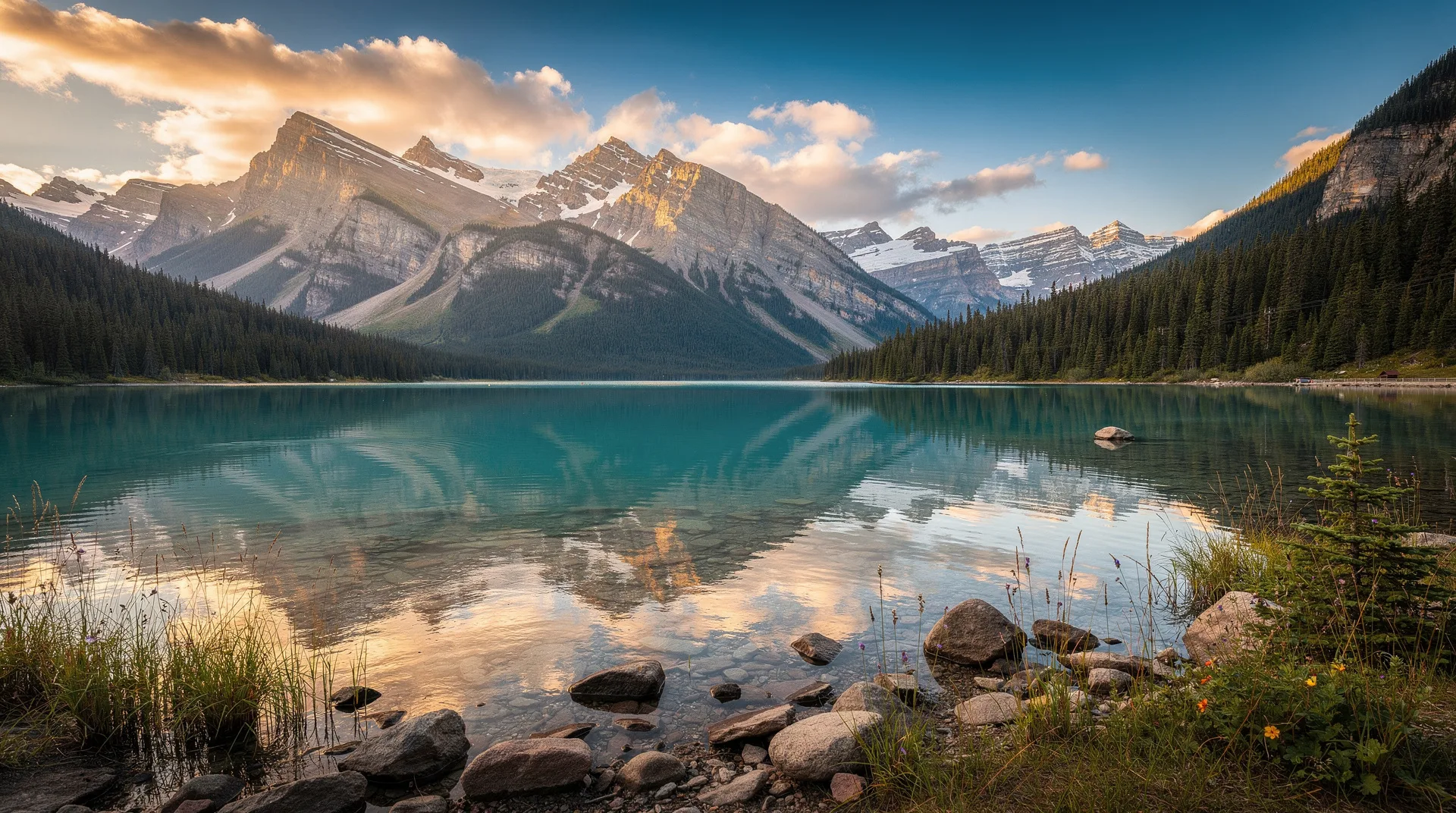
Wood Buffalo National Park is the largest national park in Canada and the second largest in the world, covering 44,807 square kilometres — an area larger than Switzerland — straddling the border between northeastern Alberta and the southern Northwest Territories. Established in 1922 to protect the last herds of free-roaming bison in North America, the park has grown in significance to encompass one of the most exceptional dark sky preserves on earth, the only natural nesting habitat of the endangered whooping crane, and a landscape of salt plains, boreal forest, river deltas, and karst topography of global geological significance.
The park received UNESCO World Heritage Status in 1983. In 2019, it was placed on the UNESCO World Heritage in Danger list following concerns about the cumulative impacts of upstream development on the Peace-Athabasca Delta within the park — a situation that remains contentious between conservation organisations, Indigenous communities whose treaty rights are tied to the delta’s ecological health, and resource development interests in Alberta.
The bison: why the park exists
The plains bison once numbered 30–60 million animals across the North American grasslands — the largest aggregation of large mammals on earth. By the early 20th century, hunting had reduced the population to fewer than 1,000. Wood Buffalo was established specifically to protect a remnant population of wood bison (a larger subspecies than the plains bison) that had survived in the remote boreal country south of Great Slave Lake.
Today the park contains approximately 5,000 free-roaming bison — the largest wild bison herd in existence anywhere on earth. These are not managed animals in a fenced reserve; they move through the park’s full extent according to seasonal forage and behaviour patterns, following routes shaped by thousands of years of bison ecology. Encountering a bison herd in Wood Buffalo is an encounter with an ancient North American reality that barely survived to the present.
Viewing: Bison are commonly seen along park roads, particularly the road through the Salt Plains area and along the Peace River corridor. They are large, unpredictable, and should be observed from a vehicle distance. A bison that appears calm can move extremely quickly. Parks Canada provides guidance on safe viewing distances at the Fort Smith visitor centre.
The whooping crane: the rarest large bird in North America
The whooping crane — at 1.5 metres tall, the tallest bird in North America — breeds exclusively in Wood Buffalo National Park. The species was reduced to approximately 15 birds in 1941. Through a recovery program combining habitat protection in Wood Buffalo and wintering ground protection in Aransas National Wildlife Refuge in Texas, the population has recovered to approximately 800 birds (wild and captive combined), with roughly 500 in the wild.
The cranes nest in a remote portion of the park’s Sass River wetlands — an area that is not open to general visitor access to avoid disturbing nesting behaviour. Aerial surveys in June typically locate active nests; Parks Canada publicises the results. The best viewing opportunity for whooping cranes in Wood Buffalo is during fall migration staging (August–September) in the Peace-Athabasca Delta area, when family groups gather before the 4,000-kilometre migration to Texas.
The Peace-Athabasca Delta
The Peace-Athabasca Delta is one of the largest inland freshwater deltas in the world, covering approximately 5,000 square kilometres within the park where the Peace, Athabasca, and Birch rivers meet and spread across a vast floodplain. It is one of the most important waterbird staging areas in North America — an estimated 400,000 waterfowl and shorebirds use the delta during migration, drawn by the shallow lakes and wetlands produced by periodic spring flooding.
The delta is also the centre of Mikisew Cree, Chipewyan (Denesuline), and Métis traditional territories. Indigenous communities in Fort Chipewyan, on the southern edge of the park in Alberta, have documented the ecological decline of the delta in recent decades and connected it to changes in Peace River hydrology related to upstream development in Alberta. The traditional use of the delta — for hunting, fishing, and trapping — has been part of community life for thousands of years and is one of the treaty rights affected by ecological change.
Dark sky and aurora
Wood Buffalo holds the distinction of being the largest dark sky preserve in the world — designated by the Royal Astronomical Society of Canada in 2013. The combination of size (44,807 km²) and almost complete absence of light pollution within its boundaries produces conditions for night sky observation that are surpassed by very few locations on earth.
Aurora viewing in Wood Buffalo is exceptional. The park’s latitude places it under or near the auroral oval, and the absence of light pollution means displays appear at their full intensity. The aurora season runs from late August through April; the January–March period offers the longest dark periods combined with frequently clear skies.
Fort Smith, the main service community adjacent to the park’s northern boundary, has aurora viewing infrastructure — local operators run viewing excursions to optimal dark-sky sites within the park. The contrast between the boreal forest silhouette, the vast dark sky, and an active aurora at -30°C produces a sensory experience that is difficult to convey in photographs.
Browse Canada northern lights and aurora experiences across the northern wildernessFort Smith: the main access point
Fort Smith is an NWT community of approximately 2,500 people on the NWT-Alberta border, 30 kilometres north of the park’s northern boundary. It serves as the practical base for Wood Buffalo visits, with accommodation, restaurants, a Parks Canada visitor centre, and the cultural resources of the Métis and Dene communities who have long inhabited this area.
The Wood Buffalo National Park Visitor Centre in Fort Smith is the essential first stop — current bison locations, road conditions, wildlife activity updates, and aurora forecasts are all available here. Staff can recommend appropriate viewing areas based on current conditions.
The Northern Life Museum and Cultural Centre covers the history and natural history of the region, with a particular focus on the Indigenous peoples of the area and the fur trade history of the Mackenzie watershed.
Salt Plains
The Salt Plains, accessible by a short drive and walk from the park road north of Fort Smith, are one of the park’s most unusual geological features — a saline flat where mineral springs leave brilliant white salt deposits across a broad lowland, creating a landscape unlike anything else in the boreal North. The bison visit the salt plains regularly; bird life concentrates at the margins where fresh water meets saline soil. The visual effect — flat white salt against dark spruce forest under a wide northern sky — is distinctive and photogenic.
Karst topography and sinkholes
Wood Buffalo contains the largest area of karst topography in Canada — a landscape formed by the dissolution of limestone bedrock by acidic water, producing sinkholes, caves, and disappearing rivers. Some of the sinkholes in the park are several metres in diameter and drop into underground drainage systems. The karst landscape requires care on foot — sinkholes can be disguised by vegetation and are potentially dangerous. Guided karst hikes are available through the visitor centre.
Getting to Wood Buffalo
To Fort Smith (NWT northern access): Canadian North operates scheduled service from Yellowknife (approximately 1 hour). From Yellowknife, a flight is the most practical approach. Alternatively, the highway from Hay River (accessible from Edmonton via Mackenzie Highway) reaches Fort Smith — approximately 500 kilometres from Hay River on paved road.
To Fort Chipewyan (Alberta southern access): Fort Chipewyan is accessible only by air or by winter ice road from Fort McMurray. In summer, there is no road connection to the rest of Alberta. The floatplane service from Fort McMurray is the summer access option.
Cost: Wood Buffalo is a genuine northern destination with associated costs. A Parks Canada entry fee or Discovery Pass applies. Accommodation in Fort Smith: CAD 120–200/night. Meals at northern remote prices. If flying from Yellowknife, add flight costs to the budget.
Browse guided tours and wilderness experiences across Canada’s northern territoriesRelated destinations
Wood Buffalo sits between the Northwest Territories and Alberta — a genuinely border destination. Yellowknife to the north is the NWT capital and the most practical staging point for flights to Fort Smith. The park’s southern Alberta connection links it to the broader boreal region. For an NWT wilderness circuit, combine Wood Buffalo with Nahanni National Park Reserve — the two UNESCO sites represent the territory’s premier conservation areas.
Frequently asked questions about Wood Buffalo National Park: Canada’s Largest NP
Can I camp in Wood Buffalo? Yes — the park has campgrounds accessible by road near Fort Smith, and backcountry camping is permitted with Parks Canada registration. The Pine Lake Campground is the main serviced campground, popular in summer for its lakeside setting. Backcountry travel in the park’s interior is for experienced wilderness travellers with navigation skills and appropriate equipment.
Is Wood Buffalo accessible in winter? Fort Smith and the northern part of the park are accessible year-round. Winter activities include aurora viewing, cross-country skiing, and snowshoeing. The ice road to Fort Chipewyan opens in winter. Winter temperatures regularly drop to -35°C; dress accordingly.
How do I see bison in Wood Buffalo? Drive the park roads during morning and evening hours when bison are most active. The road through the Salt Plains area and along the Peace River Corridor are consistently productive. Do not approach bison on foot; observe from your vehicle. Park staff at the visitor centre can provide current location information for recent bison sightings.
Is the park worth visiting without a wildlife focus? The dark sky and aurora alone justify a visit in winter. The karst landscape and salt plains are genuinely unusual geological features. The Peace-Athabasca Delta is important historically and ecologically. Wood Buffalo is a park of multiple significant features rather than a single spectacular attraction — appreciate it for complexity rather than a single dramatic image.