Niagara Escarpment: Hiking the Bruce Trail and Scenic Stops
What is the Niagara Escarpment?
The Niagara Escarpment is a 725 km UNESCO Biosphere Reserve running from Niagara Falls to Tobermory. The Bruce Trail (900 km) follows its length, passing Hamilton's waterfalls, Blue Mountain, Bruce Peninsula National Park, and ending at Tobermory. Ontario's premier hiking trail.
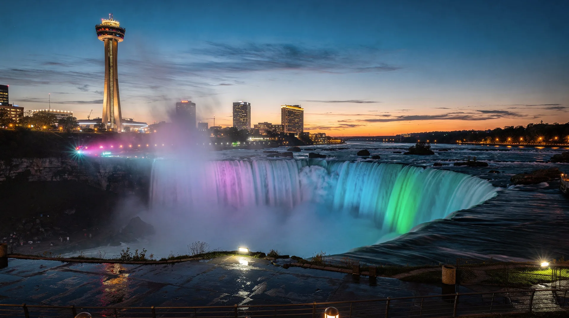
The Niagara Escarpment is one of Ontario’s most significant landscape features — a 725-kilometre limestone ridge that runs from Niagara Falls north along the western shore of Lake Ontario, up the Bruce Peninsula, and ending at Tobermory where it plunges into Georgian Bay and continues underwater to emerge as Manitoulin Island. UNESCO designated the Ontario section a World Biosphere Reserve in 1990, recognising it as one of the most ecologically significant natural features in North America. For hikers, the Escarpment is the backbone of Ontario’s single greatest trail — the Bruce Trail, Canada’s oldest and longest marked footpath, which runs 900 kilometres along the Escarpment’s length. The trail passes through Niagara wine country, over Hamilton’s 100+ waterfalls, through the Dundas Valley, past Blue Mountain Ski Resort, along Georgian Bay cliffs, and ends at the turquoise water and white cliffs of Tobermory. For hiking-focused visitors, the Escarpment is Ontario’s defining natural asset.
This guide covers the geology, the main sections of the Bruce Trail, the best day hikes, and how to plan a visit. For related destinations, see Bruce Peninsula, Hamilton Ontario, Hamilton waterfalls, and Blue Mountain.
What the Escarpment is
The Niagara Escarpment formed roughly 450 million years ago when a shallow sea covered what is now central North America. Limestone and dolostone sediments accumulated on the seabed, eventually hardening into rock. Over tens of millions of years, softer sedimentary rock eroded away while the harder dolostone cap rock resisted — the result is the distinctive cliff-and-slope profile that defines the Escarpment today. The same geology produces Niagara Falls itself: the Niagara River crosses the Escarpment at Niagara Falls, and the falls are an ongoing erosive process working the cliff backward at roughly 1 metre per year.
The Escarpment’s ecological significance derives from its height and variety. The cliff edges create microclimates that support species ranging from rare cliff-dwelling ferns to nesting raptors; the deep valleys carved by Ice Age runoff contain old-growth cedar forests over 1,000 years old (among the oldest trees in eastern North America); the caves and talus slopes support unique cave ecosystems.
The Bruce Trail
The Bruce Trail was conceived in 1959 and completed in 1967 — Canada’s first long-distance marked hiking trail. It runs 900 kilometres from Queenston Heights near Niagara Falls to Tobermory at the tip of the Bruce Peninsula. The trail is maintained by the Bruce Trail Conservancy and a network of nine local chapter organisations.
Trail sections (south to north):
-
Niagara section: Queenston Heights to Grimsby. Runs through Niagara wine country; forested; easy-to-moderate terrain. Access from Niagara-on-the-Lake area.
-
Iroquoia section: Grimsby through Hamilton to Burlington. Passes the Dundas Peak, Webster’s Falls, Tew’s Falls, and most of Hamilton’s waterfalls. One of the most popular day-hike sections.
-
Toronto section: Burlington through Milton (Crawford Lake area). Accessible from Toronto as day hikes; the Crawford Lake Conservation Area section includes an Iroquoian long-house reconstruction.
-
Caledon Hills section: Milton to Mono. Rolling hills, forest, and the Cheltenham Badlands (distinctive red shale formations).
-
Dufferin Hi-Land section: Mono to the Mulmur Hills. Rural; less visited.
-
Blue Mountains section: Dufferin Hi-Land to Craigleith (near Collingwood). Contains Pretty River Valley, Old Baldy Conservation Area, and routes near Blue Mountain ski area.
-
Beaver Valley section: Craigleith to Meaford. One of the most scenic sections; Eugenia Falls, Hoggs Falls, and panoramic valley views.
-
Sydenham section: Meaford to Wiarton. Includes Inglis Falls near Owen Sound.
-
Peninsula section: Wiarton to Tobermory, through Bruce Peninsula National Park. The most dramatic section — cliff-top walking directly along Georgian Bay with turquoise water below. Includes the famous Grotto and Halfway Log Dump.
End-to-end hiking takes 30-35 days (typical), often split over multiple seasons. Most hikers experience sections rather than the full trail.
Best day hikes on the Escarpment
For visitors without multiple days, the following day hikes represent the trail at its best:
Tobermory / Bruce Peninsula National Park — Halfway Log Dump to Indian Head Cove
Distance: 6 km return | Difficulty: Moderate The most dramatic single day hike in Ontario. The trail runs along the cliff edge of Georgian Bay with 30-metre drops into turquoise water. Indian Head Cove (with the adjacent Grotto sea cave) is the photographic highlight. Parking reservations required in summer through Parks Canada. See Bruce Peninsula.
Beaver Valley — Eugenia Falls and Hoggs Falls
Distance: Variable (3-10 km options) | Difficulty: Moderate Twin waterfalls in the Beaver Valley section north of Flesherton. Eugenia Falls is a 25-metre plunge; Hoggs Falls a more delicate cascade. Excellent fall colour in October.
Hamilton — Dundas Peak loop
Distance: 6 km loop | Difficulty: Moderate The Dundas Peak viewpoint offers one of Ontario’s most photographed views — the Dundas Valley spread out below, with the escarpment cliff in the foreground. The loop can be extended to include Webster’s Falls (31 m) and Tew’s Falls (41 m, the tallest in Hamilton). See Hamilton waterfalls.
Caledon Hills — Cheltenham Badlands
Distance: 2 km loop | Difficulty: Easy The Cheltenham Badlands are a geologically distinctive red-shale formation — rolling waves of iron-rich clay exposed by erosion. Not hiking per se but a short walkable site. Access restricted (reservation required via Ontario Heritage Trust).
Blue Mountains section — Old Baldy Conservation Area
Distance: 3-8 km depending on route | Difficulty: Moderate Old Baldy is a cliff-top lookout over the Beaver Valley with one of the finest panoramic views in southern Ontario. Combines well with a ski day at Blue Mountain or a drive through the Beaver Valley.
Peninsula — Lion’s Head Lookout
Distance: 6 km return | Difficulty: Moderate The headland of Lion’s Head has cliffs that rise 200 metres directly from Georgian Bay; the trail runs along the top. Second only to the Tobermory cliff walks in dramatic scenery. Less crowded than Bruce Peninsula National Park.
Toronto / Milton — Crawford Lake
Distance: 3-8 km options | Difficulty: Easy-moderate Accessible as a day trip from Toronto. The Crawford Lake Conservation Area contains a meromictic lake (rare stratified water column) and a reconstructed 15th-century Iroquoian long-house village.
Other Niagara Escarpment highlights
Beyond Bruce Trail hiking, the Escarpment includes several significant non-hiking destinations:
- Niagara Falls: The southern terminus of the Escarpment and the most famous single feature. See Niagara Falls.
- Niagara wine country: The Escarpment creates the microclimate that makes Niagara wine country possible. See Niagara wineries.
- Hamilton (“City of Waterfalls”): 100+ waterfalls along the Escarpment within the city. See Hamilton Ontario.
- Flowerpot Island: Off Tobermory, where the Escarpment continues underwater. See Bruce Peninsula.
- Caves: The Escarpment contains thousands of caves including the Warsaw Caves near Peterborough and the Scenic Caves near Collingwood.
Planning your Escarpment hiking trip
Multi-day traverse: The Peninsula section from Wiarton to Tobermory (roughly 160 km) is the classic multi-day section and takes 6-10 days depending on pace. Requires reservations at Bruce Peninsula National Park backcountry campsites.
Section day hikes from Toronto: The Iroquoia section (Hamilton area) and the Caledon Hills section are accessible as day trips from Toronto. The Tobermory section requires a 4-hour drive.
Guided options: Several operators run guided Bruce Trail day hikes and multi-day tours. Bruce Trail Conservancy can recommend accredited guides.
Maps and navigation: The Bruce Trail is well-marked with white blazes. The Bruce Trail Reference — a guidebook with detailed maps — is essential for any serious section hiking. Available from the Bruce Trail Conservancy at brucetrail.org.
When to hike: Late April through early November is the standard hiking season. May-June sees wildflowers and migrating birds; July-August is warmest; September-October has peak fall colour; winter hiking is possible on many sections but requires appropriate equipment.
Permits: The Bruce Trail itself is free to hike (maintained by donations). Some sections cross conservation authority land requiring day-use permits (CAD $5-15). Bruce Peninsula National Park requires a Parks Canada pass.
Related guides
- Bruce Peninsula National Park — the northern terminus
- Bruce Peninsula destination guide
- Hamilton waterfalls guide
- Hamilton Ontario
- Blue Mountain
- Niagara-on-the-Lake
- Niagara wineries
- Georgian Bay