Quick facts
- Located in
- Niagara Escarpment, Hamilton, Ontario
- Best time
- April to June for peak flow; September to October for foliage
- Getting there
- 70 km from Toronto via QEW and 403; car recommended for most falls
- Days needed
- Full day for a thorough waterfall tour
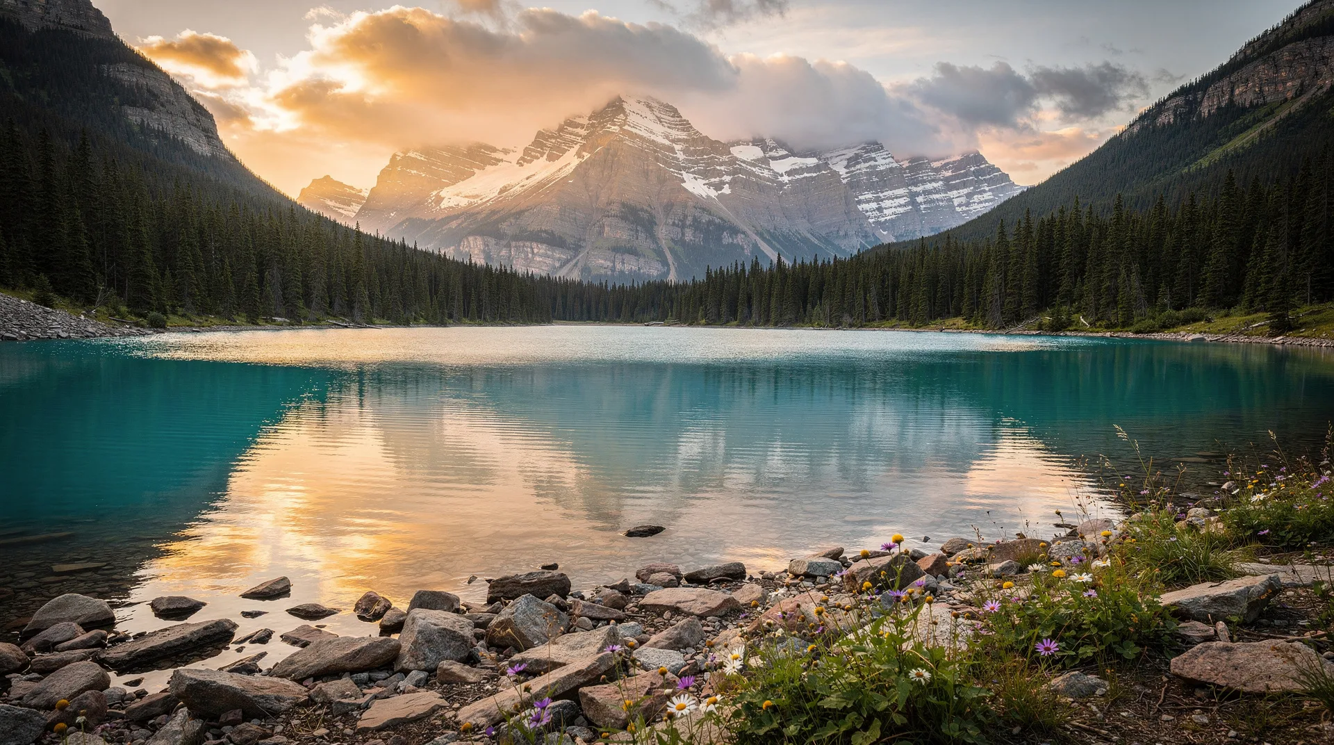
Hamilton’s waterfalls are not a curiosity or an exaggeration — they are one of the most extraordinary urban natural phenomena in Canada. More than 100 waterfalls fall within Hamilton’s city boundaries, the result of the Niagara Escarpment cutting across the city’s southern edge. Streams that drain the agricultural plateau above the escarpment drop suddenly and dramatically into the creek valleys below, creating waterfalls that range from gentle seasonal trickles to the 41-metre curtain of Tews Falls, taller than Horseshoe Falls at Niagara.
This guide covers the most significant waterfalls in practical detail: where they are, how to reach them, what the trails are like, and how to organize a waterfall day that maximizes the experience within the time available. The falls are organized by area — east Hamilton, west Hamilton and Dundas — which reflects the geographic split that most efficient day trips will follow.
Understanding Hamilton’s waterfall geography
The Niagara Escarpment crosses Hamilton roughly east to west, with the escarpment face running along the Mountain — locals’ term for the plateau above the escarpment — visible from most of the lower city. Streams draining the plateau north toward Lake Ontario cross this escarpment edge and create the waterfalls.
The escarpment varies in height across Hamilton from approximately 75 to 100 metres. The waterfalls vary in height from a few metres to Tews Falls at 41 metres, with most falling between 15 and 30 metres. Flow volume depends entirely on precipitation and snowmelt: spring peak flow, particularly in April and May after winter snowpack melts, produces waterfall conditions that are dramatically different from the reduced summer flows of July and August.
A useful division for planning: East Hamilton falls (Albion Falls, Felker’s Falls, and the Red Hill Valley group) are concentrated 20-30 minutes’ drive from downtown Hamilton on the city’s east side. West Hamilton and Dundas falls (Tews Falls, Webster’s Falls, Dundas Valley Conservation Area falls) are 20-30 minutes west of downtown. Most efficient day-trip itineraries tackle one side in the morning and the other in the afternoon.
East Hamilton: Albion Falls and Red Hill Valley
Albion Falls
Albion Falls is Hamilton’s signature waterfall — the one that appears on social media, tourist guides, and the mental image people carry when they think of Hamilton’s escarpment. The falls drop approximately 19 metres over a series of cascading limestone steps in the Red Hill Valley, creating a wide, multi-tiered cascade that varies from a thin sheet in dry summer months to an impressive torrent in spring flood conditions.
The main viewing area is at the top of the falls, accessed from the parking lot at the end of Mud Street East in the Red Hill Valley. The view from the top is the classic composition — looking down the cascade from the upstream perspective. A trail descends the gorge wall to the creek below and connects to additional viewpoints from the downstream side; the descent is moderately strenuous with some uneven footing on the upper section but manageable for most hikers.
Trail details: The main loop from the Mud Street parking area covers approximately 2 kilometres and includes the top viewpoint, the gorge descent, and the downstream crossing. Allow 45 to 90 minutes for an unhurried visit including time at viewpoints.
Access: The parking lot on Mud Street East fills by mid-morning on spring and fall weekends. Arriving before 8:30am guarantees a spot; arriving after 10am on a busy weekend requires patience or a roadside park along Mud Street. Weekday visits avoid the parking challenge entirely.
Best season: Spring (April to June) for peak flow; fall (September to October) for foliage. The falls are flowing year-round but reduce significantly in dry summer periods.
Felker’s Falls
Felker’s Falls, approximately 4 kilometres east of Albion Falls in the same Red Hill Valley system, drops approximately 22 metres in a single curtain fall over a lip of dolomite. Less visited than Albion Falls, Felker’s provides a more solitary experience — particularly on weekdays — in a quieter gorge setting.
The falls are accessible via the Bruce Trail (which follows the escarpment edge through this section) and from the Felker’s Falls Conservation Area parking area off Green Mountain Road. The trail from the parking area reaches the main falls viewpoint in about 15 minutes of easy walking along the gorge rim.
Trail details: The easy loop from parking area to falls viewpoint and back is approximately 1.5 kilometres. The Bruce Trail continues east and west along the escarpment for those who want to extend the walk.
Combination: Albion Falls and Felker’s Falls together make a natural morning itinerary — two hours total including driving between them — before crossing to the west Hamilton area for Tews and Webster’s.
Buttermilk Falls and smaller east falls
Several smaller falls in the east Hamilton area are worth noting for photographers with time:
Buttermilk Falls near Fifty Road in Stoney Creek (at the eastern edge of Hamilton) is a multi-stepped cascade reaching approximately 30 metres in total height, though spread across several drops. The approach is via informal trail; the falls are less developed than the main Hamilton conservation areas.
Devil’s Punchbowl Conservation Area on the eastern escarpment edge near Stoney Creek is technically a 28-metre waterfall into a circular bowl — a geological formation created by ancient erosion. The punchbowl is particularly striking in spring when the falls are full; in dry periods it reduces substantially. The view from the escarpment rim looking down into the bowl is one of the more dramatic geological perspectives on the Hamilton escarpment.
West Hamilton and Dundas: Tews Falls and Webster’s Falls
Tews Falls
Tews Falls is Hamilton’s — and one of Ontario’s — most impressive waterfalls, dropping approximately 41 metres in a single plunge into the Spencer Gorge. At this height it exceeds Horseshoe Falls at Niagara (57 metres by the conventional measurement) — a fact that surprises most visitors who have not researched Hamilton’s escarpment before arriving.
The falls are located in the Spencer Gorge Wilderness Area, managed by the Hamilton Conservation Authority. The main viewing area at the gorge rim above Tews Falls is reached from the parking area on Harvest Road. From the viewing platform, the full 41-metre drop is visible — the water launches from the lip of the dolomite cliff and falls free into the gorge below. In spring flood conditions, the sound and visual impact are extraordinary. In dry summer conditions, the falls thin to a narrower ribbon but remain impressive given the height.
Trail details: The walking distance from the Harvest Road parking area to the Tews Falls viewpoint is approximately 300 metres — very short. Most visitors continue on the Spencer Gorge trail to Webster’s Falls (see below), a loop of approximately 4-5 kilometres through forest along the gorge rim.
Conservation authority access: The Spencer Gorge Wilderness Area is managed by Hamilton Conservation Authority and charges seasonal entry fees, typically $8-12 per person per day. The fee is collected at the parking area. The site is open from late April through October; check the HCA website for current seasonal dates and fees before visiting.
Best time: Spring for maximum flow; fall for foliage combined with gorge views. The narrow Harvest Road access requires early arrival or possible parking distance from the conservation area entrance on busy summer and fall weekends.
Webster’s Falls
Webster’s Falls, 500 metres northwest of Tews Falls in the same conservation area, is shorter at approximately 22 metres but significantly broader — a horseshoe-shaped cascade over grooved limestone ledges that spans 30 metres in full flow. The horseshoe shape recalls Niagara Falls at a radically different scale.
The falls are reached from the same Spencer Gorge parking area via a trail through mature forest. The main viewing platform is at the top of the falls looking into the horseshoe; a suspension footbridge provides a crossing point above the gorge with elevated views back toward the falls and down into the gorge below. The suspension bridge sways gently underfoot — enough to be exciting without being alarming, and a highlight for children.
Trail details: The Spencer Gorge loop connecting Tews Falls and Webster’s Falls covers approximately 4 kilometres of forest trail along the gorge rim with good signage. The full loop, including time at both viewpoints, takes approximately 2 to 3 hours. The terrain is mostly moderate with some uneven sections on the gorge rim path.
Combination: Tews Falls and Webster’s Falls together represent the most complete single waterfall hiking experience available in Hamilton. Budget half a day including drive time from downtown Hamilton or an hour from the GO station via car rental.
Dundas Valley Conservation Area: Crooks’ Hollow and additional falls
The Dundas Valley Conservation Area, a 1,200-hectare protected area at the escarpment base west of Hamilton, contains multiple waterfalls accessible via its 40-kilometre trail network.
Crooks’ Hollow is a historic mill site in the valley with associated waterfall features, reached via the Dundas Valley trail system from the main conservation area entrance on Governors Road. The site includes the ruins of several 19th-century mills and associated millponds — the combination of industrial history and natural scenery is evocative.
Christie Lake Conservation Area, northwest of Dundas, includes waterfall features associated with Spencer Creek and provides swimming and camping options in summer — a good family extension if a longer stay in the area is planned.
Planning a full waterfall day in Hamilton
A practical one-day waterfall itinerary, starting from downtown Hamilton or arriving from Toronto:
Morning (8am to 12pm): East Hamilton group. Begin with Albion Falls — arrive early for parking and light. Walk the gorge loop (45-90 minutes). Drive east 10 minutes to Felker’s Falls (30-45 minutes). Optional: Devil’s Punchbowl (15-minute stop at the rim).
Midday lunch: Return to downtown Hamilton or the Dundas main street for lunch. James Street North or Dundas Main Street both have good options. 30-45 minutes.
Afternoon (1pm to 5pm): West Hamilton and Dundas group. Spencer Gorge Conservation Area (Tews and Webster’s Falls combined loop — 2.5 to 3 hours including trail walking and viewpoints). Optional if time allows: Dundas Valley Conservation Area for a shorter additional trail.
This itinerary covers the four most significant Hamilton waterfalls in a single day with moderate hiking distances.
Trail difficulty overview
Most Hamilton waterfall trails are classified as easy to moderate. The specific considerations:
Albion Falls gorge descent: Moderate — steep in sections with loose footing on the upper gorge trail. Trekking poles helpful.
Spencer Gorge loop (Tews and Webster’s): Moderate — rolling terrain on maintained forest trails with some rooty sections. Accessible for most hikers; not suitable for strollers on the gorge rim sections.
Felker’s Falls: Easy — level trail along gorge rim to viewing platform.
Devil’s Punchbowl: Easy — paved and gravel paths to the rim viewpoint.
Dundas Valley main trails: Easy to moderate depending on route chosen.
All waterfall trails require sturdy footwear — trail runners or hiking boots are appropriate; running shoes are adequate for most but slip-risk on wet rocks near falls. Water-resistant footwear is recommended in spring when trails may be muddy.
Photography guide to Hamilton’s waterfalls
Hamilton’s waterfalls photograph best under specific conditions:
Overcast light eliminates the harsh shadows of direct sunlight in the gorge and allows the white water to retain detail without blowing out in the exposure. Heavily overcast days are often better for waterfall photography than brilliant sunshine.
Spring flow (April to June) provides the volume and energy that makes the falls look as dramatic as they genuinely are.
Low perspective: Getting close to the water’s edge — where the trail permits safe access — provides more immersive compositions than the rim-level viewpoints alone.
Long exposure: A tripod and 1-4 second exposure creates the silky water effect that distinguishes waterfall photography. Bring a neutral density filter for shooting in bright conditions.
Best individual compositions: The Tews Falls viewpoint looking across the gorge at the full drop; Webster’s Falls from below-left looking into the horseshoe; Albion Falls from the trail crossing below the cascade, looking upstream at the full series of drops.
Getting to Hamilton’s waterfalls
A car is the most practical tool for visiting multiple waterfalls efficiently. Hamilton’s conservation area parking lots are widely separated by road, and no transit connection serves the full waterfall circuit.
From Toronto by car: QEW west to 403 west, exit onto Lincoln Alexander Parkway (LINC) or Centennial Parkway for east Hamilton falls; continue 403 into downtown Hamilton for west-side and Dundas access. Total drive from downtown Toronto: 60-80 minutes in normal traffic.
From Toronto by GO Transit: GO Train to Hamilton GO Centre (downtown Hamilton) — 65-80 minutes from Union Station. Car rental from Hamilton airport or downtown is necessary for reaching the conservation areas. Alternatively, several tour operators run day trips from Toronto to the Hamilton escarpment.
From Niagara Falls: 403 west from the QEW to Hamilton — approximately 60-70 minutes.
For more context on Hamilton as a destination — the arts scene, food, neighbourhoods, and broader trip planning — see the Hamilton Ontario destination guide.
Browse Ontario nature tours and escarpment experiences from TorontoFrequently asked questions about Hamilton Waterfalls Guide: Albion Falls, Tews Falls & Best Hikes
When is the best time to visit Hamilton’s waterfalls?
April through early June for maximum flow after winter snowmelt. Late September to mid-October for autumn foliage. The two best weekends of the year are typically the last weekend of April (high flow, spring wildflowers) and the second weekend of October (peak foliage, moderate-to-good flow).
Are any of the waterfalls accessible without a car?
Albion Falls is the most practical without a car: Hamilton Street Railway bus route 56 (Queenston) stops within a 20-minute walk of the Mud Street parking area. For all other waterfalls, a car or bicycle (for the fitter visitor) is effectively necessary.
Is swimming allowed at the waterfalls?
Swimming near the bases of most Hamilton waterfalls is not permitted by the conservation authorities and is genuinely dangerous in spring high-water conditions. Rock surfaces are slippery, currents in the gorge pools are unpredictable, and cold-water shock is a real risk. The conservation area pools are not swimming venues.
How many waterfalls can I see in one day?
Four to six significant falls in a well-organized day with a car. Albion Falls, Felker’s Falls, Tews Falls, and Webster’s Falls constitute the core four. Devil’s Punchbowl and a Dundas Valley stop add two more. This is a full day of hiking — approximately 8-10 kilometres total — and requires an early start and good energy.