Northern Ontario: The Complete Travel Guide
What is Northern Ontario known for?
Northern Ontario is known for its vast Canadian Shield wilderness, boreal forest, Great Lakes shorelines, and Indigenous heritage. Key destinations include Thunder Bay (Sleeping Giant, Fort William), Sault Ste. Marie (Agawa Canyon Train), and Manitoulin Island — the world's largest freshwater island.
Northern Ontario begins somewhere around Sudbury and does not end until the Manitoba border — a territory nearly twice the size of France that most southern Ontarians regard as something you drive through on the way to somewhere else. This is a mistake of significant proportions. The region between the French River and the Manitoba border contains some of the most dramatic and least visited landscapes in Canada: the Canadian Shield at its most raw, the Great Lakes at their most imposing, boreal forest that extends to every horizon, and communities with histories rooted in fur trade, mining, and Indigenous culture that are completely unlike anything in southern Ontario.
Northern Ontario is not a compact or easily navigated region. Distances are large — Thunder Bay is 1,400 kilometres from Toronto — and the Trans-Canada Highway (Highway 17 along the north shore of Lake Huron and Lake Superior) is a long, largely undeveloped corridor that requires either genuine interest in the road journey itself or acceptance that getting there is part of the experience. Travellers who approach it that way consistently report that the journey along the Superior shore is one of the most spectacular drives in North America.
This guide covers the main destinations, how to structure a northern Ontario road trip, and the practical planning that makes the difference between a frustrating experience and a remarkable one.
The geography of Northern Ontario
Northern Ontario divides naturally into three zones. The near north — Sudbury, North Bay, the French River, and the Parry Sound area — transitions from the developed cottage-country lake district of central Ontario into the true boreal and Shield terrain. The Lake Superior shore from Sault Ste. Marie through the Algoma country to Thunder Bay is the spectacular centrepiece of a northern Ontario road trip. And the far north — from Thunder Bay to Kenora and the Manitoba border, and north through the James Bay lowlands — is genuine wilderness that requires specific planning, fly-in access to some areas, and a tolerance for absolute remoteness.
Most northern Ontario visitors focus on the Lake Superior corridor, which provides the best ratio of accessibility to drama. This guide concentrates there.
Thunder Bay: the western gateway
Thunder Bay sits at the head of Lake Superior — the largest freshwater lake in the world by surface area — and serves as the gateway to northwestern Ontario. The city of 120,000 is a working port and transportation hub, with a complicated history as the former twin cities of Port Arthur and Fort William (amalgamated in 1970). The waterfront grain elevators, still active as part of Canada’s wheat export infrastructure, define the harbour skyline.
The essential Thunder Bay experience is the view of the Sleeping Giant Provincial Park from the city — the distinctive flat-topped mesa formation rising from the lake 50 kilometres to the east looks unmistakably like a supine figure, and the Ojibwe legend of Nanabijou that explains the formation is one of the region’s foundational stories.
Fort William Historical Park is one of the best living-history museums in Canada — a full-scale reconstruction of the North West Company’s inland fur trade headquarters as it existed in 1816. The scale is genuinely impressive: a complete fur trade post with reconstructed buildings, interpreters in period dress conducting the actual trades and crafts of the period, canoe brigades, Ojibwe cultural presentations, and enough historical detail to absorb a full day.
The Terry Fox Memorial and Lookout on the Trans-Canada east of Thunder Bay marks the spot where Terry Fox, running his Marathon of Hope cancer research fundraiser across Canada in 1980, was forced to stop when his cancer spread to his lungs. The view from the lookout — over the Thunder Bay harbour, the Sleeping Giant, and the sweep of Lake Superior — is extraordinary and gives the memorial site a weight appropriate to what happened there.
See the full Thunder Bay travel guide for accommodation, restaurants, Sleeping Giant hiking, and day-trip options.
Sault Ste. Marie: Superior’s eastern gateway
Sault Ste. Marie — “the Soo” — sits at the junction of Lake Superior and Lake Huron, connected to its Michigan twin by an international bridge across the St. Mary’s River. The Soo Locks, which allow ships to transit the 6-metre elevation difference between the two lakes, are a working engineering landmark; the three-hour Soo Locks boat tour provides close-up access to the lock chambers as vessels transit through.
The city’s signature tourism experience is the Agawa Canyon Tour Train — a full-day excursion into the Algoma wilderness north of the city that has no road access. The train operates from Sault Ste. Marie through 183 kilometres of Canadian Shield to the Agawa Canyon, where passengers disembark for two hours to walk to waterfalls, climb the canyon rim lookout staircase, and sit in a wilderness that is completely inaccessible except by this railway. In late September, when the maple forest turns, it is one of the finest fall colour experiences in North America.
See the full Sault Ste. Marie travel guide for the Agawa Canyon train, the Canadian Bushplane Heritage Centre, Lake Superior shoreline access, and where to eat and stay.
Manitoulin Island: world’s largest freshwater island
Manitoulin Island sits in northern Lake Huron, connected to the Ontario mainland by a swing bridge at Little Current and accessible by ferry from Tobermory on the Bruce Peninsula in summer. The island is the world’s largest freshwater island — 2,766 square kilometres — and contains its own inland lakes, including Lake Manitou, one of the world’s largest lakes within an island.
Manitoulin has the highest proportion of First Nations population of any area in Ontario and is the traditional homeland of the Ojibwe and Odawa peoples. The island’s cultural landscape — the Wikwemikong Unceded Territory (which has never been surrendered to the Crown and remains technically unceded), the pow-wows and cultural events of summer, and the Ojibwe presence in every aspect of the island’s identity — makes it unlike any other Ontario destination.
The island is also genuinely beautiful in a quiet, unhurried way: the interior lakes, the exposed limestone headlands along the Lake Huron shore, the small towns of Mindemoya, Manitowaning, and Providence Bay, and the scale of rural island life that has changed more slowly than anywhere else in the region.
See the full Manitoulin Island travel guide for ferry schedules, First Nations cultural experiences, camping, and island itineraries.
Killarney Provincial Park
Killarney, on the northern shore of Georgian Bay about 90 kilometres west of Sudbury, is one of Ontario’s most spectacular provincial parks and one of the less visited. The combination of the white quartzite ridges of the La Cloche Mountains, clear-water lakes that reflect the sky with unusual intensity, and dramatic Georgian Bay shoreline create a landscape that Group of Seven painters (particularly A.Y. Jackson) returned to throughout their careers.
The park has no road access to its interior — all travel is by canoe or on foot. The La Cloche Silhouette Trail (100 km, 7–10 days) is one of the great long-distance hiking routes in Ontario, crossing the quartzite ridges above treeline with expansive views over the Georgian Bay coastline. Day-use canoe rentals and shorter trail loops from the park gate provide access for visitors without backcountry experience.
See the full Killarney Provincial Park guide for canoe routes, trail details, camping reservations, and what makes the park’s geology distinctive.
The Trans-Canada along Lake Superior: the drive
The section of Highway 17 from Sault Ste. Marie to Thunder Bay — approximately 700 kilometres — is one of the great road drives in Canada. The highway follows the northern shore of Lake Superior, the largest freshwater lake in the world, and the scale of the lake from the roadside viewpoints is difficult to comprehend until you are in front of it.
Lake Superior is not ocean-like in the way of the Pacific — it is more severe and less domesticated. The grey quartzite and granite cliffs dropping into the lake, the dark water whose depths reach 406 metres, and the complete absence of development along most of the shoreline give the drive a genuineness that coastal drives in more heavily touristed regions cannot match.
Key stops along the Superior shore:
Lake Superior Provincial Park (north of Sault Ste. Marie): a large provincial park with campgrounds, short hikes to pictographs painted on the lake cliff faces, and the most accessible Superior shoreline swimming beaches. The Agawa Rock pictographs — Ojibwe rock paintings on a cliff face accessible only by a challenging shoreline scramble — are among the oldest rock art sites in Ontario.
The Wawa Goose at Wawa: The giant Canada goose statue is a beloved northern Ontario roadside landmark, serving as the unofficial marker of the Superior north shore corridor. The town of Wawa has good services for road-trippers.
White River: birthplace of the real-life bear whose name inspired A.A. Milne’s Winnie-the-Pooh — the bear was captured here by a Canadian soldier in 1914 and named after Winnipeg (shortened to Winnie).
Nipigon: where the Trans-Canada bridges the Nipigon River into the Superior highlands. The rainbow trout that produced Canada’s world-record catch in 1915 came from this river.
Ouimet Canyon Provincial Park (east of Thunder Bay): A dramatic canyon 150 metres wide and 100 metres deep cut into the Shield, with a lookout platform above the cliff edge and a microclimate cold enough to support arctic plants on the canyon floor.
Planning a northern Ontario road trip
Time required: Doing the full Sault Ste. Marie to Thunder Bay Trans-Canada corridor justice requires a minimum of 5–7 days from the Soo, or 10 days if approaching from Toronto through Sudbury and building in Manitoulin Island and Killarney.
Vehicle: A reliable car with recent servicing is essential. Gas stations are spaced significantly further apart in northern Ontario than in southern Ontario. Fill up in Wawa, White River, and Nipigon on the Superior corridor; do not count on service between them.
Accommodation: The corridor has limited accommodation options outside the main towns. Wawa, White River, and Nipigon have basic motels. Booking ahead is advisable for summer months when provincial park campgrounds fill and motels see genuine demand from Trans-Canada travellers.
Cell coverage: Expect significant gaps in cell coverage along Highway 17. Download offline maps before departing. Satellite communication devices (SPOT, Garmin inReach) are worth considering for backcountry activities or extensive driving in the region.
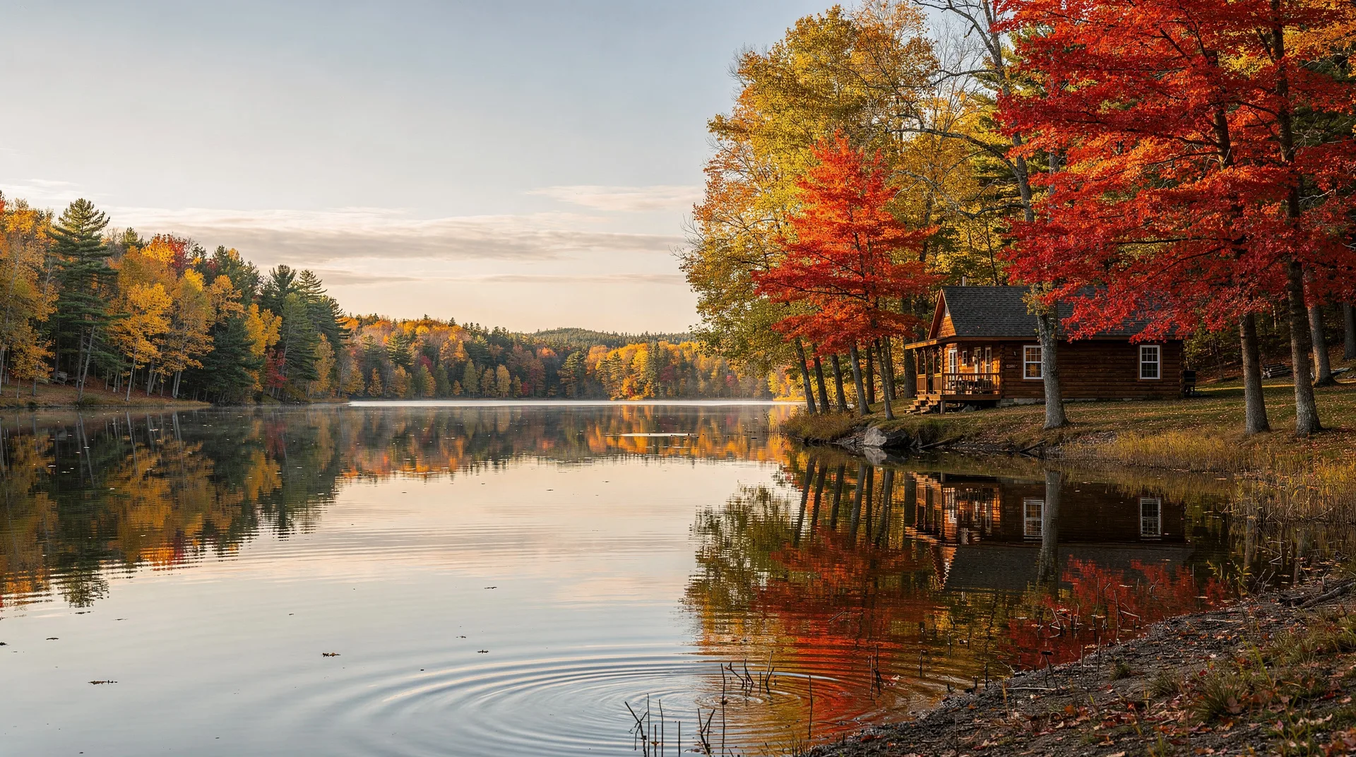
Weather: Northern Ontario weather is variable and changes quickly, particularly on Lake Superior. Summer days are warm (20–28°C) but thunderstorms are common. September brings cool nights and the possibility of early frost. Snow is possible in October.
Browse Canada-wide outdoor and wilderness experiencesIndigenous culture and history in Northern Ontario
Northern Ontario is the traditional territory of several Ojibwe (Anishinaabe) nations, including the Treaty 3 nations of northwestern Ontario, the Robinson-Huron Treaty nations along Lake Huron, and the many First Nations communities from Sudbury through to the Manitoba border. Unlike much of southern Ontario, where the visible evidence of pre-colonial Indigenous presence has been largely built over, northern Ontario retains an active living Indigenous culture that visitors can engage with respectfully.
Wikwemikong Unceded Territory on Manitoulin Island hosts one of the largest powwows in Ontario each August — a multi-day event of traditional dance, drumming, and ceremony that is open to visitors.
Bizhiki (Buffalo) Cultural and Heritage Centre and other community facilities provide context for the history and contemporary culture of northern Ontario’s First Nations.
The Agawa Rock pictographs in Lake Superior Provincial Park and similar rock art sites throughout the north are not museums — they are sacred sites of living cultures. Approach them with the same respect you would any sacred site.
Wildlife in Northern Ontario
Northern Ontario’s boreal and Shield ecosystems support wildlife populations that have been largely displaced from southern Ontario. Moose are common throughout the north — sightings along Highway 17 are frequent, and moose-vehicle collisions are a genuine hazard particularly at dawn and dusk. Drive carefully.
Woodland caribou persist in the far north. Timber wolves, black bears, and lynx are present throughout the boreal zone. Bald eagles and osprey nest along the lake shores. The rivers and lakes support native walleye, northern pike, lake trout, and in select rivers, brook trout of exceptional quality.
The birding along the northern Lake Superior shore is particularly good during spring and fall migration — the Superior shoreline concentrates migrating species that have crossed or are crossing the lake, and places like Whitefish Point on the Michigan shore (accessible via ferry from Sault Ste. Marie) are among the great hawk and owl migration concentration points in North America.
The near north: Sudbury and the French River
The city of Greater Sudbury — population 170,000, the largest city in northern Ontario and the largest municipality by area in Canada — is the practical gateway from Toronto to the north. Sitting on the Canadian Shield approximately 4 hours north of Toronto by car, Sudbury has reinvented itself from a heavily polluted nickel-smelting centre into a city with growing arts and science institutions.
Science North is the most significant attraction in Sudbury for visitors — a science museum of national quality, built into the Canadian Shield rock of Ramsey Lake’s shoreline, with two hexagonal buildings connected by a tunnel drilled through the bedrock. The museum’s permanent exhibits cover northern Ontario’s geology, ecology, and space science with interactive installations that work for children and adults. The IMAX theatre and planetarium are included in the general admission.
The Dynamic Earth mine museum adjacent to Science North is the geological heritage component — a surface museum and underground mine tour into the actual workings of a Canadian Shield mine, including the Big Nickel monument (a reproduction of a 1951 nickel coin, nine metres in diameter) that has been the most photographed landmark in Sudbury for 50 years.
Val-Caron and the Nickel Ranges north and east of the city provide context for the landscape alteration that 120 years of nickel and copper smelting created — and its gradual partial reversal through one of the largest land restoration programs in history (over 10 million trees planted since the 1970s). The greening of Sudbury’s barrens is one of the most significant environmental restoration success stories in North America.
French River Provincial Park, 60 kilometres south of Sudbury, marks the transition between the Great Lakes-St. Lawrence forest and the Canadian Shield terrain. The French River was the voyageur highway connecting Lake Nipissing to Georgian Bay in the fur trade era, and the paddling through the river’s narrow channels, rapids, and granite islands retains a historical quality that the Trent-Severn Waterway further south cannot match. Day canoe trips and multi-day paddling are available through outfitters on both the North Bay and Sudbury sides of the river.
Sudbury to Sault Ste. Marie: the north shore of Huron
Highway 17 west from Sudbury to Sault Ste. Marie (300 kilometres, approximately 3 hours) follows the north shore of Lake Huron through a series of small communities and Canadian Shield terrain that gives way progressively to the open lake views of the North Channel.
Espanola (80 km west of Sudbury) is the junction for Highway 6 south to Manitoulin Island — a direct detour from the main Trans-Canada route that adds significant interest to any northern Ontario itinerary.
Blind River and Thessalon are small Lake Huron shore communities with basic services and waterfront access — worth a brief stop to see the Huron shoreline’s limestone character before it transitions to the more dramatic Shield terrain near the Soo.
Mississagi Provincial Park (north of Elliot Lake) has canoeing and hiking in a Shield lake environment with good populations of moose and beaver and relatively light visitor use — a good overnight camping option on the Sudbury-to-Soo corridor for those who want a wilderness night without the logistical complexity of Killarney or Algonquin.
Food culture in northern Ontario
Northern Ontario’s food culture is shaped by resource economy roots — the working communities of mining, logging, and fishing towns where food was fuel rather than experience — and by the multicultural influx of immigrant workers from Finland, Ukraine, Italy, and Portugal who came to work the mines from the early 20th century onward.
The Finnish food tradition in Thunder Bay and in communities throughout the north — pulla bread, viili cultured milk, korvapuusti cinnamon rolls, mojakka stew — is the most distinctive northern Ontario culinary heritage and is still visible in bakeries, clubs, and community events throughout the region.
Ukrainian influences are visible in Sudbury and several Nickel Belt communities in the form of pyrogy restaurants and the Ukrainian Orthodox churches that serve the community.
Wild game appears on northern Ontario menus in ways that southern Ontario rarely supports — moose stew, venison, northern pike, lake trout, and wild blueberry preparations are all genuinely regional rather than affectedly rustic. Wild blueberries — smaller, more intensely flavoured than the cultivated variety — grow in profusion on the open Shield barrens and are harvested commercially and informally throughout the north.
Related guides
- Thunder Bay: Sleeping Giant and travel guide
- Sault Ste. Marie: Agawa Canyon and travel guide
- Manitoulin Island travel guide
- Killarney Provincial Park: canoeing and hiking guide
- Northern Ontario 10-day road trip itinerary
- Ontario travel guide
Northern Ontario rewards visitors who approach it with patience and genuine curiosity. The region is not trying to make tourism easy — the distances are real, the infrastructure is sparse, and the landscape answers to nobody. Those who accept these terms on the region’s behalf find a Canada that has been progressively removed from the rest of the country through development: vast, old, and demanding enough to feel like a genuine encounter with something.