BC driving distances and times: the planning map
How long does it take to drive across British Columbia?
Vancouver to Prince Rupert (coastal northern BC) is about 15-17 hours driving via Highway 16 over two days. Vancouver to the Alberta border at Golden is 8-9 hours. BC is vast — plan multi-day drives and use the distances in this guide to build realistic itineraries.
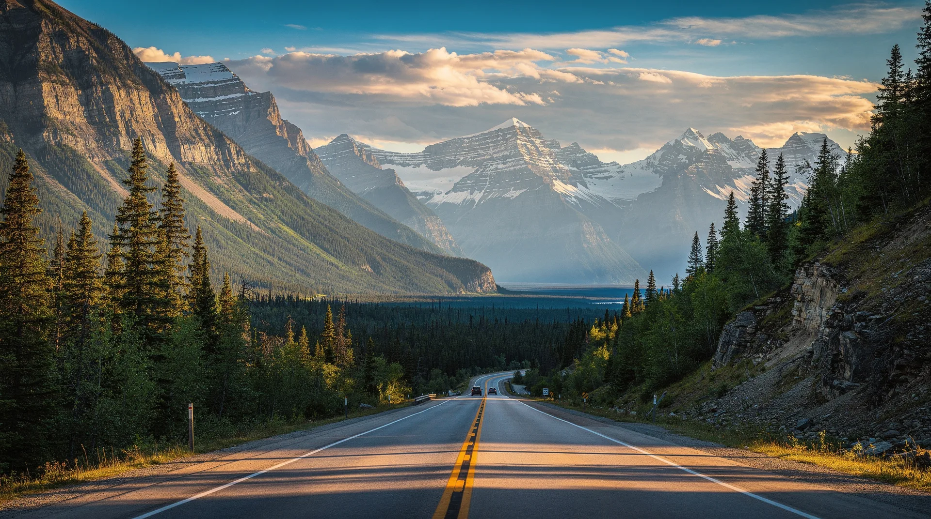
British Columbia is genuinely vast. Driving from Vancouver to the Alberta border takes as long as driving from Paris to Berlin. Driving from Vancouver to Prince Rupert on the northern coast takes as long as driving from Paris to Madrid. First-time visitors routinely underestimate distances and end up rushing through places that deserved more time or cancelling legs that turned out to be unrealistic.
This guide provides realistic driving times (not Google Maps best-case) for the most common BC routes, plus practical notes on road conditions, fuel availability, ferry connections, and the seasonal factors that can double your travel time.
Vancouver area and Sea-to-Sky
| Route | Distance | Driving time | Notes |
|---|---|---|---|
| Vancouver to Horseshoe Bay | 20 km | 30-45 min | Ferry terminal for Nanaimo/Bowen |
| Vancouver to Squamish | 65 km | 1 hr | Sea-to-Sky Hwy 99 |
| Vancouver to Whistler | 125 km | 1h 45-2 hr | Hwy 99, scenic |
| Vancouver to Pemberton | 160 km | 2h 15 min | Past Whistler |
| Vancouver to Lillooet (via Duffey) | 255 km | 4 hr | Spectacular drive |
| Vancouver to YVR Airport | 15 km | 25-40 min | Rush hour adds 15 min |
| Vancouver to Tsawwassen Ferry | 35 km | 40-60 min | Ferry to Victoria/Gulf Islands |
| Vancouver to Harrison Hot Springs | 135 km | 1h 45 min | Fraser Valley |
| Vancouver to Hope | 155 km | 1h 45 min | Gateway to interior routes |
Vancouver Island
Travel on Vancouver Island is defined by the Island Highway (Hwy 19) running north-south and the slower coastal roads. Include the ferry crossing from the mainland (1h 35 min for Horseshoe Bay to Nanaimo, 1h 35 min for Tsawwassen to Swartz Bay/Victoria).
| Route | Distance | Driving time | Notes |
|---|---|---|---|
| Victoria to Nanaimo | 110 km | 1h 30 min | Hwy 1 then 19 |
| Victoria to Duncan | 60 km | 50 min | Cowichan Valley |
| Victoria to Tofino | 315 km | 4h 30-5 hr | Via Port Alberni — mountain pass |
| Victoria to Port Renfrew | 110 km | 2 hr | West coast road |
| Nanaimo to Tofino | 205 km | 3 hr | Via Port Alberni |
| Nanaimo to Campbell River | 155 km | 1h 45 min | Hwy 19 |
| Nanaimo to Port Hardy | 395 km | 5 hr | North Island |
| Campbell River to Port Hardy | 240 km | 3 hr | Continuation north |
| Campbell River to Telegraph Cove | 180 km | 2h 30 min | Whale watching base |
Tofino drive tip: The Hwy 4 mountain pass from Port Alberni to Tofino is narrow, winding, and subject to seasonal closures (rockslides, snow). Check DriveBC conditions. In poor weather or winter, add 30-60 minutes.
Okanagan and interior
Interior BC routes are generally paved, well-maintained highways, but winter conditions (snow, ice) can dramatically affect travel times. Chains or winter tires are legally required on some routes from October to April.
| Route | Distance | Driving time | Notes |
|---|---|---|---|
| Vancouver to Kelowna | 390 km | 4h 30-5 hr | Hwy 5 (Coquihalla) — mountain pass |
| Vancouver to Penticton | 395 km | 5 hr | Hwy 3 or Hwy 5 + Hwy 97 |
| Vancouver to Osoyoos | 400 km | 5 hr | Hwy 3 via Hope |
| Vancouver to Kamloops | 355 km | 4 hr | Hwy 5 (Coquihalla) |
| Vancouver to Sun Peaks | 405 km | 5 hr | Via Kamloops |
| Kelowna to Kamloops | 165 km | 2 hr | Hwy 97 |
| Kelowna to Nelson | 335 km | 4 hr | Hwy 3A, scenic |
| Kamloops to Wells Gray | 125 km | 1h 30 min | To Clearwater |
| Kamloops to Jasper (AB) | 440 km | 5h 30 min | Hwy 5 + Yellowhead |
Coquihalla Highway (Hwy 5): The fastest route from Vancouver to the interior, but a true alpine pass reaching 1,244 m at the Coquihalla Summit. Winter conditions are serious — check DriveBC.ca before travel between November and April.
Kootenays and BC Rockies
The Kootenay region has slower, more winding roads through mountain terrain. Adjust expectations downward from Google Maps estimates.
| Route | Distance | Driving time | Notes |
|---|---|---|---|
| Vancouver to Revelstoke | 565 km | 6h 30-7 hr | Hwy 1 |
| Vancouver to Golden | 710 km | 8 hr | Continues on Hwy 1 |
| Vancouver to Banff (AB) | 860 km | 10 hr | Full day |
| Revelstoke to Golden | 150 km | 2 hr | Hwy 1 through Glacier NP |
| Golden to Banff | 150 km | 2 hr | Kicking Horse Pass |
| Nelson to Fernie | 295 km | 4 hr | Hwy 3A + 3 |
| Kelowna to Revelstoke | 205 km | 2h 30 min | Hwy 97 + 1 |
| Nelson to Cranbrook | 230 km | 3 hr | Hwy 3A |
| Fernie to Calgary (AB) | 315 km | 3h 30 min | Hwy 3 + Crowsnest Pass |
Northern BC and Cassiar Highway
Northern BC driving covers enormous distances with long stretches between services. Carry extra fuel, water, and snacks. Some stretches have no cell service for 200+ km.
| Route | Distance | Driving time | Notes |
|---|---|---|---|
| Vancouver to Prince Rupert | 1,500 km | 16-18 hr | 2 days minimum |
| Vancouver to Prince George | 785 km | 9-10 hr | Via Hwy 97 |
| Prince George to Prince Rupert | 725 km | 9 hr | Hwy 16 (Yellowhead) |
| Prince George to Smithers | 370 km | 4h 30 min | Hwy 16 |
| Smithers to Terrace | 215 km | 2h 45 min | Continues on Hwy 16 |
| Terrace to Prince Rupert | 145 km | 2 hr | Skeena River valley |
| Prince Rupert to Stewart (via Cassiar) | 725 km | 9 hr | Hwy 16 + 37 |
| Williams Lake to Bella Coola | 455 km | 8 hr | Hwy 20, includes “The Hill” |
| Prince George to Dawson Creek | 405 km | 4h 30 min | Hwy 97 |
| Dawson Creek to Fort Nelson | 455 km | 6 hr | Alaska Highway start |
Key route planning principles
Build in buffer time
Google Maps’ estimates assume ideal conditions. In BC, realistic drive times are typically 15-30% longer due to:
- Slow traffic through towns
- Construction zones (common May-October)
- Road conditions (wildlife, rain, fog)
- Stops at viewpoints (you will stop — everyone does)
- Ferry loading/offloading time
For all-day drives (8+ hours), I recommend stopping every 2 hours and add at least 60 minutes to Google’s estimate.
Ferry crossings add hours
BC Ferries sailings are not door-to-door travel. Factor in:
- 30-60 minutes arrival time before sailing
- Sailing duration (1h 35 min for most major routes)
- Offloading + onward driving on other side
A “Victoria to Vancouver” trip is easily 5-6 hours with ferry — not the 2-3 hours a mileage-based estimate might suggest. See the BC Ferries guide for detailed route timings.
Seasonal variation
Summer (June-September): Roads are generally at their fastest. Construction peaks, adding small delays on major routes.
Winter (November-April): Mountain passes (Coquihalla, Rogers Pass, Kootenay Pass) can be slow or closed in storms. Winter tires or chains legally required. Add 50-100% to mountain pass driving times.
Shoulder seasons: Excellent driving weather in May-early June and September-October, with lower tourist traffic.
Fuel planning for remote routes
Fuel is readily available on Highway 1, Highway 5, Highway 97 (Okanagan), and Highway 16 to Prince George. Beyond that:
- Highway 20 (Bella Coola): Fill up at Williams Lake and Anahim Lake. No fuel on Heckman Pass.
- Highway 37 (Cassiar): Long gaps between fuel stations. Always top up whenever possible.
- Alaska Highway: 100-200 km gaps between services. Plan carefully.
- Duffey Lake Road (Whistler to Lillooet): No fuel between Pemberton and Lillooet.
Never run below half a tank in northern BC.
Itinerary feasibility quick-check
| Days available | Realistic scope |
|---|---|
| 3 days | Vancouver + one short loop (Whistler, or Victoria + Butchart) |
| 5-7 days | Vancouver + Whistler + Vancouver Island highlights |
| 7-10 days | Above + Okanagan |
| 10-14 days | BC Grand Loop (Van + VI + Okanagan + Rockies) |
| 14-21 days | Above + Kootenays or Sunshine Coast or Cariboo |
| 21+ days | Above + Northern BC or comprehensive Island exploration |
When to rent one-way
For itineraries that cover Vancouver + Calgary/Banff, a one-way rental (picking up in Vancouver, dropping in Calgary) saves a day of back-tracking but costs CAD $200-500 more in drop fees. See the BC car rental guide for specifics.
Browse BC tours and multi-stop experiencesFrequently asked questions about BC driving distances and times: the planning map
How long does it take to drive from Vancouver to Banff?
About 10 hours for 860 km, including basic stops. Most travellers split this over 2 days, stopping overnight in Revelstoke or Golden. In winter, allow 11-13 hours due to mountain pass conditions.
Is Vancouver to Tofino a reasonable day trip by car?
Not really. Vancouver to Tofino requires the ferry to Nanaimo (3 hours door-to-door), then a further 3-hour drive. One-way is 5-6 hours. A same-day return is 10-12 hours on the road — possible but punishing. Plan at least 2 nights in Tofino.
How long is the drive from Vancouver to Kelowna?
About 4.5-5 hours via the Coquihalla Highway (Hwy 5) in good weather. In winter, allow 5-6 hours. The Coquihalla is a genuine mountain pass and occasionally closes in severe storms.
Can I drive across BC in one day?
No. BC is too large. Even the fastest east-west route (Vancouver to Alberta border) is a hard 9-10 hour day. Most “across BC” trips in the north take 15-17 hours of driving, split over 2-3 days.
What is the fastest route from Vancouver to the interior?
The Coquihalla Highway (Hwy 5) is the fastest route from Hope to Merritt and Kamloops. From Kamloops, Hwy 97 south leads to Kelowna, Hwy 1 east continues to Revelstoke. Hwy 3 via Manning Park is slower but more scenic.