Quick facts
- Length
- 489 km (Deer Lake to St. Anthony)
- Driving time
- 6-7 hours one-way
- Best time
- June to September
- Days needed
- 5-7 days
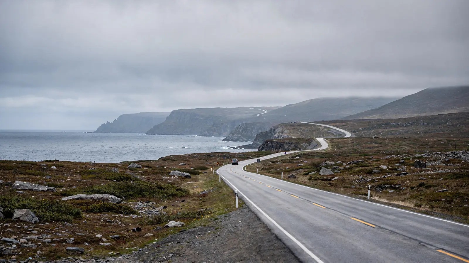
The Viking Trail is one of the greatest drives in Atlantic Canada and arguably in all of North America. Officially Route 430, it runs for 489 kilometres up the Great Northern Peninsula of Newfoundland from Deer Lake on the Trans-Canada Highway to the tiny community of St. Anthony near the northern tip of the island. Along the way it passes two UNESCO World Heritage Sites, a fjord system carved by glaciers into 600-million-year-old mantle rock, icebergs drifting south on the Labrador Current, whale-rich bays, Basque whaling archaeology, and the only authenticated Norse settlement in the Americas.
This is a slow, deliberate drive through a landscape that feels genuinely remote even by Newfoundland standards. Cell service is patchy. Gas stations are spaced out. Communities are small, often of a few hundred people. But the reward is a week that threads together geology, archaeology, wildlife, and one of the most distinctive cultural landscapes in Canada.
At a glance
| Where | Route 430, Deer Lake to St. Anthony, western Newfoundland |
| Cost | Rental car plus fuel is the main cost; Gros Morne requires a Parks Canada park pass and L’Anse aux Meadows a separate site admission (both hedged around CAD 10-20 per adult) |
| Time needed | 5-7 days for the full trail with time in Gros Morne |
| Getting there | Fly into Deer Lake Regional Airport and rent a car; there is no public transit along the route |
| Best time | Mid-June to early September, with late June to mid-July the sweet spot for icebergs |
What makes the Viking Trail special
The drive’s structure is simple: you start in Deer Lake (the regional airport hub), drive 72 kilometres north to Gros Morne National Park for its fjords and Tablelands, continue north along the Gulf of St. Lawrence coastline past L’Anse aux Meadows and eventually reach St. Anthony. A side trip to Labrador via the Strait of Belle Isle ferry at St. Barbe adds Red Bay — a second UNESCO site — to the itinerary.
The geology alone justifies the trip. Gros Morne’s Tablelands are one of the few places on Earth where the mantle — the layer of rock normally hidden tens of kilometres beneath the Earth’s crust — is exposed at the surface, pushed up during the assembly of the ancient supercontinent Pangea. Walking on the Tablelands is walking on rock that was once deep inside the planet. This single feature is why Gros Morne holds UNESCO World Heritage status.
The archaeology closes the trip. At L’Anse aux Meadows, Norse explorers established a settlement around the year 1000 — five hundred years before Columbus — in the first confirmed European presence in the Americas. The site was discovered in 1960 and declared Canada’s first UNESCO World Heritage Site in 1978. Standing in the reconstructed sod longhouses, looking out over the same cove the Norse saw, is a powerful way to end a trip.
The route, stage by stage
Stage 1: Deer Lake to Rocky Harbour (72 km, 1 hour)
Deer Lake Regional Airport is the usual starting point. Rental cars are available; groceries and supplies are cheaper here than further north, so stock up. Route 430 heads west and then north into Gros Morne National Park. The entry point at Wiltondale gives way to increasingly dramatic scenery. Rocky Harbour, the main visitor hub of Gros Morne, is the logical first overnight.
Stage 2: Gros Morne explorations (base 2-3 nights)
Base yourself in Rocky Harbour or the adjacent Norris Point for two to three nights. The essential Gros Morne experiences:
- Western Brook Pond fjord boat tour — a 3-hour cruise through a freshwater fjord walled by 600-metre cliffs, accessed by a flat 3-kilometre walk through bog terrain. Book ahead.
- Tablelands walk — the mantle rock landscape, best accessed via the interpretive trail from the Tablelands parking area on Route 431.
- Gros Morne Mountain hike (optional) — Newfoundland’s second-highest peak, an intense 16 km day hike with dramatic plateau views. Weather-dependent.
- Lobster Cove Head Lighthouse — small museum and atmospheric headland walk near Rocky Harbour.
Stage 3: Rocky Harbour to Port au Choix (190 km, 2.5 hours)
The drive north from Gros Morne passes small fishing communities strung along the Gulf of St. Lawrence shore. Port au Choix National Historic Site preserves 4,500 years of Indigenous occupation — Maritime Archaic, Dorset Palaeoeskimo, and Recent Indian cultures all lived here. The small museum is well curated and a worthwhile 2-hour stop. Continue another 90 km to St. Barbe or Plum Point for overnight.
Stage 4: Plum Point to St. Anthony and L’Anse aux Meadows (160 km, 2.5 hours)
This is the northern end of the peninsula. The landscape changes — tundra-like bog, stunted spruce, open sky. St. Anthony is the regional hub (population 2,200) with a hospital, hotels, and the Grenfell Interpretation Centre. L’Anse aux Meadows is another 40 km north-east from St. Anthony.
Budget a full day at L’Anse aux Meadows. The Parks Canada interpretive program includes reconstructed Norse longhouses staffed by costumed interpreters, the archaeological site itself with foundation outlines visible, and a museum covering the Viking sagas and the 1960 discovery. Allow 4-5 hours minimum. Norstead, a replica Viking village 5 km away, makes a good half-day companion.
Stage 5 (optional): Labrador via the ferry
From St. Barbe, the Labrador Marine ferry crosses the Strait of Belle Isle to Blanc-Sablon, Quebec (from where a short drive reaches Red Bay, Labrador). The crossing takes 90 minutes. Red Bay National Historic Site preserves the 16th-century Basque whaling station — the only UNESCO site in Labrador. Reserve ferry space well in advance.
When to drive the Viking Trail
Mid-June to early September is the practical window. Gros Morne’s Western Brook Pond boat tour and L’Anse aux Meadows operate on this calendar. Icebergs are most visible from late May through early July. July and August offer the warmest weather (15-20°C) and the longest daylight hours, though they are also the busiest.
Late June to mid-July is the sweet spot — peak iceberg viewing, warm enough days, puffins nesting, and summer crowds not yet fully built.
September brings fewer visitors and vibrant fall colour on the Tablelands. Days are shorter and some services begin to close, but weather can be excellent.
Winter driving (October through May) is not recommended for visitors — the trail includes long remote stretches with weather-dependent closures. Fuel, food, and lodging thin out substantially in winter.
What to know before you drive
- Fuel: Fill up at every major community. Distances between stations on the northern peninsula can be 100 km.
- Groceries: Rocky Harbour has a good-sized grocery store; St. Anthony has a full supermarket. Villages in between may have only convenience stores.
- Moose: Newfoundland has one of the highest moose populations per capita in North America. Dusk and dawn driving is particularly hazardous on the Viking Trail. Avoid night driving when possible.
- Accommodation: Book ahead in summer. Rocky Harbour, Cow Head, Port au Choix, St. Anthony, and St. Lunaire-Griquet all have inns and B&Bs but inventory is limited.
- Connectivity: Cell service is intermittent. Download offline maps before leaving Deer Lake.
- Ferry reservations: If planning the Labrador leg, book the Strait of Belle Isle ferry weeks in advance during summer.
Side trips worth making
Gros Morne’s Bonne Bay Kayaking — paddling the mouth of the fjord from Norris Point or Woody Point is among the best sea kayaking in eastern Canada. Half and full-day tours operate from June through September.
Cow Head and the Shallow Bay Beach — a rare warm-water beach in Newfoundland, with one of the best performance venues in rural Canada (the Gros Morne Theatre Festival) running July and August.
The Arches Provincial Park — three sea arches carved into dolomite rock, 40 km north of Parsons Pond. A 20-minute stop off the highway.
Port au Choix National Historic Site — the 4,500-year Indigenous occupation record is one of the most significant in Atlantic Canada.
Icebergs and puffins along the way
Two of the trail’s biggest draws are wildlife, not architecture. Icebergs calved off Greenland drift south on the Labrador Current and are most reliably visible from late May through early July, with sightings sometimes stretching into August in a heavy ice year — the iceberg viewing guide and the dedicated best time for icebergs guide cover the year-to-year variability in more depth than a single-season snapshot can. Puffins nest at several points along the Great Northern Peninsula’s coast through the summer; see the puffin watching guide for the best colonies and timing.
Travellers deciding between a Newfoundland-only trip and one that folds in Labrador should read Newfoundland vs Labrador before committing to the optional ferry leg described below.
Combining the Viking Trail with a longer trip
Most visitors fly into Deer Lake, drive the trail, and fly out. An extended trip combines the Viking Trail with:
- Twillingate and Fogo Island on the northeast coast — 6 hours from Deer Lake, another 3-4 days.
- St. John’s and the Avalon Peninsula — add a week and 10 hours of driving across the island.
- Labrador extension via the ferry — Red Bay, Battle Harbour, and the coastal communities.
The full Newfoundland 7-day itinerary integrates Gros Morne, the Viking Trail, and L’Anse aux Meadows in a single compact trip. For travellers with more time, a 10-14 day Newfoundland itinerary adds the east coast and central communities.
Browse guided tours and experiences in NewfoundlandFrequently asked questions
Can you do the Viking Trail in fewer than 5 days? It’s possible in 3-4 days if you drive straight through with only a night in Gros Morne and a night near L’Anse aux Meadows, but you’ll sacrifice the boat tour, the Tablelands walk, and most of the side trips. 5-7 days is the realistic minimum for the trip described here.
Is the Viking Trail doable without a rental car? No. There is no scheduled public transit along Route 430; a car (or an organized tour) is required for every stage of the drive.
Why drive the Viking Trail
Few drives anywhere in the world pack as much into a single corridor: a UNESCO geological landscape, a UNESCO archaeological site, iceberg alley, fjords, whales, and a culture shaped by 500 years of fishing settlement on the edge of the Atlantic. The Viking Trail is not a rapid drive. It rewards the traveller who gives it five to seven days, stops at the small interpretive centres, takes the boat tour, walks the headlands, and sits at a Rocky Harbour or St. Anthony bar long enough to hear a few outport stories. Done properly, it is the kind of trip that genuinely changes how you think about Canada — its depth, its strangeness, and its age.