Quebec hiking guide: top trails across all regions
Where is the best hiking in Quebec?
Parc national de la Gaspésie has Quebec's most dramatic alpine hiking, including Mount Albert and the Chic-Choc mountains. The Charlevoix coast, Parc national du Mont-Mégantic, and Parc national de la Jacques-Cartier offer excellent alternatives.
Quebec’s hiking landscape
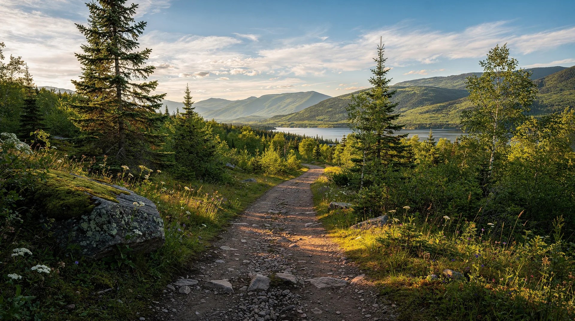
Quebec offers a hiking landscape of surprising range and diversity. The province is most often imagined as flat — the St. Lawrence Valley is indeed low-lying agricultural country — but the regions to the north, east, and southeast of that valley are mountainous, wild, and in the case of Gaspésie, genuinely alpine. Quebec has twenty-five provincial parks (parcs nationaux du Québec) and several national parks (under Parks Canada administration), collectively covering a vast area and maintaining thousands of kilometres of maintained hiking trails.
The Quebec hiking season runs primarily from mid-May through October, with peak summer conditions in July and August. Fall hiking — from late September through mid-October — is outstanding: the mixed forest turns in spectacular colour, the black flies and mosquitoes of summer are gone, the trails are less crowded, and the air is cool and clear. Winter snowshoeing on these same trails adds another dimension — see the Quebec winter activities guide for winter trail use.
This guide organises Quebec’s best hiking by region, with difficulty assessments, seasonal notes, and practical logistics. All trails mentioned are within the provincial or national park systems and have marked routes and maintained trail infrastructure.
Gaspésie: Quebec’s best alpine hiking
Parc national de la Gaspésie contains the most dramatic hiking terrain in Quebec. The Chic-Choc and McGerrigle mountains in the interior of the Gaspé Peninsula are the only mountains in eastern Canada that rise above the treeline, creating a genuinely alpine environment — open summits, arctic-alpine flora, and resident woodland caribou (the southernmost herd in eastern North America).
Mont Albert
Mont Albert is the park’s signature hike — a plateau summit at 1,154 metres, reached by a route that transitions from boreal forest to sub-alpine krummholz to open alpine tundra. The plateau itself is one of the most unusual landscapes in Quebec: flat, windswept, dotted with dwarf spruce, and supporting plant communities typically found far to the north. The caribou of the Gaspésie are often visible on the plateau.
Trail details: The full Mont Albert circuit is approximately 17 km with 900 m elevation gain — a full day hike for fit adults. A shorter southern route reaches the plateau without completing the full circuit. Trail surfaces are well-maintained; the upper section is exposed and requires windproof clothing even in summer.
Season: Best from late June through September. The plateau can receive snow at any time of year; check conditions before hiking above treeline. The park’s hostel-style accommodation (Gîte du Mont-Albert) at the base provides a reasonable overnight base.
Mont Jacques-Cartier
The highest point in Quebec at 1,268 metres, in the McGerrigle group east of Mont Albert. The summit trail (approximately 8 km return, 400 m elevation gain from the upper trailhead) is one of the most accessible high-alpine experiences in eastern Canada — the upper trailhead is reached by car in the park, significantly reducing the approach. Caribou sightings on the upper slopes are common in summer.
Lac aux Américains and waterfall trails
For visitors who prefer moderate hiking to strenuous summit climbs, Parc national de la Gaspésie has excellent waterfall and lake trails at lower elevations. The Lac aux Américains circuit (7 km, moderate) is particularly beautiful in fall colour.
Getting to Gaspésie: The park is accessible from Quebec City (approximately 5–6 hours by car) or via ferry from Tadoussac or the south shore. A minimum of two to three nights at the park is recommended to justify the journey. See the Charlevoix vs Gaspésie comparison guide for planning the broader Gaspésie itinerary.
Discover Canada outdoor and hiking experiences on GetYourGuideCharlevoix: coastal trails and the crater
The Charlevoix region between Quebec City and Saguenay combines one of Quebec’s most scenic landscapes with a network of hiking trails that are accessible, well-maintained, and range from easy river valley walks to moderate coastal climbs with St. Lawrence views.
Parc national des Hautes-Gorges-de-la-Rivière-Malbaie
One of Quebec’s most dramatic national parks — the Rivière Malbaie cuts through the Laurentian plateau in a canyon with 800-metre cliffs, among the highest vertical relief in eastern Canada. The canyon walls tower over the river in a landscape that feels genuinely northern. The park offers both hiking and river boat tours for the canyon section.
Key trail: Acropole des Draveurs — 5 km, 756 m elevation gain. A strenuous climb to the canyon rim with views over the Hautes-Gorges that are among the most spectacular in Quebec. The descent follows a different route back to the valley.
Season: Park access: mid-May to mid-October. River boat tours operate June through early October.
Parc national des Grands-Jardins
The high plateau of the Laurentian shield north of Baie-Saint-Paul, with a boreal landscape so cold and windswept that it supports a population of woodland caribou at the southern edge of their range — an ecologically remarkable site. Trail hiking (the Mont du Lac des Cygnes summit trail: 8 km return, moderate, excellent views) and winter snowshoeing.
Charlevoix coastal walks
Several informal and marked trail systems run along the Charlevoix coast, with views over the St. Lawrence River to the south shore. The terrain between Baie-Saint-Paul and Pointe-au-Pic is particularly beautiful in fall colour. The Charlevoix destinations page covers accommodation and seasonal context.
Eastern Townships: hiking and the Appalachian connection
The Eastern Townships are Quebec’s most southerly region, geologically the northern end of the Appalachian chain. The summits here are modest by Gaspésie standards but offer excellent forest hiking and views.
Parc national du Mont-Mégantic
The park is most famous as a dark sky reserve — see the Quebec dark sky preserves guide for the astronomy context — but the hiking here is also excellent. Mont Mégantic (1,105 m) and Mont Saint-Joseph (1,035 m) offer summit trails (approximately 9 km return for Mont Mégantic, 800 m elevation gain) through old-growth forest to views that on clear days extend to Maine.
Parc national du Mont-Orford
The most accessible provincial park for Montreal visitors — 90 minutes from the city. The Mont Orford summit trail (approximately 10 km return, 600 m elevation gain) provides views over Lac Memphrémagog and the Eastern Townships. The park is heavily visited in fall but peaceful in spring and on weekdays through summer.
Massif du Sud (Chaudière-Appalaches)
A less well-known park on the south shore of the St. Lawrence, between Quebec City and Gaspésie. Excellent multi-day hiking with hut-to-hut options; fall colour here is outstanding. Quiet even in peak season.
Saguenay–Lac-Saint-Jean: fjord trails
The Saguenay Fjord — a dramatic incision into the Laurentian plateau, with cliffs rising 300 metres directly from the water — has both water-level trails (accessible by sea kayak — see the kayaking the Saguenay Fjord guide) and plateau-level trails with views over the fjord.
Parc national du Fjord-du-Saguenay
Sentier des Caps du Saguenay: A challenging multi-day trail along the north rim of the fjord — 42 km end-to-end, with backcountry camping and refuges. The trail runs through boreal forest on the plateau edge, with periodic viewpoints over the fjord far below. This is a serious multi-day hike requiring fitness and preparation; day-hiking sections are possible from multiple access points.
La Statue trail (Baie-Éternité): A popular 4.5 km return trail to a massive statue of the Virgin Mary on a cliff face above the fjord — a historic pilgrimage site and one of the most dramatic viewpoints in the Saguenay system.
Book Montreal-based outdoor and nature tours on GetYourGuideLaurentians: accessible hiking near Montreal
The Laurentian mountains north of Montreal — the ski resort country of the Laurentides region — have summer and fall hiking across a network of provincial and private parks. The terrain is rolling rather than dramatically alpine, but the trails are well-maintained and easily accessible for Montreal-based visitors.
Parc national d’Oka
On the Ottawa River west of Montreal, Oka is known more for beaches and water activities, but its forest trails are pleasant for easy to moderate hiking. Excellent for families.
Parc national de la Rivière-du-Nord (Saint-Jérôme)
Just 60 km north of Montreal, this park follows the North River through a pleasant forested gorge. The Canyon trail (6 km, moderate) passes several waterfalls and is one of the most accessible waterfall hikes near Montreal.
Parc national du Mont-Tremblant
The Laurentians’ largest provincial park (1,510 km²) with an extensive trail network. The de la Corniche trail (7 km, moderate) near the Diable sector provides excellent views. The park is much less crowded than the adjacent Mont-Tremblant resort area — see the Mont-Tremblant vs Mont-Sainte-Anne guide for the resort comparison.
Practical hiking notes
Reservations: All Quebec provincial parks require advance camping and sometimes parking reservations through the Sépaq system (sepaq.com). In peak summer and fall colour season, popular parks book up weeks in advance. Day hiking typically does not require advance reservation but confirm per-park.
Park passes: Sépaq parks charge daily access fees (approximately CAD $8–$12 per adult). The Sépaq annual pass (CAD $70–$90 per person) pays off quickly for frequent visitors.
Insects: Black flies are severe in May and June throughout Quebec’s boreal forest. Mosquitoes peak in June and July. Bug repellent (DEET-based for serious protection), head nets, and long sleeves are essential for early-season hiking. By August, the worst is past.
Bear awareness: Black bears are present throughout Quebec’s forested regions. Follow standard bear-country food storage protocols when camping. Bear encounters are rare; bear problems rarer still. Carry bear spray if concerned.
Trail conditions: Spring trail conditions can be extremely muddy following snowmelt. Most parks advise checking trail conditions on their websites before spring visits; some trails are closed until the ground firms up in May.
What to carry: Always: water (minimum 2 litres for a half-day hike), food, map or downloaded offline trail map (Alltrails has good Quebec trail coverage), first aid basics, rain layer, sun protection, emergency whistle. Cell coverage is non-existent in most Quebec backcountry.
Related pages
- Sea kayaking the Saguenay Fjord: operators, seasons and routes
- Quebec dark sky preserves: astronomy tourism and night photography
- Quebec cycling routes: Route Verte Quebec’s longest cycling network
- Charlevoix vs Gaspésie: which Quebec coast for your trip?
- Mont-Tremblant vs Mont-Sainte-Anne: best Quebec ski resort comparison
- Charlevoix destinations
- Saguenay–Lac-Saint-Jean destinations