Cabot Trail: which direction to drive? Clockwise or counter-clockwise
Should I drive the Cabot Trail clockwise or counter-clockwise?
Counter-clockwise (north through Baddeck, Ingonish, Neils Harbour, Pleasant Bay, Cheticamp, and back) is the consensus choice. You drive on the ocean side of the road with direct views, easier pullouts, and the best scenery in afternoon light. Most locals and tour guides recommend it.
Of all the practical questions about driving the Cabot Trail, one comes up more than any other: clockwise or counter-clockwise? The 298-kilometre loop around the northern cape of Cape Breton Island is one of Canada’s great coastal drives, and the direction you drive it genuinely affects the experience. The answer, once you understand why, is clear: counter-clockwise, most of the time, for most visitors.
This guide explains why direction matters on this particular drive, when the opposite direction might actually make sense, and provides a day-by-day plan in the recommended direction.
Why direction matters here
Most scenic drives are reasonably symmetric — you see similar scenery regardless of which way you travel. The Cabot Trail is different for several reasons.
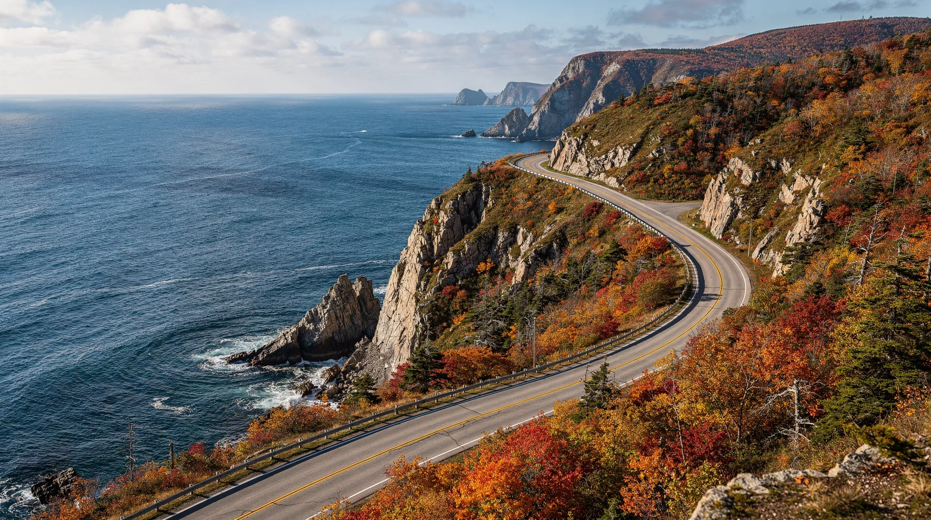
Ocean-side vs. mountain-side driving: the Cabot Trail hugs the coast for significant sections. Driving counter-clockwise (heading north along the western coast first, looping over the top, and returning south along the eastern coast), you sit on the ocean side of the road for the most dramatic stretches — the cliff sections between Cheticamp and Pleasant Bay on the west side, and the sections between Ingonish and Neils Harbour on the east side.
This matters because the road is narrow in places, with limited pullouts, and the passenger-side view determines what you actually see. Driving clockwise, you spend more time on the inland side of the road looking across oncoming traffic at the ocean.
Pullout orientation: many scenic pullouts along the Trail are specifically oriented for counter-clockwise travel — they are on the right side of the road heading north, on the right heading south on the return. Going clockwise means making awkward left turns across traffic to reach the viewpoints.
Afternoon light on the best scenery: the most-photographed scenic sections of the Cabot Trail are the western coast cliffs and the Skyline Trail viewpoint. In counter-clockwise mode, you reach these in late morning and afternoon with strong side light and warm tones. Clockwise, you hit them in the morning when light is flatter.
Traffic flow: tour buses predominantly travel counter-clockwise. This is both a reason to join them (easier flow, all pullouts positioned for your direction) and, paradoxically, a reason to reverse direction in peak summer if you want to avoid bus convoys. For most first-time visitors, following the bus direction is the more reliable choice.
The counter-clockwise route
Starting and ending in Baddeck (the usual base):
Day 1: Baddeck to Ingonish (about 100 km, 2 hours’ driving plus stops)
- Alexander Graham Bell National Historic Site (Baddeck) — morning
- Drive north on Route 105 to Englishtown ferry
- Englishtown ferry crossing (short, small, working — part of the experience)
- Route 312 to Neils Harbour, then onto the Cabot Trail
- Ingonish — late afternoon arrival; Keltic Lodge, Highlands Links golf
- Overnight in Ingonish area
Day 2: Ingonish to Pleasant Bay (about 110 km, but with major hikes, 4+ hours)
- Skyline Trail hike (8 km loop, 3-4 hours, arguably the best trail in Canada for sunset; hike in morning for better wildlife and fewer crowds)
- Cape Breton Highlands National Park sections
- French Mountain lookoff
- Descent to Pleasant Bay — Pleasant Bay for whale watching
- Overnight in Pleasant Bay
Day 3: Pleasant Bay to Cheticamp, return to Baddeck (about 200 km, full day)
- Afternoon whale-watching trip from Pleasant Bay
- Or drive south to Cheticamp via the dramatic west-coast cliff section
- Cheticamp — Acadian culture, restaurants, crafts
- Cheticamp Island coastal drive
- Return to Baddeck via Route 19 (the Ceilidh Trail) — inland route, different scenery
- Alternative: base in Cheticamp for a second night and return via the main Cabot Trail
When clockwise might make sense
Despite the consensus, a few scenarios favour clockwise driving:
You’re staying in Cheticamp and driving a day trip: clockwise from Cheticamp (south to Baddeck, or north to Pleasant Bay and back) can make local logistical sense.
You want to avoid tour buses: if you’re travelling in the height of summer and want the best views with the fewest buses in the frame, clockwise can help — you’re moving against the main flow.
You’re a photographer with a specific morning/evening plan: if you know exactly which locations you want at which time of day, a clockwise traverse can prioritise dawn shots at the western coast sections (though the logistics are complex).
Multi-day loop with specific overnight preferences: if your accommodation arrangements naturally start in Cheticamp, clockwise becomes the sensible direction. Don’t try to reverse the direction to satisfy a “rule” that costs you a better base location.
For 95% of first-time visitors, the counter-clockwise direction is correct. The 5% of exceptions usually involve specific accommodation plans or photography logistics.
How many days do you need?
Two full days is the minimum viable Cabot Trail experience — you will see the scenery but miss the hiking, Skyline Trail, and whale watching. Good for visitors on a tight schedule but not recommended.
Three days is the standard and best-value duration. Allows for Skyline Trail, one whale-watching trip, adequate time at the major viewpoints, and evening meals without rushing. This is the recommended duration.
Four to five days opens time for more hiking (multiple trails in Cape Breton Highlands National Park), slower restaurant stops, second whale-watching trips, and deeper exploration of Pleasant Bay, Cheticamp, or Ingonish.
Seven-plus days allows deeper combination with the broader Cape Breton region — the Bird Island boat tour from Baddeck, the Fortress of Louisbourg, the Celtic music scene, and base time in each of the Trail communities.
Key stops in the recommended direction
Baddeck: the Alexander Graham Bell Museum is excellent (Bell spent his last 35 years on Bras d’Or Lake). The Bras d’Or Yacht Club sunset is worth timing for.
Englishtown ferry: small cable ferry connecting the east side of St. Ann’s Bay. Costs around $7, takes 2 minutes, operates from early morning to evening.
Neils Harbour: a classic Cape Breton fishing village; Chowder House restaurant for lobster rolls.
Ingonish: Keltic Lodge on its dramatic peninsula; Middle Head Trail (5.5 km loop) for views of the coast; Highlands Links golf course (top-ranked in Canada).
Cape Breton Highlands National Park: entry fee required (Parks Canada pass accepted). The park covers about a third of the Trail and contains the best hiking.
Skyline Trail: the 8 km loop (easy to moderate) at the top of French Mountain, with its famous cantilevered deck overlooking the coast — the single most-photographed view on the Cabot Trail. Hike in the morning or late afternoon for best light; avoid midday in summer.
Pleasant Bay: the “whale watching capital” of Cape Breton — pilot whale tours depart here. Whale Interpretive Centre worth 30 minutes.
Cheticamp: Acadian community, the Trois Pignons Acadian cultural centre, excellent restaurants. Cheticamp is also home to one of the entrances to the national park.
Margaree Valley (on Route 19 inland): salmon fishing heritage, Margaree Salmon Museum, pleasant alternative return route.
The drive’s practical details
Total distance: 298 km for the core Cabot Trail loop. Add 100-150 km for detours and hikes.
Driving time: 6-8 hours of actual driving if no stops. Budget 2-3 days to do it properly.
Road conditions: mostly two-lane paved highway. Steep grades on French Mountain and MacKenzie Mountain. In winter (November-April), conditions can be hazardous; Cabot Trail is fully open but weather-dependent.
Fuel: stations in Baddeck, Ingonish, Pleasant Bay, and Cheticamp. Budget carefully — distances between stations can be 80 km.
Cell coverage: intermittent. Download offline maps before departure.
Best season: June through late October. July and August are peak; September and early October are excellent for fall colour and fewer crowds. The Celtic Colours Festival in early October adds cultural programming.
Combining the Cabot Trail with a larger trip
The Cabot Trail is typically a 3-5 day segment within a longer Atlantic Canada itinerary. Most visitors arrive at the Halifax airport and drive up — 400 km and a full day’s drive from Halifax to Baddeck.
The Cape Breton 5-day itinerary provides a complete plan including Louisbourg, Baddeck, and the Cabot Trail loop.
The Cabot Trail vs Gaspésie comparison may be useful for visitors choosing between the two most famous Atlantic scenic drives.
Book guided Cabot Trail tours and Cape Breton experiencesThe bottom line
Drive counter-clockwise. Start in Baddeck, north via Englishtown ferry, along the east coast to Ingonish, across the top via Skyline Trail and the national park, down the west coast via Pleasant Bay and Cheticamp, and back to Baddeck. Plan three days minimum. You will have the best scenery on your side of the road, the best afternoon light on the most dramatic sections, and the smoothest logistics at pullouts and viewpoints.
The clockwise drive works for specific scenarios but should be the exception rather than the rule. Trust the consensus on this one — it is based on the actual geography of the road.