Canada's greatest road trips: a 14-day drive across three iconic routes
Overview
Canada’s road trip culture is inseparable from its geography: a country that stretches 7,700 kilometres coast to coast has produced some of the world’s most compelling drives. This 14-day itinerary combines the three most celebrated: the Sea-to-Sky Highway through the Coast Mountains above Howe Sound, the Icefields Parkway between Lake Louise and Jasper across the spine of the Rockies, and — via an eastern flight — the Cabot Trail circuit around Cape Breton Island. Between them you cover mountain fjords, icefields, highland plateaus, and Atlantic cliffs. A fourth section, the Trans-Canada through Rogers Pass, adds a connecting drive of its own character.
This is a driving-first itinerary: the road is part of the experience, not just the means of getting between sights. Pull over often. The layby with no name on the map is sometimes better than the one in the guidebook.
| Days | Route | Highlights |
|---|---|---|
| 1–2 | Vancouver — Sea-to-Sky — Whistler | Howe Sound cliffs, Shannon Falls, Squamish Chief |
| 3–5 | Whistler — Coquihalla — Revelstoke — Banff | Rogers Pass, Rogers Pass tunnel, Glacier NP |
| 6–7 | Banff National Park | Lake Louise, Moraine Lake, Banff town |
| 8–9 | Icefields Parkway: Lake Louise to Jasper | Peyto Lake, Columbia Icefield, Athabasca Falls |
| 10 | Jasper — drive to Calgary — fly east | — |
| 11–14 | Cape Breton Island — Cabot Trail circuit | Highlands, Skyline Trail, Cheticamp |
Day 1: Vancouver — collecting the car and heading north
Pick up your rental car in Vancouver. The major agencies (Enterprise, Budget, National) all operate from Vancouver Airport arrivals level, with no shuttle required. For this itinerary, book a mid-size SUV or 4WD — it handles mountain passes better and gives more ground clearance on gravel viewpoint roads.
Drive through North Vancouver and onto Highway 99 north: the Sea-to-Sky Highway begins almost immediately after crossing the Lions Gate Bridge, where the road narrows and the cliffs close in on the left while Howe Sound opens to the right. The first stop is Porteau Cove Provincial Park (40 minutes from downtown Vancouver), where the Sound widens and the mountains of the Tantalus Range appear across the water. Walk to the shoreline and you will understand why this drive has its reputation.
Continue north to Shannon Falls Provincial Park — a short, flat 10-minute walk to an 84-metre waterfall, the third-highest in BC, that you hear before you see it. The parking area fills by 10am in summer; arrive before 9:00 for an easy approach. Just north of Shannon Falls, the 700-metre granite monolith of Stawamus Chief dominates the highway on the left — one of the largest granite faces in North America, and a serious technical climbing destination.
Continue to Squamish for lunch. Squamish has transformed over the past decade into a small city of excellent coffee shops and climbing gear stores. The Squamish Lil’wat Cultural Centre in nearby Whistler provides essential context on the peoples of this territory.
Arrive in Whistler by mid-afternoon. The pedestrian village at the base of Whistler and Blackcomb mountains is worth an evening stroll: no cars, good restaurants, and the two mountains rising immediately behind with trails and gondolas ascending into the alpine zone.
Where to stay in Whistler: Fairmont Chateau Whistler (luxury, ski-in ski-out at Blackcomb base), Summit Lodge Boutique Hotel (comfortable mid-range in the village), HI Whistler Hostel (budget, village-centre location).
Day 2: Whistler — the mountain and the Peak 2 Peak
Dedicate the morning to Whistler Mountain. In summer, the Whistler Village Gondola ascends to the alpine zone, where the Peak 2 Peak Gondola crosses 3 kilometres between Whistler and Blackcomb peaks at 436 metres above the valley floor — the highest and longest unsupported gondola span in the world. On a clear day, the Coast Mountains spread in every direction. In winter, 200-plus ski runs fill both mountains; the terrain is among the most varied in North America.
For a more active morning, hike the Flank Trail or the lower sections of the Valley Trail network along the River of Golden Dreams, connecting the resort’s various lakes. The Lost Lake loop (5 km) is flat, forested, and dotted with swimming spots in summer.
Afternoon: drive the final 50 kilometres of the Sea-to-Sky beyond Whistler to Pemberton and Lillooet. This northern extension of Highway 99 gets almost none of the traffic of the Whistler section, yet the scenery — the Pemberton Valley’s flat farmland surrounded by snow-capped peaks, the green river braids — is extraordinary. The drive to Lillooet and back adds 2.5 hours but gives a genuine sense of the BC Interior beyond the resort corridor.
Return to Whistler for dinner. Araxi and 21 Steps are two of the best restaurants in the village; both have good locally sourced menus and local wine lists.
Day 3: Coquihalla Highway to Revelstoke
Depart Whistler early. The route east to Banff begins with the Coquihalla Highway (Highway 5), which climbs from Hope — reached via Highway 99 south to Hope — through the Coquihalla Summit (1,244 m) and drops into the Thompson River canyon at Merritt. The highway is dual-carriageway and fast, with less scenery than the Trans-Canada alternative, but it saves roughly 45 minutes and avoids the congestion of the Fraser Canyon.
From Kamloops (where the Thompson and North Thompson rivers meet — a pleasant stop for coffee at the revitalised downtown waterfront), continue east on the Trans-Canada (Highway 1). The highway follows the South Thompson to Shuswap Lake, then climbs toward Revelstoke through increasingly dramatic terrain.
Revelstoke is one of BC’s most rewarding small cities: a grid of Victorian brick storefronts at the base of the Selkirk Mountains, with the Columbia River running alongside and the highest average snowfall of any ski resort in North America on the mountain above. Walk the main street (MacKenzie Avenue), have dinner at modern Canadian restaurant Quartermaster or the Taco Club, and stay at the Regent Inn or the Revelstoke Mountain Resort village hotels at the base of the ski area.
The Rogers Pass section of the Trans-Canada — running through Glacier National Park between Revelstoke and Golden — is covered in the following day’s drive.
Day 4: Rogers Pass and the drive to Banff
The morning drive from Revelstoke east through Glacier National Park on the Trans-Canada covers the Rogers Pass (1,330 m), the route through the Selkirk Mountains that Canadian Pacific Railway engineers discovered in 1881 and that the Trans-Canada Highway follows today. The pass is surrounded by some of the most technically demanding terrain in North America for avalanche control — you will see the concrete snowsheds and artillery emplacements used to trigger controlled slides above the highway. The Glacier NP visitor centre at the summit explains the park’s ecology and the engineering of the highway.
Continue east through Golden (a worthy coffee stop, with spectacular mountain views) and into the Columbia River Valley. At Castle Junction, the highway enters Banff National Park — a park pass is required (approximately CAD 70 for 10 days, covering all national parks on this route). The Bow Valley opens out and the first recognisable Rockies skyline appears ahead.
Arrive in Banff by early afternoon. Drive the Bow Valley Parkway (Highway 1A) from the park gate rather than the Trans-Canada — a quieter, slower road through riverside meadows where elk, deer, and occasionally black bears are visible from the car. The Johnston Canyon trailhead is on this road; if there is time, the 1.1 km walk to the Lower Falls through the carved limestone canyon is exceptional.
Where to stay in Banff: Fairmont Banff Springs (iconic castle-hotel, luxury), Moose Hotel and Suites (contemporary comfort, rooftop pools), HI Banff Alpine Centre (budget, excellent common areas and mountain views).
Day 5: Banff — Lake Louise and Moraine Lake
This is one of the most photographed days in Canadian travel, and deservedly so. Drive to Lake Louise (45 minutes from Banff on Highway 1) with a pre-7:00am arrival targeted. The Parks Canada reservation system (mandatory from late June through September) controls vehicle access to the Lake Louise lakeshore — either arrive very early to park, or use the park-and-ride shuttle from the highway. The colour of the water — a specific shade of glacial turquoise that changes intensity through the day — remains startling regardless of how many photographs you have seen beforehand.
Hike the Plain of Six Glaciers Trail (8.6 km return) above the lake for increasingly dramatic views of the Victoria Glacier as the trail climbs. The historic tea house at the trail’s end, open in summer with hot drinks and baked goods, is worth the climb. Return to the lake in time for the morning light to shift onto the lower slopes.
Afternoon: drive to Moraine Lake in the Valley of the Ten Peaks. Access is controlled similarly to Lake Louise; arrive before 6:00am to drive to the lake, or take the Parks Canada shuttle. The view from the rockpile at the east end of the lake — the ten peaks of the Wenkchemna Range reflected in the water, the boulders piled at the shore — is the single scene most firmly associated with the Canadian Rockies in international imagination. It has appeared on the back of the Canadian CAD 20 bill.
Evening: drive the Bow Valley Parkway toward Banff watching for elk. Return to Banff for dinner on Banff Avenue or at the Banff Springs.
Day 6: Banff National Park — town and surroundings
Use this day to explore the parts of Banff that the lakeshore crowds obscure. Morning: drive the Minnewanka Loop north of Banff town — Lake Minnewanka is the largest lake in the park, and the road runs along its eastern shore through old forest. Two Jack Lake, a smaller lake on the loop, reflects Mount Rundle in its calm mornings. The Minnewanka boat cruise (1-hour, guided) reaches areas inaccessible by road and often spots big-horn sheep on the cliffsides.
Afternoon: hike Sulphur Mountain (5.5 km up, gaining 655 m, or take the Banff Gondola) to the summit ridge where a 1.5 km boardwalk connects the cosmic ray station to panoramic views over the Bow Valley, Rundle, and the full southern Rockies skyline. The views justify the gondola price, especially at sunset. Afterwards, the Banff Upper Hot Springs pool (1.5 km below the gondola) at 39°C, with Sulphur Mountain behind and the valley spreading below, is an excellent end to the day.
Dinner in Banff town: Bison Restaurant (bison tenderloin, local sourcing), The Maple Leaf (Canadian classics), or Eden at the Rimrock Resort Hotel for a more elevated meal with the town spread below.
Day 7: The Icefields Parkway — Lake Louise to the Columbia Icefield
The Icefields Parkway (Highway 93) is a 232-kilometre drive from Lake Louise north to Jasper, consistently listed among the world’s great scenic roads. Treat it as an all-day event, not a transit. Depart before 8:00am.
Bow Lake (30 km from Lake Louise): the jade-green lake beside the highway reflects Crowfoot Glacier and the Waputik Icefields above. Stop at Num-Ti-Jah Lodge for coffee and the reflection view. The Crowfoot Glacier has receded dramatically in recent decades — park signage at the viewpoint documents the retreat.
Peyto Lake Viewpoint (40 km): the most photographed viewpoint on the Parkway. A 1.5 km return walk from the car park reaches the new viewing platform (rebuilt 2023) above the electric-blue lake, its wolf-head silhouette visible in the valley below. Allow 30–40 minutes.
Saskatchewan River Crossing (77 km): a petrol station with basic café at the confluence of three rivers. Fuel up; it is the only petrol between Lake Louise and Jasper.
Columbia Icefield (104 km): one of the largest non-polar icefields in the world, where the Athabasca Glacier reaches the roadside. Walk to the glacier’s edge — the terminal moraine and retreat markers show the ice pulling back. The Ice Explorer bus ride onto the glacier surface (booked in advance at the Columbia Icefield Discovery Centre) takes you to a point where the ice is 300 metres deep. The Columbia Icefield Skywalk, a glass-floored cantilever platform over the Sunwapta Valley, is an optional extra offering vertiginous views.
Athabasca Falls (30 km north of the Columbia Icefield): the most powerful waterfall in the Canadian Rockies, where the Athabasca River is forced through a narrow quartzite canyon. The roar is constant, the spray permanent, and the geological features — the potholes, the abandoned river channels — worth studying. Short walk from the car park; do not miss it.
Days 8–9: Jasper National Park
Jasper is larger than Banff and quieter. The town itself is smaller and less commercial; the surrounding national park — 11,228 square kilometres — is wilder. Elk graze on the golf course at dusk. Black bears appear on the Maligne Lake road. Wolves, grizzlies, and woodland caribou move through the backcountry.
Day 8: Maligne Lake (48 km east of Jasper on the Maligne Lake Road) is the highlight of Jasper National Park. The 22-kilometre-long lake at 1,670 metres, enclosed by the Queen Elizabeth Ranges, is one of the largest glacially-fed lakes in the Rockies. Spirit Island — a tiny forested island at the mid-point of the lake — is accessible only by boat and is one of the most photographed scenes in Canada. The Maligne Lake Boat Tour (2 hours) reaches Spirit Island and returns; book well in advance in summer.
Day 9: The Jasper Skytram ascends Whistlers Mountain (2,277 m) for the most panoramic views in the town area — on a clear day you can see into BC and south toward Banff. In the afternoon, drive the Maligne Canyon Loop (Highway 16 east, then south): the canyon is up to 55 metres deep with six natural limestone bridges over the Maligne River. The lower canyon section (trailhead 1 at Maligne Canyon) is the most spectacular.
Where to stay in Jasper: Fairmont Jasper Park Lodge (on Lac Beauvert, 4 km from town, atmospheric), Maligne Lodge (central, mid-range), Mount Robson Inn (comfortable budget option).
Day 10: Jasper to Calgary — then fly east
Drive south from Jasper on Highway 93 to Banff, then east on the Trans-Canada to Calgary (approximately 4 hours direct, or 5–6 hours with stops). Return the rental car at Calgary Airport.
If time allows, the detour south to Drumheller (additional 1.5 hours east of Calgary) crosses the Alberta Badlands — a landscape of hoodoos and canyon walls utterly unlike the mountains you have spent the past week in. The Royal Tyrrell Museum in Drumheller is the finest dinosaur museum in the world; allow 2 hours minimum.
Fly Calgary to Halifax, Nova Scotia, this evening — WestJet operates direct flights (4 hours). Arrive in Halifax overnight.
Where to stay in Halifax: The Muir Hotel (luxury, new waterfront property), Garrison Brewing Hotel (mid-range, excellent location), Fresh Start B&B (budget).
Days 11–14: Cape Breton Island — the Cabot Trail
Rent a second car in Halifax for the Cape Breton section. Drive the Trans-Canada north across Nova Scotia to the Canso Causeway — the fixed link to Cape Breton Island (3.5 hours from Halifax). Once on the island, join the Cabot Trail at Baddeck, the charming village on the Bras d’Or Lakes where Alexander Graham Bell had his summer estate.
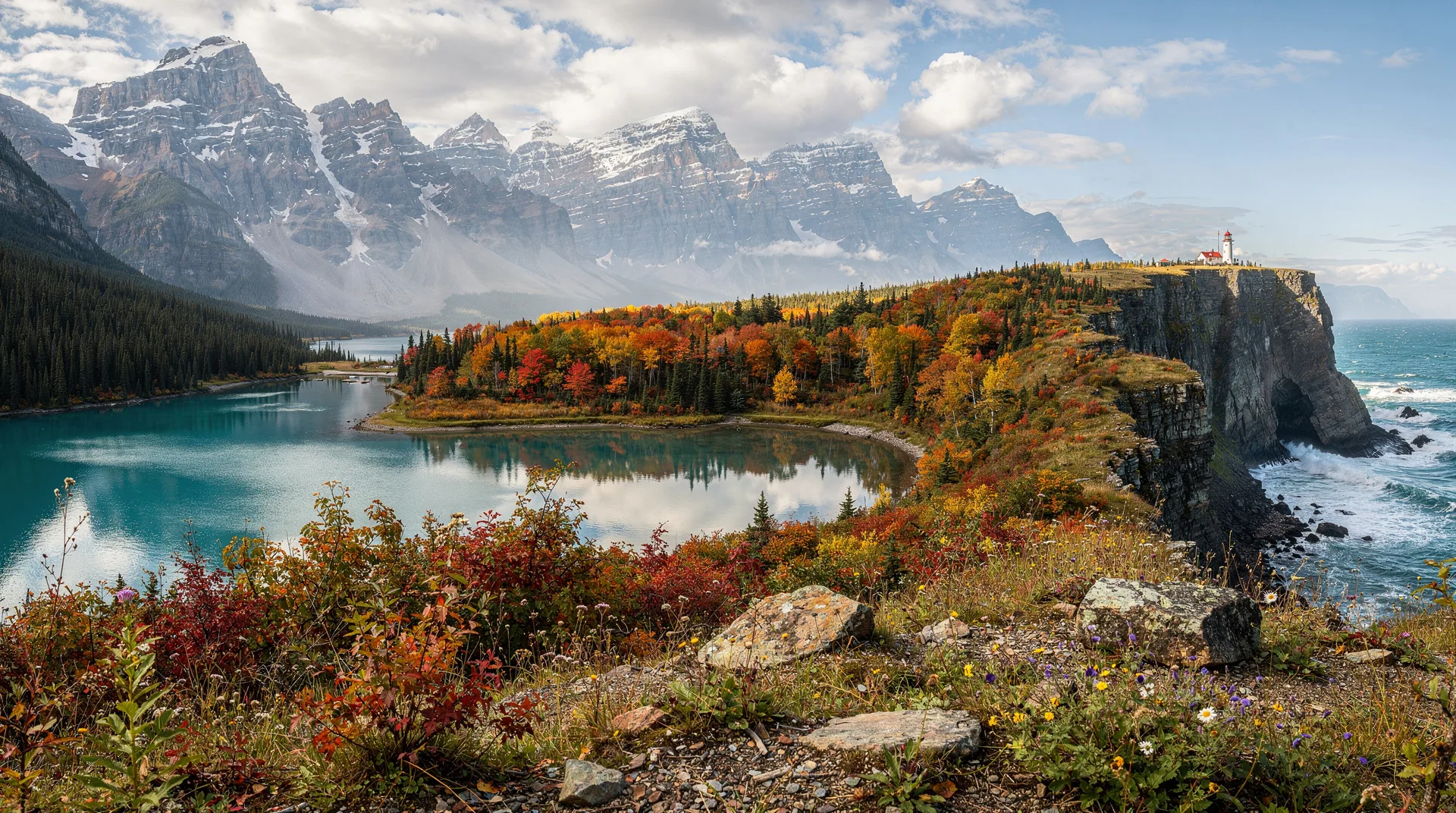
The Cabot Trail is a 298-kilometre circuit around the northern highlands of Cape Breton. Most drivers complete it in two to three days, stopping at viewpoints, beaches, and the Highland villages. Drive counter-clockwise (the standard direction) so that the cliff edges face the ocean on your right.
Day 11: Baddeck to Cheticamp (90 km). The highway climbs quickly into Cape Breton Highlands National Park. Cheticamp is an Acadian fishing village on the Gulf of St Lawrence shore with excellent Acadian French cuisine and the best starting point for the highland plateau. In the evening, whale watching from Cheticamp is possible June through October — fin whales, minke, and pilot whales are regular offshore.
Day 12: The Highland Plateau — the centrepiece of the Cabot Trail. The road climbs to 450 metres on the plateau where the subarctic ecosystem rolls to the cliff edge and the Atlantic visible in multiple directions. The Skyline Trail (9.5 km return) begins at French Mountain on the plateau and ends at a headland overlooking the Gulf of St Lawrence — one of the most dramatic coastal walks in eastern Canada. Moose are common on the plateau and particularly active at dawn and dusk.
Day 13: Ingonish, Cape Breton Highlands NP, and the east coast. Ingonish Beach — where the Cabot Trail descends back to sea level on the Atlantic side — has a sand beach inside a narrow valley enclosed by the highlands. Swim in the Atlantic (cold but exhilarating), walk the coastal trails, and visit the Keltic Lodge (a heritage resort at the headland with cliffs on three sides). Continue south on the Trail’s eastern section through the Gaelic coastal villages of Englishtown and North River.
Day 14: Return to Halifax via the Bras d’Or Lakes. The inland route back to Halifax passes through the Bras d’Or Lakes — a 1,100 square kilometre inland sea connected to the Atlantic by two channels, with bald eagles nesting along the shoreline and a microclimate mild enough for vineyards. Return the car in Halifax or Sydney and fly home.
Getting around
British Columbia and Alberta (Days 1–10): Rental car essential. Pick up at Vancouver Airport, return at Calgary Airport. The rental is one-way; one-way fees vary by agency but are generally modest on the popular Vancouver–Calgary route. Fill up at Golden and at Saskatchewan River Crossing (the only petrol on the Icefields Parkway between Lake Louise and Jasper).
Nova Scotia and Cape Breton (Days 10–14): Second rental car from Halifax Airport. Standard mid-size is sufficient; the Cabot Trail is paved throughout. Return at Halifax Airport.
Internal flight: Calgary to Halifax (WestJet, Air Canada). Book 4–8 weeks ahead for best fares; summer prices range CAD 300–600 one-way.
Parks Canada passes: A single 10-day pass (approximately CAD 70/vehicle) covers Banff, Jasper, and Glacier national parks. Cape Breton Highlands requires a separate daily pass (~CAD 10/person). Buy online or at the park gate.
Where to stay
Whistler: Summit Lodge Boutique Hotel (mid-range village-centre)
Revelstoke: Regent Inn (mid-range heritage property) or Revelstoke Mountain Resort accommodation
Banff: Moose Hotel and Suites (mid-range, central), HI Banff Alpine Centre (budget)
Jasper: Maligne Lodge (mid-range, central Jasper), Mount Robson Inn (budget)
Halifax: The Prince George Hotel (mid-range, downtown location)
Cape Breton: Inverary Resort Baddeck (lake-facing, comfortable), Keltic Lodge at the Highlands (atmospheric headland lodge, Ingonish)
Total budget estimate
Per person, two sharing, in Canadian dollars, excluding international flights:
| Category | Budget (CAD) | Moderate (CAD) |
|---|---|---|
| Accommodation (13 nights) | 1,800–2,500 | 2,800–4,200 |
| Car rental (2 one-way rentals) | 900–1,400 | 1,200–1,800 |
| Fuel | 400–600 | 400–600 |
| Internal flight (YYC–YHZ) | 300–600 | 300–600 |
| Activities and park passes | 300–500 | 500–900 |
| Food and drink | 900–1,300 | 1,400–2,000 |
| Total | ~4,600–6,900 | ~6,600–10,100 |
Best time for this itinerary
June to September is the primary window. The Icefields Parkway is fully accessible from late May, Moraine Lake opens in mid-June, and the Cabot Trail is at its most temperate. July and August are peak season — accommodation books up fast, especially in Banff and Whistler.
September and October are superb for this route. Crowds thin after Labour Day, larch season in the Rockies peaks in late September with golden colour on the high slopes, and Cape Breton autumn colour can be spectacular in early October.
May is possible on the Icefields Parkway (some high viewpoints may still be snow-blocked) and excellent in BC. The Cabot Trail in May has few visitors and fresh spring green on the highlands.
Frequently asked questions
Can I do the western and eastern sections in either order?
Yes. Some travellers prefer to start in Halifax and fly west to Vancouver at the end, which means ending on the Pacific coast. The western section (Vancouver to Calgary) is the longer and more complex drive; doing it first when energy is highest has logic. There is no wrong order.
How long does the Icefields Parkway take to drive without stopping?
The Icefields Parkway (Lake Louise to Jasper) is 232 kilometres and takes about 3 hours without stops. With the major stops described (Bow Lake, Peyto Lake, Saskatchewan River Crossing, Columbia Icefield, Athabasca Falls), allow a full day of 8–10 hours. Do not rush this road.
Is the Cabot Trail suitable for all drivers?
Yes. The road is paved, well-maintained, and signed throughout. Some sections over the highland plateau have significant grades and sharp curves — drive carefully and use lower gears on the descents. The road has no technical challenges beyond those encountered on any mountain highway. Motorcyclists consider it one of the best roads in eastern Canada.
What is the best day hike on this entire itinerary?
The Skyline Trail above Cheticamp on the Cabot Trail, and the Plain of Six Glaciers above Lake Louise, are the two strongest candidates for different reasons. The Skyline Trail offers oceanic drama; the Plain of Six Glaciers offers Alpine glacial grandeur. If you can only do one: the Plain of Six Glaciers, for the tea house at the end and the view back down to the lake from altitude.
Do I need to book Moraine Lake and Lake Louise parking in advance?
Yes — the Parks Canada reservation system (available online at reservation.pc.gc.ca) controls vehicle access to both lakes from late June through September. Book 3–4 months in advance for the most popular dates. Shuttle buses from the Lake Louise park-and-ride run frequently and cost approximately CAD 8/person return. If you arrive before 6:00am, parking at the lakes is generally possible without a reservation.