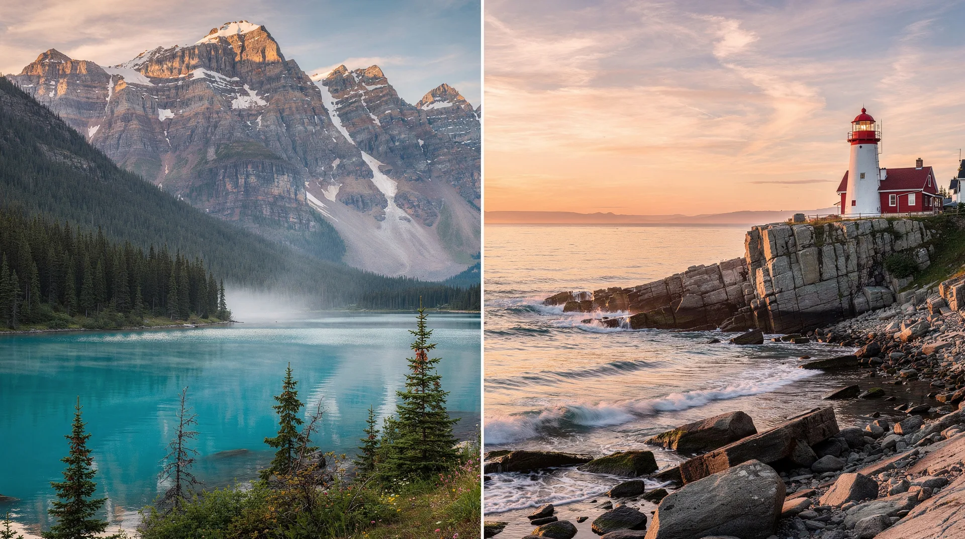
Lake Superior vs Lake Ontario: a tale of two lakes
Canada has more lake surface area than any other country on Earth, and yet most of the world’s mental image of “Canadian lake” is surprisingly uniform — clear blue water, pine trees, a canoe somewhere in the frame. The Great Lakes sit outside this mental picture entirely: they are too large, too varied, and too complex to reduce to a single image. Stand on the shore of Lake Superior during a late-October storm and you understand why sailors call it an inland sea. Stand on the Toronto waterfront and watch the skyline reflected in Lake Ontario’s winter calm and you understand something entirely different.
Superior and Ontario are the same body of connected water in the broadest sense — both drain eventually to the St. Lawrence — but as travel destinations they are as different as two places sharing a country can be. This is an attempt to think through those differences honestly.
Scale: how they actually compare
The numbers are useful context. Lake Superior is the world’s largest freshwater lake by surface area: 82,100 square kilometres. It is so large that you cannot see across it in most places, that weather systems develop over it independently, that waves in storms regularly exceed six metres. The lake holds more fresh water than all four other Great Lakes combined.
Lake Ontario is the smallest of the Great Lakes and the most easterly: 18,960 square kilometres. It is roughly the size of New Jersey. Viewed from a plane, it looks like a significant lake; viewed from Lake Superior’s perspective, it is a substantial pond.
This difference in scale produces entirely different psychological experiences. On Lake Superior’s shore at, say, Pukaskwa National Park on the northern coast, you are in wilderness of the kind that generates genuine smallness — the lake stretches to a featureless horizon, the forest comes down to the rocky shoreline, and there is nothing behind you for a very long way. On Lake Ontario’s shore at Toronto, you can see New York State across the water on a clear day. The comparison is not fair to either lake — Superior is a wilderness experience and Ontario is an urban one, and both are excellent at what they are.
Lake Superior: the wilderness shore
The Canadian shore of Lake Superior runs roughly from Sault Ste. Marie in the east to Thunder Bay in the west, with the small community of Wawa and a scattering of Indigenous communities in between. The Trans-Canada Highway runs along much of this coast and provides access, but the distances are real — Sault Ste. Marie to Thunder Bay is about 700 km with limited services along the way.
Pukaskwa National Park is the most remote accessible section of Superior’s Canadian shore, accessible only by boat or float plane (or a very serious multi-day coastal trail). The park protects old-growth boreal forest and a coastline of pink granite and deep bays that is genuinely unlike anywhere else in Canada. The water is cold enough to be dangerous for swimming in all but the shallowest bays in the height of summer.
Lake Superior Provincial Park, between Wawa and Sault Ste. Marie, is more accessible and offers excellent coastal hiking, rock art at Agawa Rock (one of the most significant Indigenous pictograph sites in Ontario, reached by a challenging shoreline scramble), and the remarkable phenomenon of autumn colour meeting lake water — the park in October is one of Canada’s great drives.
The lake itself has a reputation, earned over centuries, for being dangerous and beautiful in roughly equal measure. Gordon Lightfoot’s The Wreck of the Edmund Fitzgerald is about Superior — the bulk carrier sank in a November 1975 storm with all 29 crew. The lake claims ships on a scale that smaller lakes cannot, which gives it a weight of history that matches its physical weight.
Lake Ontario: the urban shore
Lake Ontario’s Canadian shore is defined by the cities along it: Toronto, Hamilton, Kingston, and the communities in between. This is not a wilderness experience — it is a lakefront urbanism experience, and at its best (the Toronto waterfront on a summer weekend; the Thousand Islands near Kingston; the Prince Edward County shoreline) it is excellent.
Toronto’s waterfront has been substantially redeveloped over the past two decades. The Harbourfront Centre, the Toronto Islands, the Martin Goodman Trail along the lake, and the developing Port Lands area make the waterfront a genuinely liveable public space in a way that wasn’t true twenty years ago. Taking a ferry to the Toronto Islands for an afternoon — walking the willow-lined paths, swimming at the beaches, watching the skyline from the water — is one of the best free activities the city offers.
Toronto boat tours and harbour cruises give a perspective on both the city and the lake that is impossible from shore — the CN Tower from the water, the scale of the harbour, the Lake Ontario horizon opening up as you head south. Several operators run sunset cruises that combine well with an evening in the city.
Kingston, at the eastern end of Lake Ontario, has an excellent relationship with its lake. The city’s historic limestone architecture, the presence of Fort Henry, and the extraordinary Thousand Islands region just downstream create a concentrated heritage and natural-beauty experience within a manageable distance of Toronto (two and a half hours by road or Via Rail train).
The Niagara connection
Lake Ontario’s western end connects to the Niagara River, which drains Lake Erie and, through that, the upper Great Lakes. Niagara Falls sits on this river, which gives Lake Ontario a famous neighbour. The falls are not on the lake — they are 50 km up the river — but most visitors combining Toronto and Niagara are orbiting the Lake Ontario basin.
make this combination accessible without a car. The falls are one of Canada’s most visited attractions and deserve more engagement than a brief roadside stop — the boat experience (formerly Maid of the Mist, now Hornblower/Niagara City Cruises on the Canadian side) gets you into the spray and is properly dramatic.
Wildlife: what you’ll encounter
Lake Superior’s Canadian shore has wildlife that reflects its wilderness character: moose, black bear, wolves, woodland caribou (rare but present in some northern areas), and loons on every inland lake. The lake itself supports Lake Superior lake trout, a genetically distinct form that has adapted to the extreme cold and depth. Fishing on Superior is a serious regional culture.
Lake Ontario’s wildlife is urban-adapted but more diverse than many city dwellers realise. The Toronto Islands support one of North America’s largest urban colonies of ring-billed gulls. The Don and Humber River mouths are significant migratory bird corridors in spring and fall. Point Pelee National Park, technically on Lake Erie but connected to the Lake Ontario system, is one of North America’s premier birding destinations during migration — warblers in May in numbers that beggar belief.
Choosing between them
The honest comparison comes down to what kind of trip you’re building:
Choose Lake Superior if: you want wilderness, solitude, serious hiking, a sense of scale that humbles, or the specific emotional experience of standing on a shore where the horizon is water in all directions. You need a car and ideally a week.
Choose Lake Ontario if: you want urban culture, good restaurants, accessible day trips, convenient transport, and a lake that functions as backdrop and amenity rather than destination in itself. Toronto is one of North America’s most interesting cities, and the lake is one of its best features.
Choose both if: you have two weeks and a road-trip disposition. The Trans-Canada Highway connects them, and a circuit from Toronto through Sault Ste. Marie along the Superior shore to Thunder Bay, then south through Manitoba or back through northern Ontario, is one of Canada’s great driving routes.
Practical matters
Getting to Lake Superior’s shore: Fly into Sault Ste. Marie or Thunder Bay and drive. Car rental is essential. The Trans-Canada (Highway 17) along the north shore is well maintained but fuel stops are spaced far apart — fill up when you can.
Getting to Lake Ontario: Toronto Pearson Airport is one of Canada’s busiest international hubs. Via Rail connects Toronto, Kingston, and other lake communities. No car necessary for the Toronto-Kingston corridor.
Swimming: Lake Superior’s water temperature rarely exceeds 10-12°C offshore. Sandy beaches in sheltered bays are warmer but still cold. Lake Ontario’s southern bays, particularly around Prince Edward County, reach comfortable swimming temperatures in July and August.
Final thoughts
Lake Superior and Lake Ontario are not in competition — they are simply different scales of the same Great Lakes system, serving different travel needs. Superior is one of Canada’s most underrated wilderness destinations; Ontario is the lake that 7 million people in Toronto live alongside and often underappreciate.
If you’ve only done one, do the other. If you’ve done neither, start with whichever matches your current travel appetite and plan to return for the rest.
Frequently asked questions about Lake Superior vs Lake Ontario: a tale of two lakes
Can you swim in Lake Superior?
In the sheltered bays of Lake Superior Provincial Park and around Wawa, the water is swimmable in July and August — cold by most standards but not prohibitive. The open lake stays cold year-round. Hypothermia risk is real in the open water even in summer; don’t swim far from shore.
How do you get around Lake Superior without a car?
You don’t, really. The Trans-Canada runs along parts of the northern shore, and some services connect Sault Ste. Marie to Thunder Bay, but for accessing trails, parks, and the actual shoreline, a car is essential. This is one of the few Canadian travel experiences that is genuinely inaccessible without personal transport.
Is Lake Ontario safe for swimming near Toronto?
Toronto has several monitored beaches on the lake and the Toronto Islands; water quality is tested regularly and posted publicly. Sunnyside Beach and those on the Toronto Islands are the most popular. Water quality is generally good but periodic bacterial advisories occur after heavy rains. Check the city’s beach monitoring reports before swimming.
What is the best season to visit Lake Superior?
Late August through October for hiking and fall colour. July for the best combination of warmth and long days. Winter offers snowshoe and cross-country skiing opportunities but requires cold-weather preparation. Spring (May-June) is beautiful but unpredictable.
How far apart are the two lakes?
Lake Superior’s south shore at Sault Ste. Marie is about 700 km from Toronto on Lake Ontario. Thunder Bay at the lake’s western end is about 1,400 km from Toronto. A road trip covering both lakes is possible in two weeks; a flight between Thunder Bay and Toronto takes about two hours.