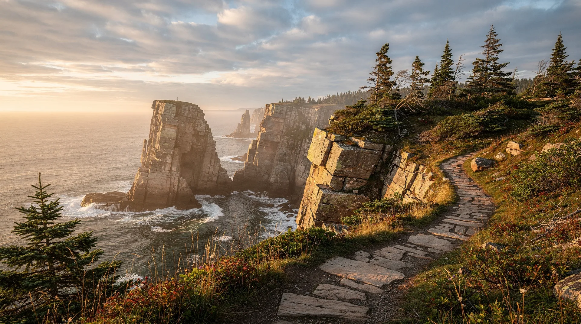
Skerwink Trail: Newfoundland's best short hike
How long is the Skerwink Trail and how hard is it?
The Skerwink Trail is a 5.3 km loop near Trinity, Newfoundland, rated moderate. It takes 2-3 hours including photo stops. The hike features sea stacks, cliff-top views, icebergs in June-July, puffins, and whales offshore.
The Skerwink Trail is one of those rare hikes that lives up to its reputation. A 5.3-kilometre loop near Trinity on Newfoundland’s Bonavista Peninsula, it routinely appears on lists of Canada’s best short hikes and is consistently identified as the best day-hike-per-kilometre anywhere in Newfoundland. Sea stacks rising from the Atlantic, fin-cove beaches accessible from the trail, iceberg viewing from June through July in most years, puffins and whales offshore, and a wildflower meadow finale — all packed into a walkable 2-3 hour loop that a reasonably fit visitor can complete before lunch.
This guide covers the trail practically: what to expect, when to hike it, how to get there, and how to combine it with the nearby heritage attractions of the Bonavista Peninsula.
| At a glance | |
|---|---|
| Where | Port Rexton, 5 km from Trinity, Bonavista Peninsula, Newfoundland |
| Cost | Free — no trail fees, free trailhead parking |
| Time needed | Around 2-3 hours for the 5.3 km loop |
| Getting there | Around 3 hours’ drive from St. John’s, or self-drive from Trinity/Port Rexton |
| Best time | Late June for icebergs, puffins and whales together |
What makes Skerwink special
The Skerwink Trail’s reputation is not inflated. Three features give it unusual reward-per-kilometre.
The sea stacks along the cliff sections are some of the most photographed coastal features in Newfoundland — pinnacles of sedimentary rock separated from the mainland by sea erosion, rising 20-40 metres from the surf. One stack forms a natural arch (at the “Pickadilly” feature). The cliff-top vantages allow direct overhead views down to the stacks.
The iceberg visibility is notable. The Skerwink Trail’s north-facing clifftop orientation and position along Iceberg Alley make it one of the better land-based iceberg viewing locations in Newfoundland during the May-to-July iceberg season. Peak years see multiple bergs visible from a single vantage point.
The trail’s compactness. Unlike many coastal hikes that require a full day and full gear, Skerwink is doable in 2-3 hours in a light pack. This accessibility — combined with the quality of the scenery — explains why it is often the first recommendation for Newfoundland hiking.
The hike in detail
The trail is a loop that can be hiked in either direction. Most hikers do it counter-clockwise (turning right at the trailhead), which puts the most dramatic cliff-top section in the second half of the hike.
Trailhead: Port Rexton, a small community adjacent to Trinity. A well-marked trailhead with a small parking area and information signage. No facilities at the trailhead; Trinity 5 km away has restaurants and services.
First section (0-1.5 km): moderate forest walking through coastal spruce, gradually climbing to the first cliff-top vantage. The first iceberg views (in season) appear here. A short side trail to the Pickadilly sea stack is well signed.
Cliff section (1.5-3.5 km): the trail follows the clifftop above dramatic sea stacks and narrow coves. This is the signature section — constant ocean views, multiple sea stacks below, cliff-top walking with some moderate ascents and descents. Several named viewpoints (including “Skerwink Head” and the signature sea-stack photo vantages) along this section.
Beach section (3.5-4 km): the trail drops to a small protected cove with a pebble beach — a good lunch stop. Seals are occasionally visible here.
Meadow and return (4-5.3 km): the trail re-enters meadow terrain with summer wildflowers and returns through forest to the trailhead.
Total ascent is approximately 200 metres cumulative with multiple short climbs. Rated moderate. Most hikers complete in 2 hours; allow 3 hours with photo stops.
When to hike the Skerwink Trail
June to early July is peak iceberg season on the Bonavista Peninsula in most years. Puffins are active at nearby colonies. Whales (humpbacks, minkes) are moving through the area. This combination makes late June the single best window for the hike.
Mid-July to August offers the warmest weather and longest daylight. Icebergs are typically gone by mid-July but whales and seabirds remain active. Wildflowers are at peak in July.
September and early October bring cooler weather, clearer skies, and genuine fall colour in the coastal forests. Fewer visitors. The hike is at its most scenically austere.
May is early season — the trail can be wet and some icebergs arrive with the spring, but trail maintenance may still be underway.
Winter (November-April): the trail is not maintained in winter. Some hikers do access it but this requires full winter gear, route-finding skills, and attention to weather.
| Month | Weather | Icebergs/wildlife | Crowds |
|---|---|---|---|
| May | Cool, sometimes wet, trail can be muddy | Early icebergs possible; trail maintenance may be underway | Quiet |
| June | Mild, variable | Peak iceberg season, puffins active, whales moving through | Busy by late June |
| July | Warm, long daylight | Icebergs usually gone by mid-month; whales and seabirds active; wildflowers peak | Peak season, arrive early for parking |
| Aug | Warm | Whales and seabirds still around, no icebergs | Busy |
| Sep-Oct | Cooler, clearer | Fall colour in the coastal forest | Quiet, good for photography |
| Nov-Apr | Cold, unmaintained trail | None of the summer wildlife | Very quiet, not recommended without winter experience |
What to pack
A short hike does not mean a casual one. The cliff-top sections are exposed, and Newfoundland weather changes fast even in summer.
Footwear: proper hiking shoes or boots — the trail surface is uneven with roots and loose rock, and wet grass on the cliff sections gets slippery.
Layers: a windproof or waterproof outer layer is worth carrying even on a sunny morning. Fog can roll in off the Atlantic within minutes and drops the temperature noticeably.
Binoculars: for iceberg, whale, and puffin spotting from the clifftop — most of the wildlife here is seen at a distance rather than up close. For a deeper dive into timing an iceberg trip, see iceberg viewing in Newfoundland and best time for icebergs. Puffin enthusiasts should also read puffin watching in Newfoundland for the full list of colonies beyond Elliston and Bonavista.
Water and a light lunch: no facilities on the trail; the beach section around the 3.5-4 km mark is the natural stopping point.
Practical information
Location: Port Rexton, Newfoundland, approximately 5 km from Trinity on the Bonavista Peninsula.
Length: 5.3 km loop.
Elevation gain: approximately 200 m cumulative.
Difficulty: moderate. Some exposed cliff-top sections (stay back from edges, especially in wind or fog).
Time required: 2-3 hours including photography.
Parking: free at the trailhead. Limited capacity — arrive early in peak summer.
Facilities: none at the trailhead. Trinity has full facilities; Port Rexton has a few establishments.
Fees: none. The trail is volunteer-maintained.
Accessibility: the trail surface is uneven with roots, rocks, and some scrambling. Not wheelchair accessible. Hiking footwear recommended.
Safety: cliff edges are genuinely exposed in some sections. Supervise children closely. In fog, stay back from edges — visibility can drop quickly.
Connectivity: cell service is variable.
Getting there
The Skerwink Trail is on the Bonavista Peninsula, approximately 3 hours’ drive from St. John’s (255 km) or 4.5 hours from Deer Lake (via the Trans-Canada Highway and Route 230). The peninsula is a standard 2-3 day side trip from either St. John’s or the central Newfoundland highway.
From St. John’s: Trans-Canada Highway west to Clarenville, then Route 230 north. Clarenville to Port Rexton is 50 minutes.
Most hikers base in Trinity (the heritage village 5 km away with B&Bs, restaurants, and theatrical summer programming) or Port Rexton itself. An overnight in the area allows early-morning hiking with the best light and smallest crowds.
Combining with Trinity and Bonavista
The Skerwink Trail is best understood as part of a broader Bonavista Peninsula visit rather than a standalone day trip.
Trinity — 5 km from the trailhead — is one of the best-preserved 19th-century villages in Canada, with heritage buildings, theatrical summer performances by Rising Tide Theatre, and excellent small-scale accommodation. A full afternoon in Trinity after a morning Skerwink hike is a classic Bonavista day.
Bonavista — 40 minutes further north — is the Cape Bonavista lighthouse community with a resident puffin colony (the easiest puffin viewing in Newfoundland), the Ryan Premises National Historic Site, and the Dungeon Provincial Park sea-cave walk.
Elliston puffin viewing site — 45 minutes from Skerwink — offers some of the closest land-based puffin viewing in the province. Birds nest on a sea-stack directly accessible by walking trail from a roadside pullout. To see the coast from the water as well, you can book Newfoundland boat tours and excursions ahead in summer.
A 2-3 day Bonavista Peninsula visit combining Skerwink, Trinity, Bonavista, and Elliston covers the peninsula’s highlights with ease.
A classic one-day Bonavista itinerary
Morning: hike Skerwink Trail (2.5-3 hours, start by 8am for best light).
Lunch: Trinity — the Twine Loft or Rocky’s Place.
Afternoon: drive to Bonavista. Cape Bonavista lighthouse and puffin viewing. Dungeon Provincial Park sea-cave walk.
Return: late afternoon return to Trinity or push back to Clarenville/St. John’s.
Combining with a Newfoundland trip
The Skerwink Trail fits naturally into a Newfoundland 7-day itinerary as part of the Bonavista Peninsula segment — typically 2 days between St. John’s and the Avalon Peninsula sections and the drive north to central Newfoundland or Gros Morne.
For hikers looking for the broader Newfoundland hiking context, the East Coast Trail system near St. John’s is the other major hiking resource in the province.
Browse Newfoundland tours, boat trips, and experiencesIs the Skerwink Trail worth the drive?
For any visitor to Newfoundland with interest in coastal walking, yes. The trail delivers a compact sample of the coastline — sea stacks, cliff-top views, wildflowers, and with luck icebergs and whales — in a few hours’ hiking. Combined with Trinity’s heritage and the Bonavista lighthouse and puffins, the peninsula anchors one of the best 2-3 day segments anywhere in Atlantic Canada.
For a Newfoundland trip that doesn’t include Skerwink, something important has been missed. It is consistently the hike that visitors remember most vividly from their provincial visit.
Frequently asked questions about Skerwink Trail
Is the Skerwink Trail suitable for children? Yes, for reasonably fit children old enough to be supervised closely on exposed cliff-top sections. The 5.3 km distance and moderate elevation gain are manageable for most kids over about 8, but adults should keep children away from the cliff edges at all times, especially in wind or fog.
Can you see icebergs from the Skerwink Trail every year? Not guaranteed. Iceberg numbers along Iceberg Alley vary significantly year to year, and the season typically runs May through July with June being the most reliable window. Some years bring dozens of visible bergs; others bring very few. Checking current iceberg-tracking reports before a trip built specifically around berg viewing is worthwhile.