East Coast Trail, Newfoundland: complete hiker's guide
How long is the East Coast Trail and how do I hike it?
The East Coast Trail runs 336 km along Newfoundland's Avalon Peninsula coast in 26 connected day-hike segments. Most hikers do individual sections (3-25 km each) rather than the full trail. Best sections: Spout Path, Stiles Cove Path, La Manche Village Path.
The East Coast Trail runs 336 kilometres along the rugged coastline of Newfoundland’s Avalon Peninsula, connecting 32 fishing villages from Topsail Beach near St. John’s south to Cappahayden. It is not a single wilderness trail but a linked series of 26 coastal day-hike paths, each walking between village headlands, along sea cliffs, past ecological reserves, and through the landscape that defines eastern Newfoundland. Icebergs drift past in June; puffins nest on offshore islands; whales feed in the near-shore waters. It is one of Canada’s great coastal hiking experiences and the premier hiking resource in Atlantic Canada.
This guide covers everything needed to plan an East Coast Trail hike: the structure of the trail system, the best individual sections, how to choose among them, and practical logistics for visitors based in St. John’s.
How the East Coast Trail works
The East Coast Trail (ECT) is maintained by the volunteer-run East Coast Trail Association, which has been developing the system since 1994. The trail is organized as 26 connected “paths,” each running between specific communities, each with its own name, its own distance, and its own character.
Unlike wilderness backpacking routes, the ECT is fundamentally a day-hike system. Most paths begin and end in villages with road access — meaning a hiker can walk one path per day, return to a fixed base (most often St. John’s or a rural B&B), and pick up the next path the following day. Through-hikers do exist, using village accommodations or wild camping, but the majority of users complete individual sections as day hikes.
Difficulty ranges widely. Several paths are easy walks suitable for families (Cape Spear Path, Stiles Cove Path partial sections); others are genuinely strenuous all-day outings with significant elevation change, rock scrambling, and full exposure to Atlantic weather (Spout Path, Motion Path, Picco Ridge Path). The Association rates each path and provides reliable current condition reports.
The coastline is the constant feature. The ECT almost never leaves the coast — headlands, sea cliffs, fin-cove beaches, and harbour approaches are the trail’s recurring landscape. You are rarely more than a kilometre from the Atlantic.
The best individual paths
For most visitors, the decision is not whether to hike the ECT but which sections to hike. These are the paths with the highest reward-to-effort ratio and the most distinctive features.
Spout Path (Bay Bulls to Shoal Bay, 16 km)
The most celebrated ECT day hike. The Spout itself is a sea-floor geyser — a wave-driven water feature that shoots a 50-foot spray through a rock formation during high swells. The path passes the Spout about 12 km in, following dramatic sea cliffs with views to the puffin colonies of the Witless Bay Ecological Reserve. Rated strenuous; allow 6-8 hours. One of the genuinely great day hikes in Canada.
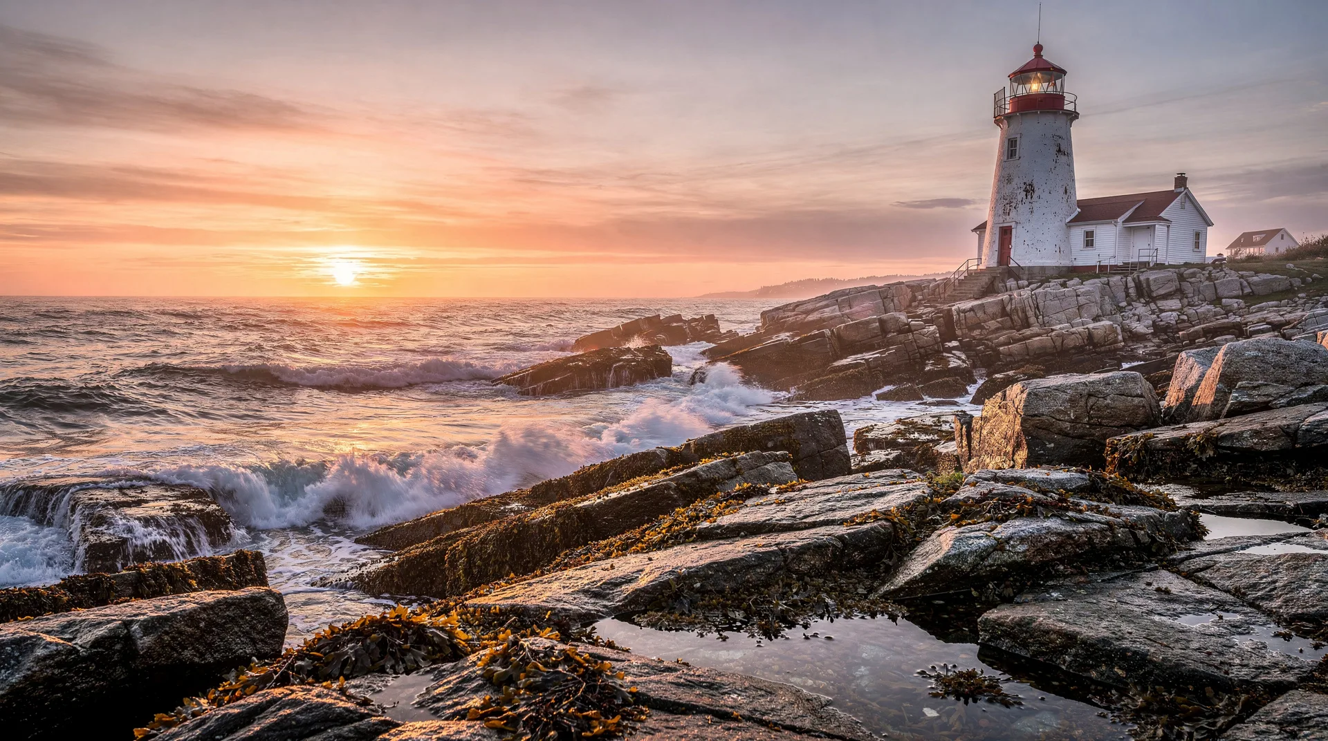
Stiles Cove Path (Flatrock to Pouch Cove, 13.5 km)
Possibly the most accessible high-reward section. Moderate terrain, constant cliff views, multiple coves, a lighthouse, and usually lower crowd density than the Spout. Puffins visible offshore in summer. Allow 4-6 hours. This is the recommended first ECT hike for most visitors.
La Manche Village Path (La Manche to Bauline East, 5.5 km each way)
Home to the most photographed ECT feature: the suspension bridge across La Manche River at the site of an abandoned fishing village destroyed by a 1966 tsunami. The village foundations remain. A shorter hike (11 km round trip) of moderate difficulty. Can be extended to include the adjacent Flamber Head Path.
Motion Path (Goulds to Bay Bulls, 21 km)
A longer, more remote coastal traverse with several dramatic headlands and the unique geological feature of Motion Head — a narrow isthmus nearly separated from the mainland. Strenuous, full-day hike. Combined with the adjacent Beaches Path (another 15 km), this becomes a substantial two-day outing.
Father Troy’s Path (Torbay to Flatrock, 11 km)
Moderate, family-friendly, with notable coastal scenery and the Flatrock Grotto (a rustic religious shrine in a striking coastal setting). Good for less experienced hikers or mixed-ability groups. Allow 4 hours.
Cape Spear Path (Maddox Cove to Cape Spear, 9 km)
Ends at Cape Spear — the most easterly point in North America. The lighthouse and WWII gun battery at Cape Spear are worth visiting in themselves, and the path provides the best approach. Moderate terrain. Allow 3-4 hours.
Beaches Path (Bay Bulls to La Manche, 15 km)
A moderate hike with several swim-possible (in summer) cove beaches. Connects directly to the Motion Path and the La Manche Village Path for longer traverses.
What you will see
Icebergs: from late May to early July in peak years, bergs calved from Greenland glaciers drift past Newfoundland’s east coast. The ECT’s elevated cliff vantages are some of the best iceberg viewing in Iceberg Alley. Check the iceberg tracking website before planning.
Puffins: the Witless Bay Ecological Reserve, visible from multiple ECT paths (especially Spout Path and Stiles Cove Path), holds the largest Atlantic puffin colony in the western North Atlantic — 260,000+ pairs. Puffins are ashore May through mid-August.
Whales: humpbacks, minkes, and fin whales feed in the near-shore waters from June through September. Visible frequently from the trail, sometimes close to shore.
Seabirds: gannets, murres, kittiwakes, razorbills, and storm-petrels use the offshore islands and cliffs throughout summer.
Historic sites: several ECT sections pass through abandoned fishing villages, shipwreck sites, historic lighthouses, and WWII coastal defences. La Manche, Broad Cove, and the Signal Hill area all include substantial heritage.
Planning your hike
Season: The ECT is hikeable from May through October. Peak season is June through September. Late June to early July combines peak icebergs, puffins in breeding activity, and reasonable weather.
Weather: Plan for rapid change. Newfoundland coastal weather includes fog (common, can reduce visibility to 50 metres), rain, and strong wind. Layers, waterproof outerwear, and wind protection are essential even on warm days. A hat with brim protects against both sun and rain.
Navigation: the ECT is well-marked with white blazes and numbered access points. Pick up the East Coast Trail maps (available in St. John’s outdoor stores and at the ECT Association website) before starting. Mobile coverage is patchy on many paths; physical maps are essential.
Fitness: assess your fitness honestly. A 16 km coastal hike with significant elevation change is a full-day effort. Start with a moderate 10-13 km path before attempting the harder sections.
Base location: St. John’s is the convenient base for the northern and central ECT sections. For southern sections (Cappahayden, Brigus), consider an overnight in a B&B closer to the trailhead.
Logistics
Getting to the trailheads: most ECT trailheads are 15-60 minutes’ drive from St. John’s. A rental car is essentially required — transit service doesn’t reach the majority of trailheads. From St. John’s, drive times: Cape Spear (20 min), Bay Bulls/Witless Bay (40 min), Flatrock (25 min), La Manche (45 min), Pouch Cove (40 min).
Water and food: carry all day. Some trailheads have convenience stores; many do not. Carry 2+ litres of water for a full-day hike.
Safety: hike in pairs or groups when possible. Tell someone your plan and expected return time. In fog, stay well back from cliff edges — visibility can drop dramatically within minutes.
Emergency: cell coverage is patchy. Consider a Garmin inReach or similar satellite communicator for solo hiking on the more remote paths.
Recommended itineraries
Half-day hike from St. John’s: Cape Spear Path (9 km) or Stiles Cove Path partial (6-7 km from Flatrock to a turnaround) — both moderate, both with strong scenery.
One full hiking day: Stiles Cove Path end-to-end (13.5 km) — the best single-day introduction to the trail system. Start early from Flatrock, lunch at a headland viewpoint, finish in Pouch Cove by mid-afternoon.
Two-day hiking visit: Day one Stiles Cove Path (13.5 km). Day two Spout Path (16 km, strenuous). This combination covers the two signature paths and gives a complete sense of the ECT’s range.
Extended hiking week: combine Stiles Cove, Spout Path, La Manche Village, Father Troy’s, and Beaches — five paths over 5-6 days covering ~70 km of trail. Plus rest days.
Through-hike consideration: completing the full 336 km ECT takes 18-25 days depending on pace. Wild camping is permitted in designated zones; village B&Bs are available but limited and must be booked ahead.
Combining the ECT with other Newfoundland experiences
A Newfoundland 7-day itinerary typically reserves 2-3 days for ECT hiking, with the balance for Gros Morne, Twillingate, or the Viking Trail.
For visitors based in St. John’s, the ECT supplies 4-5 days of hiking before needing to travel further afield. The Skerwink Trail on the Bonavista Peninsula is the natural next hiking destination.
Puffin and whale boat tours from Bay Bulls complement ECT hiking in the same area:
Book Witless Bay puffin and whale watching toursIs the East Coast Trail worth it?
For any hiker visiting Newfoundland with at least one free day, yes — emphatically. The ECT provides the kind of coastal hiking experience that is genuinely rare in North America: constant ocean views, accessible trailheads, well-maintained paths, and scenery that includes icebergs, puffins, whales, and the cultural landscape of outport Newfoundland.
The trail’s organisation as linked day hikes makes it unusually accessible — a visitor without backpacking gear or wilderness experience can hike sections of the ECT and have a complete coastal trail experience.
For hikers planning a Newfoundland trip, the ECT should be near the top of the list alongside Gros Morne’s hikes and the Skerwink Trail.