Quick facts
- Located in
- Waterton Lakes National Park, southern Alberta
- Best hiking season
- Late June to September
- Trailheads
- Waterton townsite, Red Rock Canyon, Cameron Lake
- Days needed
- 2-3 days for key trails
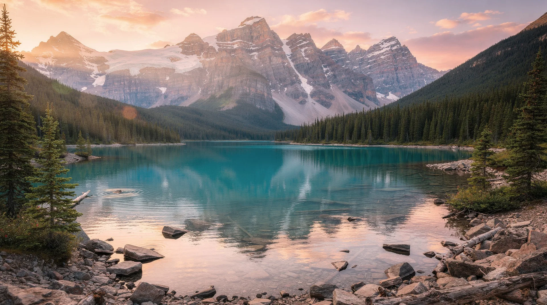
Waterton Lakes National Park punches far above its size when it comes to hiking. In 525 square kilometres — smaller than many Banff day-use zones — the park packs an extraordinary range of terrain: steep front-range ridgelines, high alpine lakes, canyon routes, and cross-border trails into Glacier National Park. Several of Waterton’s hikes regularly appear on lists of the best day hikes in Canada; one trail, Crypt Lake, is frequently cited as the single best hike in the country.
The park’s compact size means that multiple trailheads are accessible from the townsite on the same day. With 255 km of maintained trails, you could spend a week without repeating a route. This guide covers the essential hikes for first-time visitors and the major multi-day options for those who want more.
Bear’s Hump (easy)
Distance: 2.8 km return
Elevation gain: 240 m
Time: 1.5-2 hours return
Difficulty: Easy-moderate — steep but short
Trailhead: Waterton visitor centre parking area
Bear’s Hump is the essential Waterton orientation hike — short enough for almost anyone, dramatic enough to provide an immediate overview of the park’s geography. The trail climbs steeply from behind the visitor centre to the exposed ridge above the townsite, where the view opens: Upper Waterton Lake stretching south toward Montana, the townsite below, the Prince of Wales Hotel on its bluff, and the wide southern Alberta prairie spreading east.
The hump is exposed and typically windy — the wind that characterises Waterton whistles continuously across the ridge. Bring a windproof jacket even on warm days. The trail is rocky in the upper sections; hiking shoes are recommended over sandals.
Best time: Morning for the best light on the lake. The wind is often calmer in the early hours.
Crypt Lake trail (strenuous)
Distance: 17.2 km return
Elevation gain: 680 m
Time: 6-8 hours return
Difficulty: Strenuous — sustained elevation gain, a tunnel, and an exposed cable section
Trailhead: Crypt Lake boat dock (boat taxi from Waterton townsite required)
Crypt Lake is frequently listed among the best day hikes in Canada. The trail is unusual in Canada’s national park system for combining a boat crossing, a natural tunnel through the rock, a cable-assisted cliff traverse, and a destination lake of startling beauty — all in one day.
Getting there: The hike begins with a boat taxi across Upper Waterton Lake (departures typically twice daily in summer — book in advance at the townsite boat dock or visitor centre). The boat drops hikers at the Crypt Landing trailhead on the east shore.
The trail: From the boat dock, the trail climbs through forest and open terrain along Hellroaring Creek, passes two lower waterfalls, and then encounters the defining feature: a natural tunnel through the cliff band, 18 metres long and requiring hands-and-knees passage in places. Above the tunnel, a cable assists on the exposed traverse section above the cliff. This section, while protected, is exposed and not suitable for those with serious fear of heights.
Crypt Lake itself sits in a cirque directly on the international border — the far end of the lake is in Montana. The clarity of the water, the enclosed cirque walls, and the knowledge that you have earned this view through genuine effort makes Crypt Lake one of the most satisfying hiking destinations in southern Alberta.
Practical: Book the boat taxi well ahead in summer (they fill quickly on good weather days). Carry sufficient food and water for a full day — there is no resupply on the trail. Bear spray is strongly recommended in the Crypt Lake area.
Browse guided hiking tours in Alberta’s national parksCarthew-Alderson traverse (strenuous, classic day hike)
Distance: 19.4 km point-to-point
Elevation gain: 1,050 m (gain); 1,175 m (loss)
Time: 7-9 hours one-way
Difficulty: Strenuous — long distance with significant elevation change
Trailhead: Cameron Lake (start); Waterton townsite (finish)
The Carthew-Alderson is Waterton’s signature long day hike — a one-way traverse from Cameron Lake to the townsite that crosses two passes and descends through stunning alpine terrain. It is one of the finest day hikes in the entire Canadian Rockies system.
The route: Beginning at Cameron Lake (16 km from the townsite on Akamina Parkway), the trail climbs immediately and steeply to Summit Lake, then continues to the high point at Carthew Summit (2,311 m) — a broad, windswept ridge with views into both Canada and the US Glacier National Park. From Carthew Summit, the trail traverses above the Carthew Lakes (two turquoise alpine lakes in an open cirque) before a long descent through forest to Alderson Lake and eventually the townsite.
One-way logistics: The trail ends at the townsite, not at Cameron Lake. Arrange transport: either a two-car system (leave a car at each end) or use the park’s shuttle service (check at the visitor centre for current availability) to get back to Cameron Lake for your vehicle.
Best time: July and August when the upper alpine terrain is snow-free. September is dramatic but the upper section can see early snow. Start early — 7-8am at Cameron Lake — to avoid rushing the descent.
Blakiston Falls and Valley (easy-moderate)
Distance: 3.2 km return to Lower Falls; 8 km to Upper Valley
Elevation gain: 100 m
Time: 1.5-3 hours
Difficulty: Easy to moderate
Trailhead: Red Rock Canyon parking area
From the Red Rock Canyon parking area, the Blakiston Valley trail follows Blakiston Creek west into the upper valley, passing through forest and open meadow terrain. The Lower Falls (at 1.6 km) are a worthwhile short objective; continuing into the upper valley extends the walk into increasingly open alpine terrain with views of the surrounding peaks.
This trail is one of the most reliable for wildlife — the Blakiston Valley is an active wildlife corridor. Grizzly bears, black bears, deer, and moose are all recorded in this area. Travel in groups, make noise, and carry bear spray.
Red Rock Canyon loop (0.8 km, flat, wheelchair accessible) can be combined with the start of this trail — the two together make a good half-day outing from the townsite.
Cameron Lakeshore and Akamina Ridge (easy to strenuous)
Distance: 1.6 km return (lakeshore) or 8.5 km one-way (Akamina Ridge)
Elevation gain: Minimal (lakeshore); 500 m+ (ridge traverse)
Difficulty: Easy (lakeshore); strenuous (ridge)
Trailhead: Cameron Lake parking area
The flat Cameron Lakeshore walk (1.6 km return) is the most accessible trail in Waterton — a gentle path along the north shore of Cameron Lake to a beaver dam and wetland area at the lake’s western end. This is the best Waterton trail for families with young children and those who want lake views without elevation.
For more ambitious hikers, the Akamina Ridge trail climbs from Cameron Lake to the high ridgeline above, with views into both Alberta and British Columbia. The ridge traverse is open terrain requiring navigation ability in poor weather.
Rowe Lakes (moderate)
Distance: 16.2 km return
Elevation gain: 520 m
Time: 5-7 hours
Difficulty: Moderate
Trailhead: Akamina Parkway (8 km from townsite)
The Rowe Lakes trail leads through forest and open slopes to Lower and Upper Rowe Lakes — clear alpine lakes in a hanging valley above the main Waterton valley. The upper lake is the more scenic destination; the trail continues to the Lineham Ridge with panoramic views for those with energy after the lakes.
The Rowe Lakes area is particularly good for wildflowers in early July — the avalanche slopes above the lower lake have exceptional early-summer blooms. Grizzly bears frequent the area; bear spray is essential.
Twin Falls (easy-moderate)
Distance: 8 km return
Elevation gain: 325 m
Time: 3-4 hours
Difficulty: Easy-moderate
Trailhead: Waterton townsite (trail begins at the Park Street trailhead)
Twin Falls is the most accessible waterfall hike from the townsite — a pleasant forest trail above the lake that delivers to a double-drop waterfall in a shaded canyon. Less dramatic than the major destinations but a good option for a half-day when other trails feel too long.
Wildlife awareness on Waterton trails
Waterton has one of the highest grizzly bear densities of any national park in Canada. This is not a cause for alarm but for preparation:
- Carry bear spray and know how to use it — keep it accessible, not buried in a pack
- Make noise on the trail, especially in forested sections and near water (where bears may not hear you approaching)
- Travel in groups of four or more when possible; most bear encounters involve solo hikers
- Check the Waterton visitor centre for current trail closures — the park occasionally closes specific trails due to bear activity
- Never approach bears, and know the difference between defensive and predatory encounters
Cougars are present but very rarely encountered. Moose can be aggressive if approached — give them space.
Trail summary
| Trail | Distance | Gain | Time | Difficulty |
|---|---|---|---|---|
| Bear’s Hump | 2.8 km | 240 m | 1.5-2 hrs | Easy-moderate |
| Red Rock Canyon loop | 0.8 km | Minimal | 30 min | Easy |
| Blakiston Falls | 3.2-8 km | 100 m | 1.5-3 hrs | Easy-moderate |
| Cameron Lakeshore | 1.6 km | Minimal | 45 min | Easy |
| Rowe Lakes | 16.2 km | 520 m | 5-7 hrs | Moderate |
| Crypt Lake | 17.2 km | 680 m | 6-8 hrs | Strenuous |
| Carthew-Alderson | 19.4 km | 1,050 m | 7-9 hrs | Strenuous |