Quick facts
- Located in
- Between Howe Sound and Desolation Sound, BC
- Best time
- June to September for warm weather and marine activities
- Getting there
- BC Ferries from Horseshoe Bay (West Vancouver) to Langdale — 40 min crossing
- Days needed
- 2-5 days
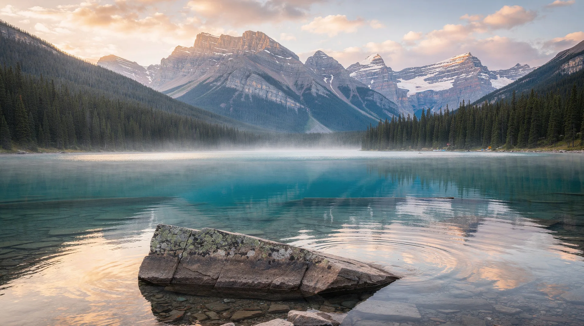
The Sunshine Coast is one of BC’s great geographical paradoxes: it sits within 50 kilometres of Vancouver as the crow flies, shares the province with the same mountains and the same ocean, and yet is inaccessible by road. The Sunshine Coast is cut off from the Lower Mainland by the fjords of Howe Sound, which means that reaching it requires a BC Ferry crossing — and this single fact of geography has preserved the coast’s character against the development pressure that has transformed most of the land within easy driving distance of Vancouver.
The coast stretches approximately 180 kilometres from Langdale (the Lower Sunshine Coast ferry terminal) northwest to the Saltery Bay terminal, where a second ferry continues to Powell River and the Upper Sunshine Coast. This two-ferry structure creates natural divisions: the Lower Sunshine Coast (Gibsons, Roberts Creek, Sechelt, Halfmoon Bay, Pender Harbour) and the Upper Sunshine Coast (Powell River, Lund, Desolation Sound).
For visitors who prefer a slower pace than the ski resorts and city centres of mainstream BC tourism, the Sunshine Coast offers something increasingly rare: a stretch of inhabited BC coast that maintains a working relationship with its landscape — fishing, logging, oyster farming, art-making — alongside the recreation economy that has grown steadily since the 1970s.
Getting to the Sunshine Coast
The Horseshoe Bay to Langdale ferry
The BC Ferries Horseshoe Bay to Langdale crossing is the gateway to the entire Sunshine Coast. The ferry terminal at Horseshoe Bay is in West Vancouver, approximately 30 minutes from downtown Vancouver by bus (#257 from downtown). The crossing takes 40 minutes and runs approximately every two hours throughout the day.
The ferry experience itself is worth noting: Howe Sound is one of the most spectacular bodies of water accessible by scheduled ferry service in Canada, with mountains rising directly from the water on three sides and the occasional seal or porpoise visible from the deck. The upper deck of the ferry on a clear morning is genuinely outstanding.
Vehicle reservations are strongly recommended for summer weekend crossings. Foot passengers can board without reservations.
The Earls Cove to Saltery Bay ferry
To reach the Upper Sunshine Coast (Powell River and beyond), a second BC Ferries crossing is required — from Earls Cove north of Sechelt to Saltery Bay south of Powell River. This 50-minute crossing traverses Jervis Inlet, a spectacular fjord that reaches 60 kilometres inland. The ferry is smaller and less frequent than the Horseshoe Bay route; check schedules carefully if you plan to continue north.
The Lower Sunshine Coast
Gibsons Landing
Gibsons is the first community you reach after the Langdale ferry terminal — a 5-kilometre drive to Gibsons Landing, the historic waterfront village that served as the filming location for the television series “The Beachcombers” (1972–1990), Canada’s longest-running dramatic series. The show’s legacy is well-documented at the Sunshine Coast Museum and Archives.
The Landing is a pleasant compact waterfront with galleries, cafes, and the working Gibsons Marina. It is the Sunshine Coast’s most overtly picturesque community and a natural first stop. The Sunshine Coast Arts Centre in Gibsons hosts exhibitions and events and provides an introduction to the coast’s substantial artistic community.
Roberts Creek
Roberts Creek, between Gibsons and Sechelt, is the Sunshine Coast’s most bohemian community — an intentional-feeling village of organic farms, cooperative businesses, independent bookshops, and a Saturday farmers market that reflects the coast’s alternative-lifestyle history. The Roberts Creek Provincial Park just south of the village has old-growth forest and a sandy beach that is one of the best on the Lower Sunshine Coast.
Sechelt
Sechelt is the Sunshine Coast’s largest town and the commercial centre of the Lower Coast. The Sechelt Inlet, which cuts inland from the town, is one of the finest kayaking destinations on the coast — protected, relatively warm water with dramatic fjord walls and wildlife including seals, great blue herons, and bald eagles. Porpoise Bay Provincial Park on the inlet shore has a good campground and sandy beach.
The shíshálh Nation’s Raven’s Cry Theatre in Sechelt is the cultural centre of the local Indigenous community and hosts performances, exhibitions, and cultural programming. The nation’s traditional territory encompasses the entire Sechelt Peninsula and the surrounding waters.
Pender Harbour
Pender Harbour, at the northern end of the Lower Sunshine Coast, is actually a series of connected bays that forms one of the most protected anchorages on the BC coast. The marina communities at Madeira Park, Garden Bay, and Irvines Landing are popular with recreational boaters, and the area’s combination of sheltered water and forest makes it excellent sea kayaking territory. Sakinaw Lake immediately north of Pender Harbour is one of the warmest freshwater lakes on the Sunshine Coast and a popular summer swimming destination.
Book a Sunshine Coast day tour from Vancouver on GetYourGuideThe Upper Sunshine Coast
Powell River
Powell River sits on the Upper Sunshine Coast, accessed by the second BC Ferries crossing from Earls Cove to Saltery Bay. The town was built around a massive pulp and paper mill established in 1912 — at the time one of the largest in the world — and the mill’s imposing waterfront presence shapes the industrial character of the harbour area. The historic townsite, however, is a remarkably well-preserved example of early 20th-century company town planning, designated a National Historic District and featuring complete streets of heritage worker housing, company buildings, and civic facilities in original condition.
Powell River has become one of BC’s most interesting small cities for the performing arts. The Powell River Academy of Music operates year-round with international performers, and the annual choral festival (Powell River Choral Connection) draws singing groups from across North America. For a small city in a remote coastal location, the cultural infrastructure is surprising.
For more on Powell River, including the kayaking around the lakes, see the dedicated Powell River guide.
Lund
Lund is the end of Highway 101 — or, depending on which direction you’re oriented, the beginning. Highway 101, which starts in Puerto Montt, Chile and runs up the Pacific coast, ends at the Lund Harbour dock on the Sunshine Coast. The sign at Lund reads “15,000 km to Puerto Montt” and it is one of the more quietly remarkable pieces of road signage in Canada.
Lund is a tiny former logging community with a historic hotel, a small marina, excellent fish and chips, and — this is the relevant part — a water taxi service to the northern reaches of Desolation Sound Marine Park. Lund is where organized kayaking expeditions into Desolation Sound typically launch.
Desolation Sound
Overview
Desolation Sound Marine Provincial Park is the largest marine park in BC and one of the finest sea kayaking destinations in the world. The park encompasses 84 kilometres of coastline, multiple islands, and the warm, sheltered waters of Desolation Sound itself — a convergence of channels that traps warm Pacific water and produces summer sea temperatures of 22–24°C, the warmest saltwater swimming in Canada north of the Gulf Islands.
The name is famously misleading. George Vancouver named the sound “Desolation” in 1792 because he found nothing useful there — no fresh water, no game, no harvestable timber by the standards of a Royal Navy expedition. What he missed was one of the most beautiful and ecologically rich marine environments on the BC coast.
Kayaking Desolation Sound
A week-long kayaking circuit of Desolation Sound is one of Canada’s great outdoor experiences. The main destinations within the park — Tenedos Bay, Prideaux Haven, Melanie Cove, and the Gifford Peninsula — offer a combination of sheltered camping, warm swimming, old-growth forest, and marine wildlife that has no equivalent in accessible distance from a major city.
Kayak rentals and guided tours depart from Lund and from several operators in Powell River. Novice kayakers can participate in guided trips; the protected water of the sound is manageable for most paddling ability levels in fair summer conditions.
Eating and drinking on the Sunshine Coast
The coast has a solid restaurant scene that draws on its own oyster farms, salmon fishery, and small-scale agriculture.
Smitty’s Oyster House at Pender Harbour serves local Sunshine Coast oysters in a waterfront setting that may be the most genuine seafood shack experience on the entire BC coast. The oysters are from local farms and are presented simply — the ocean-cold bivalves speak for themselves.
Blue Heron Restaurant in Sechelt has long been the most ambitious restaurant on the Lower Sunshine Coast, with a menu that makes serious use of local seafood and a wine list that respects BC’s growing wine culture.
Townsite Brewing in Powell River produces excellent craft beers in a brewing facility adjacent to the historic townsite. The taproom is one of the most pleasant on the Sunshine Coast, and the beer — particularly the imperial stout and the various session ales — is genuinely accomplished.
Browse BC coast and nature tours on GetYourGuideCycling the Sunshine Coast
The Sunshine Coast is an excellent cycling destination. The main highway (Highway 101) is a two-lane road with manageable traffic and consistent scenery. The Lower Coast from Langdale to Earls Cove is approximately 80 kilometres and can be cycled in two days with an overnight in Sechelt or Pender Harbour. The Upper Coast from Saltery Bay to Lund is a further 30 kilometres.
The coastline topography is hilly — the coast consistently climbs and descends as it follows the inlets and bays — but without the severe elevation of mountain cycling. E-bike rentals are available and make the hills more manageable.
Where to stay on the Sunshine Coast
Rockwater Secret Cove Resort near Halfmoon Bay is the Sunshine Coast’s most spectacular accommodation — luxury clifftop tented cabins suspended above the ocean in a forested setting. The price reflects the setting.
Beach Garden Resort and Marina in Powell River offers marina-adjacent accommodation on the Upper Coast with access to Desolation Sound kayaking.
For budget travellers, provincial campgrounds throughout the coast (Roberts Creek, Porpoise Bay, Saltery Bay) offer affordable camping in excellent settings. The coast is well-suited to camping-based road travel.
When to visit the Sunshine Coast
July and August are peak season — warm weather, maximum ferry frequency, kayaking season in full swing, and all accommodation at capacity. The Sunshine Coast receives more sunshine hours than Vancouver (it gets weather from the Strait of Georgia rather than from the open Pacific), and summer days are reliably warm and clear.
June is excellent — warm enough for outdoor activities, less crowded than July and August, and the landscape is at its most lush after spring rain.
September and October offer the coast’s best outdoor weather with significantly fewer visitors.
Frequently asked questions about the Sunshine Coast
Do you need a car to visit the Sunshine Coast?
A car adds significant flexibility — the communities are spread over 180 kilometres of highway and the most interesting destinations (Pender Harbour, Lund, Desolation Sound) are not easily reached without one. However, the Lower Sunshine Coast is manageable without a car for visitors staying in Gibsons or Sechelt and focusing on nearby beaches and hiking.
How long does it take to get to Powell River from Vancouver?
Approximately 4–5 hours including both ferry crossings. Horseshoe Bay to Langdale (40 minutes), drive to Earls Cove (1.5 hours), Earls Cove to Saltery Bay (50 minutes), and drive to Powell River (20 minutes). Timing the two ferries efficiently requires planning around their schedules.
Is the Sunshine Coast more scenic than Vancouver Island?
They are different kinds of beautiful. The Sunshine Coast has a quieter, less developed character than most of Vancouver Island, and Desolation Sound has no equivalent on the island. For kayaking and fjord scenery, the Sunshine Coast is superior. For general tourist infrastructure, hiking, and whale watching, Vancouver Island has more options.