Gaspésie Peninsula 7-Day Driving Loop
Overview
The Gaspésie Peninsula juts into the Gulf of St. Lawrence like a fist, and Highway 132 circles it entirely — a 900-kilometre loop around one of Quebec’s most spectacular coastlines. This 7-day itinerary completes the full loop: east along the dramatic north coast beneath the Chic-Choc Mountains, around the tip of the peninsula through Forillon National Park, south through Percé and the gannet colony of Île Bonaventure, and west along the sheltered Chaleur Bay coast before cutting inland through the Matapédia Valley.
The Gaspésie rewards visitors who come expecting variety. The north coast — the Gulf of St. Lawrence shore — is wild, cold, and backed by ancient mountains. The tip of the peninsula at Forillon is wilderness meeting sea. Percé is geological spectacle combined with one of the world’s most accessible gannet colonies. The Chaleur Bay coast is warmer, softer, and carries the heritage of the Acadian people. And the return through the Matapédia Valley is some of the finest inland driving in eastern Canada.
Most visitors access the Gaspésie from Quebec City (approximately 450 kilometres to the tip of the peninsula) or from the Matane ferry crossing from the Côte-Nord. This itinerary begins in Matane, at the western entrance to the Gaspésie proper, and ends in Rimouski for a return to Quebec City.
At a glance
| Day | Route | Highlights |
|---|---|---|
| 1 | Matane → Sainte-Anne-des-Monts | Arrive, coastal drive, Gaspésie gateway |
| 2 | Sainte-Anne-des-Monts → Gaspésie National Park | Mont Jacques-Cartier hike |
| 3 | Gaspésie NP → Forillon NP → Gaspé | Cap-Bon-Ami, Gaspé town |
| 4 | Forillon National Park full day | Cap-Gaspé trail, Grande-Grave |
| 5 | Gaspé → Percé | Rocher Percé, Île Bonaventure excursion |
| 6 | Percé → Carleton-sur-Mer | Chaleur Bay coast, Acadian culture |
| 7 | Carleton-sur-Mer → Rimouski via Matapédia | Return west, valley drive |
Day 1: Arrival in Matane and the first coastal drive
Matane is the practical western gateway to the Gaspésie Peninsula. If arriving by the Baie-Comeau–Matane ferry from the north shore, the ferry crossing itself (approximately 2.5 hours) provides excellent views of the widening St. Lawrence. If driving from Quebec City on the south shore, Matane is approximately 380 kilometres on Highway 20 and then 132 — allow 4 hours.
Matane is known for its shrimp (crevettes de Matane are a regional speciality — the Fête de la crevette de Matane in August is one of the peninsula’s major food festivals). The Matane salmon ladder on the Rivière Matane allows viewing of Atlantic salmon ascending to their spawning grounds from late June through August.
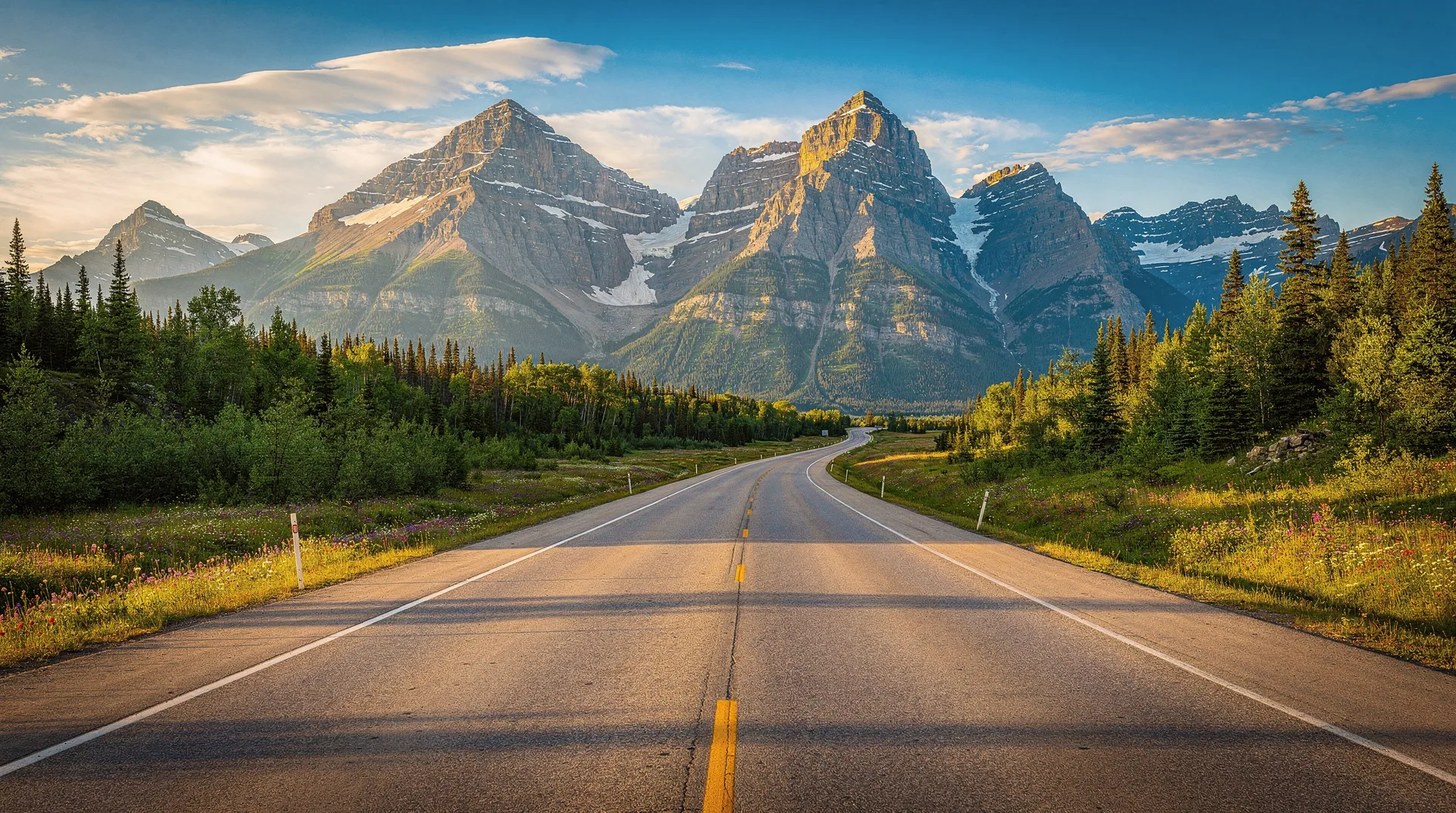
After arriving, drive east on Highway 132 for 65 kilometres to Sainte-Anne-des-Monts — the main jumping-off point for Parc national de la Gaspésie. The coastal drive is your first encounter with the Gaspésie’s north coast character: the Gulf of St. Lawrence visible beyond the shore, with the Chic-Choc mountains rising immediately inland.
Where to stay in Sainte-Anne-des-Monts: Hôtel Beaurivage (comfortable, good restaurant, central location) or the Motel Beaumont for a more budget option. Base yourself here for Day 2’s park excursion.
Day 2: Parc national de la Gaspésie — the high mountain experience
The turn inland at Sainte-Anne-des-Monts leads to Route 299, which climbs into the Chic-Choc Mountains through the Parc national de la Gaspésie. The park protects Quebec’s highest mountains south of James Bay — the McGerrigle plateau includes Mont Jacques-Cartier (1,268 metres) and Mont Richardson (1,049 metres).
Mont Jacques-Cartier trail (full day option): The summit trail is 19 kilometres round-trip with approximately 700 metres of elevation gain. The trail climbs through boreal forest, then sub-alpine krummholz (wind-stunted trees), then opens onto the broad alpine tundra of the summit plateau. The plateau hosts a resident caribou herd — one of the last in southern Quebec — and provides panoramic views over the Gulf on clear days. A Parks Canada naturalist is stationed at the summit cabin in summer to interpret the tundra ecosystem. Allow 7 to 8 hours.
Gîte du Mont-Albert: The park’s historic lodge — a large, rambling building with chalet-style rooms and a good restaurant — is one of Quebec’s finest wilderness lodges. If you can secure a room, staying overnight in the park is an exceptional experience; the lodge is surrounded by mountains with no light pollution at night. Book well in advance for summer weekends.
Alternative for shorter hikers: The Lac-aux-Américains trail (5 kilometres round-trip) leads to a mountain lake set beneath the Chic-Choc cliffs — one of the most scenic short hikes in the park.
Return to Sainte-Anne-des-Monts in the evening, or overnight at the Gîte du Mont-Albert for a mountain atmosphere.
Day 3: Gaspésie National Park to Forillon via the coast
Drive east from Sainte-Anne-des-Monts on Highway 132, continuing along the north coast toward Forillon. The road passes through a sequence of small fishing villages — Grande-Vallée, Cloridorme, Anse-à-Valleau — where the Gulf is immediately present and the mountains are directly behind.
Parc national du Canada Forillon: The national park at the very tip of the Gaspésie Peninsula is approximately 200 kilometres from Sainte-Anne-des-Monts (allow 2.5 to 3 hours with short stops). The park entrance via the Cap-Bon-Ami sector (north side) is the first and most dramatic approach: the road follows a limestone bench above the Gulf before the park’s main facilities.
Afternoon at Cap-Bon-Ami: The Cap-Bon-Ami trail (9 kilometres, approximately 3 hours) follows the cliff-top above the Gulf of St. Lawrence, with views down to the sea and back toward the Chic-Choc Mountains. Seabirds — razorbills, murres, kittiwakes — breed on the cliffs below the trail. Minke whales are regularly visible offshore from the trail’s high points during summer months.
Overnight in the town of Gaspé, 10 kilometres southeast of the park entrance. The Gîte du Passant Colibri or the Auberge Maison William Wakeham are both comfortable options in the town.
Day 4: Forillon National Park — full immersion
A full day in Forillon allows time for the park’s most substantial experiences.
Morning — Cap-Gaspé trail: The trail to the lighthouse at the very tip of the Gaspé Peninsula is 18 kilometres round-trip and takes approximately 5 hours. The trail begins at the park’s northern entrance (near the Grande-Grave historic site) and passes through boreal spruce forest before emerging onto the open cliff tops above the Gulf. The lighthouse at Cap-Gaspé marks the absolute terminus of the Appalachian Mountains — the mountain chain that runs from Alabama to this point ends here, at the water’s edge.
Afternoon — Grande-Grave historic site: The reconstructed 19th-century fishing village at the park’s inner bay is one of the most evocative heritage sites in Quebec. The buildings — a general store, fish-drying stages, workers’ houses — have been restored and interpreted to show how the Gaspésie’s inshore fishing communities lived in the late 1800s. Parks Canada staff in period dress operate the buildings. Allow 90 minutes.
Kayaking in the park: The inner bay of Forillon (near the Grande-Grave site) has calm water suitable for beginner sea kayaking, with a rental operation in summer. The outer coast requires more skill and experience due to swell and tidal currents.
Book a Forillon National Park guided sea kayaking or whale watching excursionDay 5: Gaspé to Percé — the most photographed rock in Quebec
Drive south from Gaspé to Percé — 75 kilometres, about one hour on Highway 132. The approach to Percé from the north provides the first dramatic view of the Rocher Percé as the road descends to the village: the 438-metre limestone monolith standing in the sea, with its natural arch (the “pierced rock” that gives the village its name) clearly visible.
Morning — Île Bonaventure boat excursion: The island 4 kilometres offshore is home to one of the world’s largest accessible northern gannet colonies. Book the first morning departure from the village wharf — the early light on the colony is the best for photography, and the island trails to the cliff-top viewpoint are less crowded before the midday boats arrive. Approximately 60,000 nesting pairs of gannets occupy the eastern cliff face from May through September. The island trail loops through the interior boreal forest and approaches the colony from above — the scale and intensity of the colony viewed from the cliff-top path is extraordinary.
Afternoon — Percé village and geology: Walk the village waterfront, browse the galleries, and visit the Géoparc de Percé interpretive site (a geological interpretation trail along the cliffs behind the village, covering the 375-million-year evolution of the Percé rock formations). At low tide, it is possible to walk to the Rocher Percé across the tidal sandbar — time this carefully as the tide turns quickly.
Stay two nights in Percé. Recommended accommodation: the Hôtel La Normandie (sea view rooms facing the Rocher are worth the premium) or the Auberge Percé on the Rocks.
Dinner in Percé: Le Gaspésien restaurant for local fish and seafood; La Maison du Pêcheur on the waterfront is the reliable standard.
Day 6: Percé to Chaleur Bay — the south coast
Drive south and west from Percé on Highway 132 as it rounds the peninsula’s southern tip at Barachois and follows the Chaleur Bay shoreline west. The transition from the Gulf coast to the Chaleur Bay coast is immediately felt: the water is calmer, the coastline lower, and the air temperature warmer.
Carleton-sur-Mer: The most pleasant town on the Chaleur Bay coast, Carleton-sur-Mer sits on a long curved beach with the bay on one side and Mont Saint-Joseph rising behind the town. The summit of Mont Saint-Joseph (accessible by road to a viewpoint near the top) provides a panoramic view over the full length of Chaleur Bay to the New Brunswick shore, approximately 25 kilometres across.
Bonaventure: The small town of Bonaventure, 20 kilometres east of Carleton, has the Musée acadien du Québec — the most significant museum of Acadian culture in the province, covering the history of the Acadian people who settled the south Gaspésie following the 1755 Grand Dérangement (expulsion from Maritime Canada by the British). The museum is well-curated and emotionally engaging.
Saint-Omer and New Carlisle: The anglophone communities of the lower Chaleur Bay reflect a distinct historical presence — English-speaking families who settled here in the 18th and 19th centuries and maintained an English-language community distinct from the surrounding Francophone Gaspésie. The New Carlisle heritage house museum on a street of painted Victorian homes is worth a brief stop.
Stay overnight in Carleton-sur-Mer (Hôtel Baie Bleue has bay views; the Auberge Le Havre is smaller and more intimate).
Day 7: Return west via the Matapédia Valley
The return west from Chaleur Bay to the main Bas-Saint-Laurent highway follows the Matapédia Valley — a forested river corridor cutting north through the Appalachian foothills that is genuinely one of the finest inland drives in eastern Quebec.
Route 132 north from Carleton-sur-Mer to Amqui: The road follows the Matapédia River north through a valley of forested hills and small farming communities. The river itself is famous for Atlantic salmon fishing — the Matapédia is one of the premier salmon rivers in eastern Canada, with private fishing clubs and outfitters operating along its length.
The town of Amqui at the valley’s northern end is the regional centre for the Matapédia, with a good visitor centre covering the valley’s geography and ecology.
Rejoin the south shore highway at Rimouski: Continue north to Rimouski on Highway 132, joining the south shore of the St. Lawrence. Rimouski is approximately 4 hours from Quebec City — a comfortable evening drive, or an overnight in Rimouski for a relaxed final morning.
Rimouski: A genuine city of 48,000 with quality restaurants and the Musée régional de Rimouski in a beautiful converted stone church. The nearby site of the Empress of Ireland memorial at Pointe-au-Père (the ship sank here in 1914 with the loss of 1,012 lives) is a sobering and well-interpreted heritage site.
Budget breakdown
Per person, two people sharing, Canadian dollars.
| Category | Budget (CAD) | Moderate (CAD) | Comfort (CAD) |
|---|---|---|---|
| Accommodation (7 nights) | 700–950 | 1,200–1,700 | 1,800–2,800 |
| Food and drink | 400–550 | 700–1,000 | 1,100–1,600 |
| Car rental and fuel (7 days) | 500–650 | 700–900 | 900–1,200 |
| Activities and park admissions | 150–250 | 300–450 | 450–700 |
| Île Bonaventure boat (included above) | — | — | — |
| Total per person | ~1,750–2,400 | ~2,900–4,050 | ~4,250–6,300 |
Forillon National Park admission is approximately CAD 10 per person per day (Discovery Pass covers all national parks for a year and is excellent value for a multi-park trip). Île Bonaventure boat tour approximately CAD 30–45 per person, plus island admission through Parks Canada.
Booking tips
Forillon and Percé accommodation in July: Percé has limited accommodation options and they fill completely for summer weekends. Book Percé hotels immediately upon confirming your trip — the best waterfront rooms go first.
Gîte du Mont-Albert (Gaspésie National Park): This is one of the most popular provincial park lodges in Quebec. Book by February or March for July and August stays.
Île Bonaventure boat departures: Multiple operators run from Percé village. Most run first departures around 8am — book the earliest available slot for the best light and quieter island trails.
Variations
Combine with the 14-day Quebec tour: The Gaspésie loop integrates naturally with the 14-day Quebec grand tour, which adds Montreal, Quebec City, and Charlevoix to the north. Together they cover the province comprehensively.
Reverse the loop: Starting from the south (Chaleur Bay) instead of the north (Matane) works equally well. Access via the Amqui–Matapédia Valley from Rimouski, then north coast east to Forillon, and back west via the coast. This puts Percé earlier in the trip, which is useful if whale watching at Forillon is a priority.
Add Îles-de-la-Madeleine: A ferry from Souris, Prince Edward Island (accessible from Gaspé) connects to the Magdalen Islands (Îles-de-la-Madeleine), a Quebec archipelago in the Gulf of St. Lawrence with extraordinary beaches, red sandstone cliffs, and a distinctive Acadian fishing culture. This extension adds three to four days and a significant ferry crossing.
Closing
The Gaspésie loop is one of eastern Canada’s finest road trips. The variety packed into 900 kilometres of highway — alpine mountains, boreal forests, Gulf coastline, seabird colonies, whale feeding grounds, geological wonders, and two distinct cultural traditions (Mi’kmaq, French Acadian, and anglophone) — is exceptional. Percé alone, with the Rocher and the gannet colony, would justify the trip. Forillon adds wilderness depth. The Chic-Choc Mountains provide an alpine dimension that surprises many visitors who expect Quebec’s interior to be flat boreal forest. The Gaspésie consistently exceeds expectations, which is the best thing that can be said of any destination.