Quick facts
- Located in
- West End, Vancouver BC
- Best time
- June to September for cycling and swimming; year-round for hiking
- Getting there
- 10-min walk from downtown; bus #19 to park entrance
- Days needed
- Half to full day
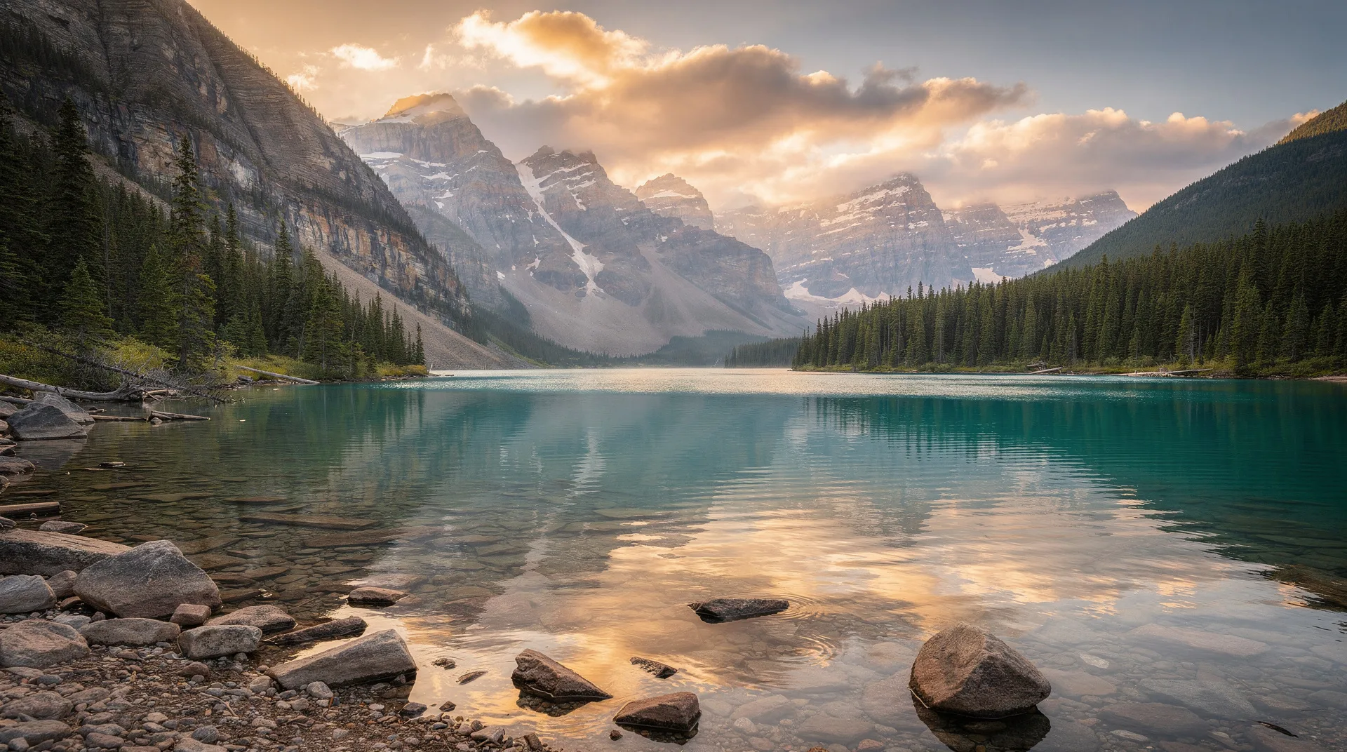
Stanley Park sits at the western edge of downtown Vancouver, a 405-hectare forested peninsula that juts into Burrard Inlet between English Bay and the North Shore mountains. It is one of the great urban parks in the world — not merely a pleasant green space, but a genuine wilderness pressed against a major city, where Douglas firs and western red cedars that are centuries old grow within sight of a glass-and-steel skyline.
The park was set aside as a military reserve in 1863 and transferred to the City of Vancouver as a park in 1888 — just two years after the city itself was incorporated. The timing was fortunate. Had those 405 hectares been developed, Vancouver would be a fundamentally different city. Instead, the park has shaped everything around it: the density and character of the West End, the seawall that now extends along the entire waterfront, and the psychological relationship that Vancouverites have with their city’s natural setting.
For visitors, Stanley Park is not an optional add-on to a Vancouver itinerary. It is the thing that makes Vancouver what it is, and spending a half day or full day exploring it is among the most rewarding activities available in the city.
The seawall
The 9-kilometre seawall that encircles Stanley Park is the park’s most famous feature and one of the world’s great urban cycling and walking routes. The path runs at water level around the entire peninsula, with uninterrupted views of English Bay, Burrard Inlet, the North Shore mountains, and the downtown skyline — all within the same loop.
Cycling the seawall
Cycling the full loop takes 60–90 minutes at a relaxed pace. The route is one-directional for cyclists (counter-clockwise, so the ocean is always on your right), which keeps traffic moving and allows pedestrians space on the outer path. Bike rentals are available from several operators clustered at the Denman Street entrance to the park.
The highlights by kilometre: from the entrance, the path passes the rowing club and past Deadman’s Island toward Brockton Point, where the totem poles stand. From there it continues around the northwestern point of the park past the 9 O’Clock Gun (a nightly cannon that has fired since 1898) and toward Prospect Point at the tip of the peninsula. The Lions Gate Bridge looms overhead at Prospect Point, and the view of ships entering and leaving Burrard Inlet is extraordinary. From Prospect Point the path swings south through the more sheltered western side of the park, passing Third Beach and Second Beach before returning to English Bay.
Walking the seawall
The seawall is open to walkers throughout, with pedestrian paths running parallel to the cycling path in most sections. Walking the full loop takes 2.5–3 hours at a comfortable pace. The most popular walking sections are from the park entrance to Brockton Point (45 minutes return) and from Second Beach north toward Third Beach (30 minutes one-way).
The totem poles at Brockton Point
What you’ll see
The collection of nine totem poles at Brockton Point is one of Vancouver’s most visited sights, and it deserves the attention. These are not decorative reproductions — they represent a genuine collection of Northwest Coast Indigenous monumental art, brought together from various BC communities and, in several cases, carved specifically for display in the park.
The poles represent the carving traditions of multiple BC First Nations, including the Haida, Kwakwaka’wakw, and Squamish peoples. Interpretive signage explains the cultural context of each pole — the figures depicted, the stories embedded in the carvings, and the specific nations whose artistic traditions they represent. Taking time to read these signs transforms the visit from a photo stop into a meaningful encounter with the region’s Indigenous cultures.
Historical context
The original poles at Brockton Point were collected in the early 20th century, a period when Northwest Coast Indigenous culture was under severe pressure from federal policies banning potlatches and other ceremonies. Several of the original poles were loaned to the Museum of Anthropology at UBC or to other museums as they deteriorated; some were replaced with replicas carved by descendant artists. The current collection represents multiple generations of this history.
The Vancouver Aquarium
Overview
The Vancouver Aquarium, located in the interior of Stanley Park, is the largest aquarium in Canada and one of the finest in North America. It houses over 50,000 animals across habitats representing the Pacific Northwest, tropical ocean environments, the Amazon, and the Arctic. Unlike many aquariums that prioritise spectacle, the Vancouver Aquarium has a serious research and conservation mission — it has been a centre for marine mammal rescue and rehabilitation since the 1960s.
Key exhibits
The Pacific Northwest exhibit, which opens the aquarium experience, displays the marine life of BC waters with impressive depth: giant Pacific octopus (the largest octopus species in the world), wolf eels, lingcod, rockfish, and the extraordinary range of invertebrates that characterise the cold, nutrient-rich waters of the Salish Sea.
The Open Ocean exhibit has the aquarium’s largest tank, with shark species, rays, and open-water fish. The Amazon gallery recreates the flooded forest of the Amazon basin. The Arctic Canada section has beluga whales — the aquarium’s most iconic residents — and the Tropic Zone has sea turtles and tropical reef species.
The BC Wetlands outdoor exhibit, refurbished in recent years, provides habitat for river otters, beavers, and various waterfowl in a naturalistic outdoor setting.
Book a Stanley Park and Vancouver Aquarium tour on GetYourGuideHiking in Stanley Park
Trails overview
The park’s interior — which most visitors never reach — contains over 27 kilometres of walking trails through old-growth temperate rainforest. The trees here are genuinely old: western red cedars, Douglas firs, and Sitka spruces of immense girth that predate European contact in the Pacific Northwest. The forest floor is dense with sword ferns, salal, and the mosses that thrive in the mild, wet coastal climate.
Key trails
The Rawlings Trail traverses the interior of the park and connects with the Bridle Path for a longer forest loop. The Beaver Lake Trail circles a small lake in the park’s interior that hosts breeding birds and turtles. This section of the park on a quiet weekday morning — fog in the canopy, the sound of ravens, the smell of cedar — provides a wilderness experience that is astonishing given its location in a major city.
The Hollow Tree — an enormous western red cedar stump in the park’s interior that has been a landmark for over a century — is accessible from the main trail network and worth seeking out. The tree is long dead but the remaining stump, with its massive root system, gives a sense of how enormous old-growth cedars could grow.
Prospect Point
Prospect Point at the park’s northern tip is accessible by car as well as by seawall. The viewpoint above the Lions Gate Bridge is one of Vancouver’s great lookouts — the suspension bridge directly below, the mountains of the North Shore rising immediately behind it, and the shipping lanes of the First Narrows carrying tankers and container ships through the narrow passage. The café at Prospect Point is a reliable stop for coffee.
Lost Lagoon and wildlife
Lost Lagoon
The tidal inlet at the park’s southeastern entrance was separated from the ocean early in the park’s history by the construction of a causeway, creating the freshwater Lost Lagoon — a shallow lake that now serves as a wildlife sanctuary in the heart of the park’s most accessible section. Great blue herons nest in the adjacent trees, Canada geese and various duck species are resident year-round, and river otters are occasionally seen along the shoreline.
The path around Lost Lagoon is flat, fully paved, and accessible, making it the best section of the park for those with mobility limitations. The nature house on the lagoon’s southern shore has interpretive exhibits about the park’s wildlife.
Wildlife in the park
Stanley Park supports a surprising diversity of wildlife given its urban context. Raccoons are everywhere and should not be fed — they are bold and occasionally aggressive. Coyotes live in the park’s interior and are occasionally seen at dusk and dawn, particularly in the forested trails. Great blue herons nest in a large colony near the aquarium each spring. Bald eagles are regularly sighted over the park and the inlet.
Getting to and around Stanley Park
The park is accessible on foot from the West End, Vancouver’s densest residential neighbourhood. The Denman Street corridor, one block west of the park entrance, has bike rental shops, coffee shops, and restaurants that make a natural staging point.
Bus #19 from downtown Vancouver runs to the park entrance on Pipeline Road. The Stanley Park bus loop, accessible from the #19, provides transport to the aquarium and Prospect Point for those who don’t want to walk or cycle.
Driving to the park is possible; a one-way loop road follows the seawall and provides access to several parking areas. On summer weekends, parking fills quickly. The road through the park is often closed for events and resurfacing — check current conditions.
When to visit Stanley Park
Summer (June to September) is peak season — the seawall is in full use, the swimming beaches (Second Beach Pool has a heated outdoor pool; Third Beach is natural) are open, and the park operates at maximum animation. The downside is that summer weekends bring genuine crowds, particularly around the park entrance, Brockton Point, and Second Beach.
Spring (March to May) is excellent for the park’s forested interior. The absence of summer crowds and the spectacular light after winter rain make April and May among the best months for photography and hiking. The great blue heron colony is active at the nest in March and April.
Autumn (October) offers the park’s finest colours, particularly around Lost Lagoon where the deciduous trees turn amber. Cycling the seawall in October with the mountains clear and the air sharp is one of Vancouver’s best seasonal experiences.
Winter is the park at its most local. The seawall walkers are bundled up and purposeful; the forest trails are wet but rarely muddy enough to be impassable; and the perspective on how Vancouverites relate to their natural environment is more honest than in the performed beauty of summer.
Practical tips
The park is free to access. The Vancouver Aquarium charges admission (approximately CAD $40 for adults; pre-booking online avoids queues in summer). Bike rental rates are approximately CAD $10–15 per hour from Denman Street operators.
The park has restrooms at the aquarium, Prospect Point, Second Beach, and Third Beach. Food is available at the Prospect Point café, the aquarium, and the Sequoia Grill at the Teahouse Restaurant (the park’s most formal dining option, set in a heritage building near Ferguson Point with ocean views).
Dogs are welcome on leash in most areas of the park. The seawall and most hiking trails are accessible to dogs; the aquarium is not. Off-leash areas are designated.
Frequently asked questions about Stanley Park
How long does it take to cycle the Stanley Park seawall?
The 9-kilometre loop takes approximately 60–90 minutes at a comfortable pace, not counting stops. Allow 2.5–3 hours if you plan to stop at the totem poles, Prospect Point, and Second Beach. Bike rentals are available from Denman Street operators just outside the park.
Can you visit Stanley Park without a car?
Absolutely. The park is directly accessible on foot from the West End neighbourhood, and the Denman Street entrance is a 15-minute walk from the downtown hotel district. Bus #19 also serves the park entrance. Most of the park’s attractions are accessible without any vehicle.
Is Stanley Park bigger than Central Park?
Yes — Stanley Park’s 405 hectares is roughly twice the size of New York’s Central Park (340 hectares). The forested interior makes it feel even larger, as much of the park has no visual markers of the surrounding city.