Quick facts
- Area
- 404 km² (inland) + 22 km² (Seaside)
- Designation
- Dark Sky Preserve
- Best time
- June to October
- Days needed
- 2-3 days
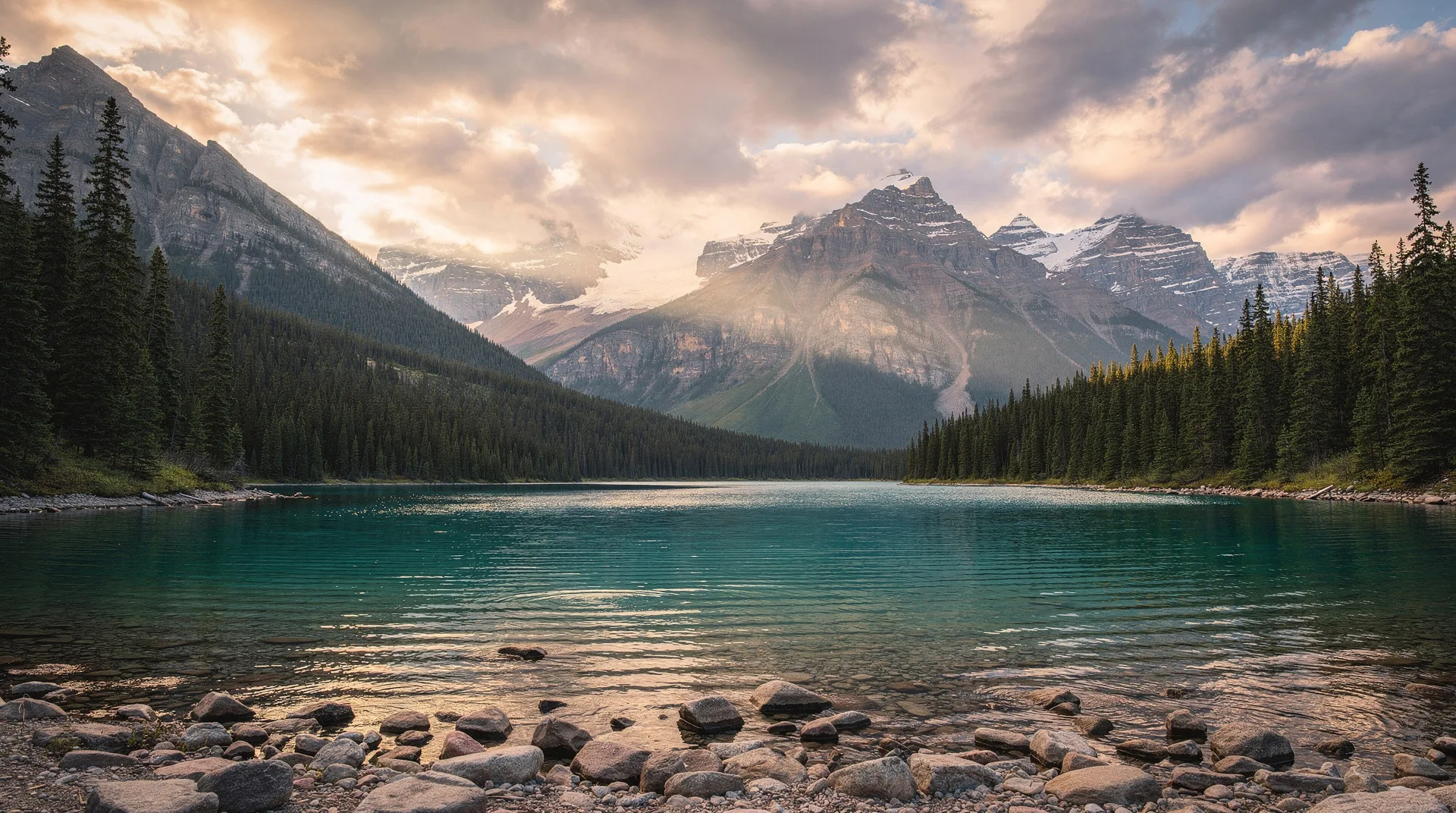
Kejimkujik National Park is Nova Scotia’s inland national park — 404 square kilometres of boreal forest, lakes, rivers and bogs in the heart of the province’s southwestern interior, plus a separate 22-square-kilometre coastal section on the Atlantic shore. It is Canada’s only national park designated both as a National Historic Site (for the Mi’kmaw cultural heritage that predates European contact by thousands of years) and as a Dark Sky Preserve (one of the darkest skies in eastern Canada). Locals and regulars call it Keji, and the place rewards visitors who are willing to slow down — this is a canoe-and-campfire park rather than a photo-op park.
This guide covers the main Kejimkujik experience, the separate Seaside Adjunct on the Atlantic coast, the Mi’kmaw history that runs through every part of the park, and the practical logistics of visiting.
Why Kejimkujik is different
Most of Canada’s most famous national parks are mountain parks (Banff, Jasper, Gros Morne) or coastal parks (Pacific Rim, Cape Breton Highlands). Kejimkujik is neither. It protects a low-relief inland landscape of shallow lakes and slow-moving rivers — the kind of landscape that made canoe travel the defining transportation mode for thousands of years. The Mi’kmaw people travelled, camped, fished and lived across this landscape for at least 4,000 years before European contact, and the park contains one of the most significant concentrations of Mi’kmaw petroglyphs (rock carvings) in eastern Canada.
The park’s Dark Sky Preserve designation, awarded by the Royal Astronomical Society of Canada, reflects genuinely dark skies. The nearest significant light dome is Halifax, nearly 200 kilometres northeast. On clear moonless nights, the Milky Way is visible overhead with the kind of clarity and density that urban Canadians may never have experienced.
Mi’kmaw heritage and the petroglyphs
The name Kejimkujik is a Mi’kmaw word whose exact translation is debated — interpretations include “attempting to escape” and “swollen waters” or “tired muscles” (from the effort of paddling Kejimkujik Lake against the wind). The area around the lake was used continuously by Mi’kmaw people as a summer fishing camp, a travel corridor between the Bay of Fundy and the Atlantic coast, and a hunting and gathering area.
Mi’kmaw petroglyphs are present at several locations within the park, carved into exposed slate bedrock. The petroglyphs depict human figures, canoes, porpoises, men wearing European clothing (so post-contact), ceremonial subjects, and symbols whose meanings remain with the Mi’kmaw communities who consider them sacred. The petroglyph sites are carefully protected — some are accessible only with Mi’kmaw guides, and none are heavily promoted.
Parks Canada’s programming at Kejimkujik includes interpretive walks led by Mi’kmaw guides, cultural demonstrations during peak season, and the ongoing work of co-management between Parks Canada and the surrounding Mi’kmaw communities. The Mi’kmawey Debert Cultural Centre outside the park in Truro is a separate but related cultural institution worth combining with a Kejimkujik visit for travellers interested in Mi’kmaw history.
Canoeing Kejimkujik
Kejimkujik is, at its core, a canoe park. The waterways connecting Kejimkujik Lake, Kejimkujik Backcountry lakes, and the Mersey River offer dozens of canoe routes ranging from an afternoon paddle to a week-long wilderness circuit.
Day paddles from Jake’s Landing (the main canoe rental location) include routes to Grafton Lake, Snake Lake and the various sheltered bays of Kejimkujik Lake. Canoes, kayaks and paddleboards are available for rent through the contracted concessioner.
Backcountry canoe routes — approximately 46 backcountry campsites accessible only by canoe — allow multi-day trips into the park’s interior. The Mersey-Allains Circuit (2-3 days) and the Kejimkujik-Big Dam route (3-4 days) are the classic backcountry itineraries. Backcountry permits and campsite reservations are required through Parks Canada’s reservation system, released each winter for the following season.
Canoe portages in Kejimkujik are short and well-maintained by comparison with the more ambitious paddle parks of northern Ontario and Quebec. The park is suitable for families with moderate paddling experience and for novice backcountry travellers.
Browse Nova Scotia outdoor and cultural tour experiencesHiking and day-use
Mill Falls Trail (2.5 km) — an easy forested loop near the main campground, good for a first walk.
Hemlocks and Hardwoods (5 km) — through old-growth hemlock stands, some trees over 350 years old.
Peskowesk Trail (5 km) — a moderate day hike to Peskowesk Lake.
Channel Lake Trail (8 km return) — a full half-day hike through representative Kejimkujik forest and lake landscapes.
Gold Mines Trail (3.5 km) — the site of the late 19th-century gold rush that briefly brought industrial activity to the area, with interpretive signage about the mining era.
Stargazing at the Dark Sky Preserve
The designated Dark Sky Preserve covers the entire Kejimkujik inland section. The best stargazing locations within the park are Sky Circle at Jeremy’s Bay Campground, the beaches along Kejimkujik Lake, and any of the backcountry campsites.
Parks Canada runs Dark Sky programming during July, August and early September, typically including telescope nights, star party events, and astronomy talks. The Kejimkujik Dark Sky Festival in late August is the park’s signature astronomy event, drawing amateur astronomers from across the Maritimes with a long weekend of presentations, observing sessions and family programming.
For visitors wanting guaranteed dark skies: avoid full-moon nights, check cloud forecasts carefully, and bring warm layers — clear nights in Nova Scotia are cold even in summer.
Seaside Adjunct
The Kejimkujik Seaside section is a separate piece of protected coastline on the Atlantic Ocean, about 100 km south of the main park. This is a different environment entirely: white sand beaches, coastal bogs, heath barrens, and granite headlands rather than inland lakes.
Access is by a 6.5-km loop trail from a trailhead on Route 103 near the community of Port Joli. The trail is easy, mostly flat, and leads to Little Port Joli Beach and St. Catherine’s River Beach — genuinely beautiful Atlantic beaches with seals typically visible offshore. The round trip takes 2-3 hours.
The Seaside section has no camping, no services beyond the trailhead parking and pit toilets, and minimal infrastructure. It is a day-use destination, suitable for a stop during a drive along the South Shore.
Where to stay
Jeremy’s Bay Campground is the main front-country campground — unserviced sites and serviced sites, reservable through Parks Canada, open mid-May to mid-October. The campground has beach access, flush toilets and showers.
oTENTiks — Parks Canada’s tent-cabin hybrid accommodation — are available at Jeremy’s Bay and at several backcountry locations. These are the best option for travellers who want to camp but don’t have their own gear.
Backcountry campsites (canoe-in) — approximately 46 sites across the park, reservable in advance. Some are lakeside, all are basic (tent pad, fire pit, pit toilet). The experience is genuine Canadian backcountry canoeing.
Nearby commercial accommodation: The town of Maitland Bridge and the larger community of Caledonia have basic motels and B&Bs. For more substantial accommodation, Liverpool and Bridgewater are 45-60 minutes away and have full-service hotels.
Getting to Kejimkujik
From Halifax: 2.5 hours via Highway 103 and Route 8. From Halifax International Airport: approximately 3 hours.
From the Annapolis Valley (Wolfville, Annapolis Royal): 1 hour from Annapolis Royal via Route 8.
The park’s main entrance is at Maitland Bridge on Route 8 between Annapolis Royal and Liverpool. There is no public transit to the park — a car is essential.
Related destinations
Annapolis Royal is the nearest town of visitor interest — an easy combination with a Kejimkujik stay. Lunenburg and the South Shore are 1-1.5 hours southeast. Halifax is 2.5 hours northeast. For the full inland-to-coast experience, combine Kejimkujik with the Seaside Adjunct and the South Shore drive.
Frequently asked questions about Kejimkujik National Park
How long should I spend at Kejimkujik?
Two to three days is the minimum for a satisfying visit — one day for a day hike and a paddle, one evening for stargazing at the Dark Sky Preserve, and a second day for either the Seaside Adjunct or a longer canoe trip. Backcountry canoe trips typically need 3-5 days.
Do I need a Parks Canada pass?
Yes. A Parks Canada daily admission or a Discovery Pass is required. The Discovery Pass covers all Canadian national parks for a year and is worthwhile for travellers visiting multiple parks. See our Parks Canada Discovery Pass guide.
Can I see the Mi’kmaw petroglyphs?
Some petroglyph sites are interpreted by Parks Canada and accessible with Mi’kmaw guides during peak season programming. Other sites are protected and not publicly disclosed. Ask at the Visitor Centre about current interpretive programming schedules.
Is Kejimkujik good for families?
Yes — it is one of the most family-friendly national parks in Canada. Easy hiking, shallow lakeside beaches, accessible canoeing, evening interpretive programs and the Dark Sky Preserve all work well for children.
What is the Seaside Adjunct?
A separate coastal section of the park, about 100 km south of the main inland park, featuring Atlantic beaches and coastal walking. It is a day-use only area reached by a 6.5-km loop trail from the trailhead on Highway 103 near Port Joli.